ISRO NVS-03 Satellite and NavIC Constellation Navigation
Source:The Hindu ↗
हे का महत्त्वाचे आहे
Understanding ISRO's navigation satellite updates like NVS-03 directly aligns with syllabus requirements regarding space technology, indigenous developments, and applications of science and technology for national security and socio-economic growth.
सारांश
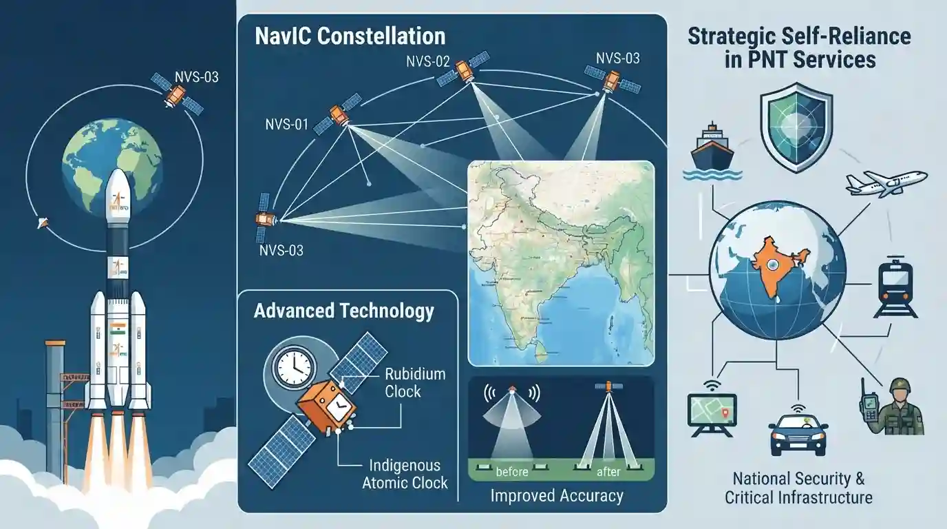
The article explains the significance of ISRO's launch of the NVS-03 satellite, part of the second-generation NavIC constellation. It highlights how these satellites improve navigation accuracy, introduce advanced rubidium and indigenous atomic clocks, and reinforce India's strategic self-reliance in positioning, navigation, and timing (PNT) services.
मुख्य मुद्दे
- ISRO’s NVS-03 satellite is a crucial component of India’s second-generation NavIC (Navigation with Indian Constellation) regional navigation system.
- It features advanced atomic clocks for enhanced timing accuracy, crucial for precision civilian and strategic applications.
- The mission improves India's technological self-reliance in satellite navigation, reducing dependence on foreign global positioning systems like GPS.
- NavIC provides regional positioning services covering India and an area extending up to 1,500 km beyond its borders.
महत्त्वाच्या संज्ञा
NavIC

India's regional satellite navigation system (Navigation with Indian Constellation) designed to provide accurate position information service to users in India and the region extending up to 1,500 km from its borders.
UPSC context
GS Paper III - Science & Technology: Awareness in the field of Space and indigenization of critical technologies.
NVS-03
The third satellite in ISRO's second-generation navigation series, equipped with advanced indigenous atomic clocks to enhance positioning, navigation, and timing services for NavIC.
UPSC context
GS Paper III - Science & Technology: Achievements of Indians in science & technology and space tech developments.
IRNSS
Indian Regional Navigation Satellite System, the official name for the autonomous regional satellite navigation system established by India, now widely known as NavIC.
UPSC context
GS Paper III - Science & Technology: Space technology, satellite constellations, and strategic infrastructure.
ISRO
The national space agency of India responsible for the country's space research, satellite launches, and deep-space exploration missions.
UPSC context
GS Paper III - Science & Technology: Key scientific institutions, achievements, and technological self-reliance.
पूर्वपरीक्षा सापळा
NavIC is a global satellite navigation system covering the entire globe similar to the US GPS.
Aspirants often confuse NavIC as a global positioning system like GPS; however, it is strictly an autonomous regional satellite navigation system.
संबंधित स्थिर संकल्पना
What are the core architectural and service features of India's NavIC system?
- Constellation Scope: Regional coverage spans India and 1,500 km beyond its borders using GEO and IGSO orbital configurations.
- Service Types: Provides Standard Position Service (SPS) for civilians and encrypted Restricted Service (RS) for strategic users.
- Frequency Bands: Operates on multiple frequency bands (L5, S, and L1 frequencies introduced in second-gen) for enhanced interoperability.
आंतर-विषय नमुने
NavIC & Strategic Border Security Linkages
NavIC's regional coverage and strategic encryption (RS) directly connect space technology with national security architecture and border management requirements.
Atomic Clocks & Deep-Tech Indigenization
The integration of indigenous atomic clocks illustrates how space indigenization initiatives overlap with domestic high-tech manufacturing and strategic autonomy goals.

Expect statement-based questions testing NavIC coverage range, orbital configuration (GEO/IGSO), and frequency bands vis-à-vis GPS/GLONASS.
संबंधित PYQ · 3
संबंधित PYQ · 3
- 2023PrelimsGS1
Which one of the following countries has its own Satellite Navigation System?
- 2018PrelimsGS1
With reference to the Indian Regional Navigation Satellite System (IRNSS), consider the following statements: 1. IRNSS has three satellites in geostationary and four satellites in geosynchronous orbits. 2. IRNSS covers entire India and about 5500 sq. km beyond its borders. 3. India will have its own satellite navigation system with full global coverage by the middle of 2019. Which of the statements given above is/are correct?
- 2015MainsGS3
What do you understand by 'Standard Positioning Systems' and 'Precision Positioning Systems' in the GPS era? Discuss the advantages India perceives from its ambitious IRNSS programme employing just seven satellites.
