ISRO NVS 03 launch strengthens NavIC navigation capabilities
Source:The Hindu ↗
આ શા માટે મહત્વનું છે
NavIC and India's satellite navigation capabilities are regular focus areas for UPSC Prelims (orbital configurations, coverage, comparisons with GPS) and Mains (strategic autonomy, socio-economic and national security applications of space technology).
સારાંશ
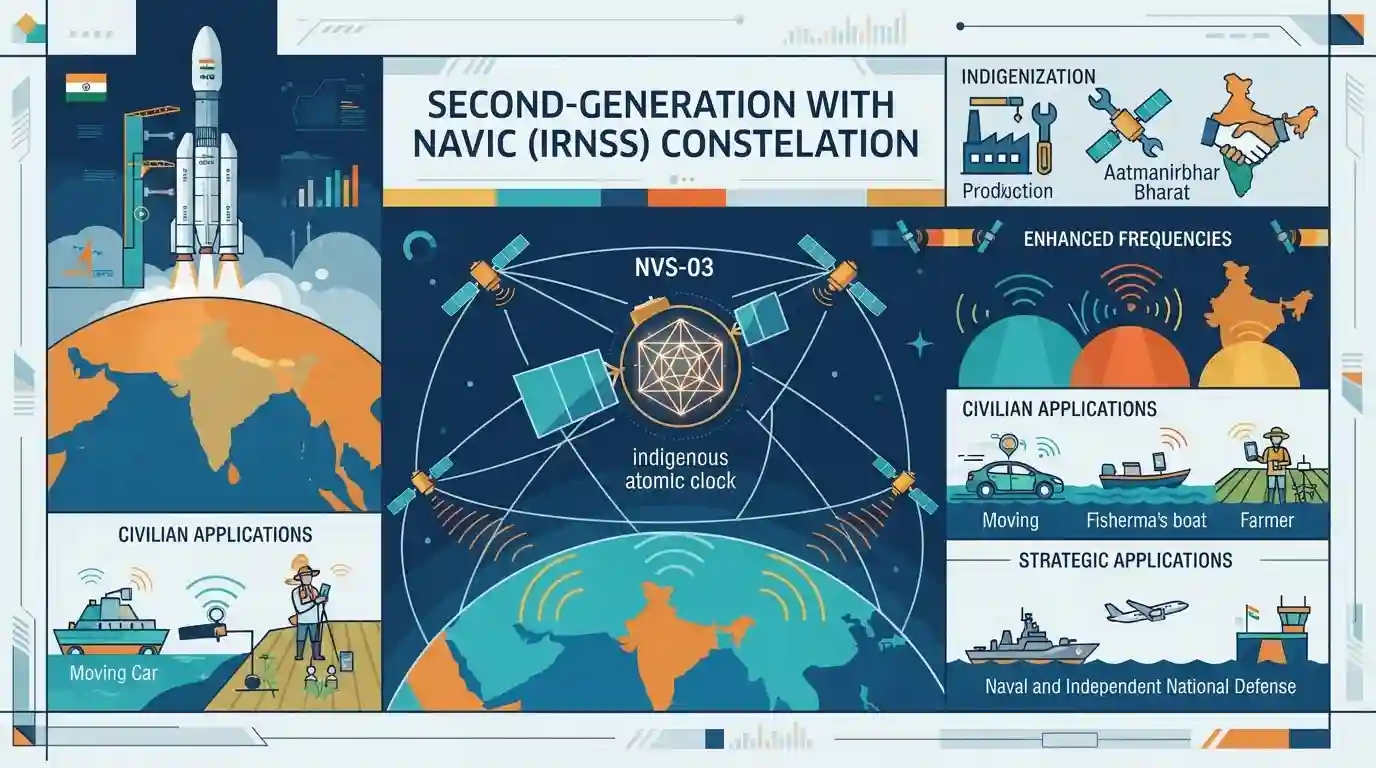
The article explains the strategic and technical significance of ISRO's upcoming NVS-03 satellite launch, part of the second-generation NavIC (IRNSS) constellation. It highlights improvements like indigenous atomic clocks and enhanced frequency bands, bolstering India's independent satellite navigation system for civilian and strategic applications.
મુખ્ય મુદ્દા
- ISRO's NVS-03 is a crucial second-generation navigation satellite designed to strengthen India's regional navigation system, NavIC (IRNSS).
- It features enhanced capabilities, including indigenous rubidium atomic clocks, which provide high-precision timing crucial for positioning, navigation, and timing (PNT) services.
- NavIC provides precise position information services to users in India and the region extending up to 1,500 km from its borders.
- The launch underscores India's self-reliance (Atmanirbhar Bharat) in critical space infrastructure and strategic navigation applications.
મહત્વપૂર્ણ શબ્દો
NavIC

India's autonomous regional satellite navigation system, providing accurate position, navigation, and timing services over India and surrounding regions.
UPSC context
UPSC Prelims/Mains (GS Paper III - Science & Technology): Tests knowledge of indigenous space tech, satellite constellations, and strategic autonomy.
IRNSS
The official name for India's regional satellite navigation system (NavIC), comprising a constellation of satellites designed to deliver independent positioning data.
UPSC context
UPSC Prelims (Science & Technology): Frequently tested under space technology, orbital configurations, and national security applications.
NVS-03
A second-generation navigation satellite launched by ISRO to bolster the NavIC constellation, featuring indigenous atomic clocks and new civilian frequency bands.
UPSC context
UPSC Prelims (Science & Technology - Space): Tests awareness of recent ISRO missions, indigenization of critical components like atomic clocks, and navigation upgrades.
ISRO
India's national space agency responsible for the design, development, and launch of space assets, rockets, and satellite navigation systems.
UPSC context
UPSC Prelims/Mains (GS Paper III - Space Technology): Tests achievements of Indians in science and technology, institution building, and space diplomacy.
પ્રિલિમ્સ ટ્રેપ
NavIC is a global satellite navigation system providing uninterrupted positioning across all international waters and airspace.
Aspirants often confuse NavIC as a global positioning system like GPS; however, it is strictly a regional navigation system with coverage up to 1,500 km beyond Indian borders.
સંલગ્ન સ્થિર ખ્યાલો
What are the core orbital parameters and frequency bands of India's NavIC system?
- Orbital Configuration: Constellation consists of 3 geostationary (GEO) and 4 geosynchronous (GSO) satellites covering India and 1,500 km around it.
- Frequency Bands: Operates primarily in L5 and S frequency bands, with newer NVS generation adding L1 band for civilian compatibility.
- Service Types: Provides two services: Standard Positioning Service (SPS) for civilians and Restricted Service (RS) for strategic users.
આંતર-વિષય પેટર્ન
NavIC + Consumer Electronics Standardization
Integration of L1 frequency bands in NavIC aligns with India's push for standardizing domestic location tech in consumer electronics under the BIS framework.
Space Indigenization + Critical Tech Self-Reliance
Indigenous Rubidium atomic clocks showcase how ISRO's space tech indigenization mirrors defense tech self-reliance under Atmanirbhar Bharat.

NavIC coverage range (1,500 km) and L1/L5 frequency bands are high-probability statement traps in Prelims science and tech questions.
સંલગ્ન PYQ · 3
સંલગ્ન PYQ · 3
- 2023PrelimsGS1
Which one of the following countries has its own Satellite Navigation System?
- 2018PrelimsGS1
With reference to the Indian Regional Navigation Satellite System (IRNSS), consider the following statements: 1. IRNSS has three satellites in geostationary and four satellites in geosynchronous orbits. 2. IRNSS covers entire India and about 5500 sq. km beyond its borders. 3. India will have its own satellite navigation system with full global coverage by the middle of 2019. Which of the statements given above is/are correct?
- 2016MainsGS3
Discuss India's achievements in the field of Space Science and Technology. How the application of this technology has helped India in its socio-economic development?
