Wayanad Debris Slip Search Ongoing for Missing Persons
Source:The Hindu ↗
Why It Matters
This event acts as a critical case study on the ecological fragility of the Western Ghats and the anthropogenic causes of landslides. It highlights the direct conflict between infrastructure development (such as tunnel roads) and environmental conservation, pointing to the crucial need for rigorous Environmental Impact Assessments (EIAs), effective landslide hazard zonation, and robust disaster response planning.
Summary
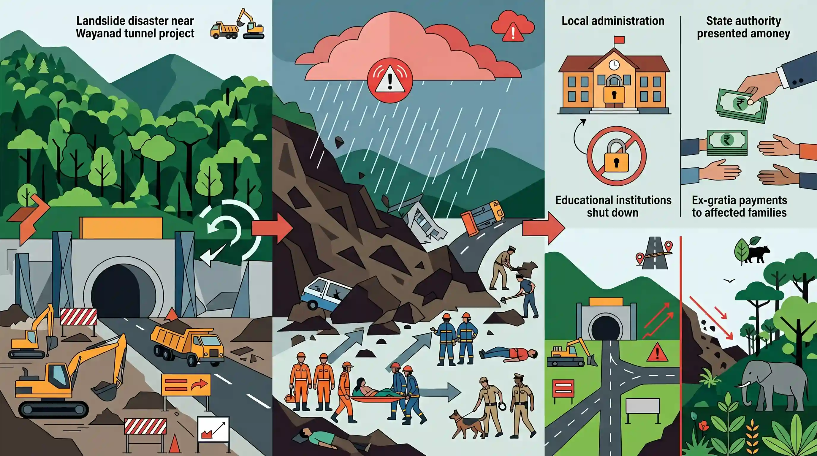
On July 7, 2026, a deadly debris slip (landslide) struck near the under-construction Wayanad tunnel road project in Kalladi, Kerala, causing three deaths and leaving five missing. Despite challenging weather and heavy rains, a joint rescue effort led by a 60-member NDRF team, Fire and Rescue Services, and police remains underway. Amidst an IMD red alert for heavy rains, local administration shut down educational institutions, while state authorities announced ₹5 lakh ex-gratia for the families of the victims. The disaster highlights the structural and environmental risks of major infrastructure projects in the fragile Western Ghats.
Key Points
- A massive debris slip (landslide) occurred near the entrance of the under-construction Wayanad twin-tunnel road project at Kalladi, near Meppadi, in Wayanad, Kerala, on July 7, 2026.
- The disaster resulted in three fatalities, ten injuries, and left five individuals missing, triggering an intensive rescue effort across designated search zones.
- A 60-member NDRF team, supported by local police, rescue personnel, volunteers, and cadaver dogs, conducted search and rescue operations despite challenges from heavy rains and inclement weather.
- An ex-gratia relief of ₹5 lakh was announced for the families of the deceased, and the state government committed to covering all medical treatment costs for the injured.
- Following an IMD red alert for extremely heavy rainfall in Wayanad, District Collector D.R. Meghashree declared a holiday for all educational institutions in the region.
- The incident highlights ongoing safety and ecological concerns surrounding major infrastructure projects (like tunneling) in the ecologically fragile and landslide-prone Western Ghats.
Important Terms
Wayanad tunnel road project

An 8.2-km under-construction twin-tunnel project (Anakkampoyil–Kalladi–Meppadi) designed to connect Kozhikode and Wayanad districts through the ecologically fragile Vellarimala mountain range in Kerala.
UPSC context
GS Paper III (Infrastructure, Environment); tests development versus conservation balance and disaster vulnerability in the fragile Western Ghats.
National Disaster Response Force (NDRF)
A specialized, multi-skilled Indian force constituted under the Disaster Management Act, 2005, tasked with providing rapid, specialist response to natural and man-made disasters.
UPSC context
GS Paper III (Disaster Management); tests administrative frameworks, emergency response capabilities, and federal coordination during severe calamities.
India Meteorological Department (IMD)
The principal government agency under the Ministry of Earth Sciences responsible for meteorological observations, weather forecasting, and issuing warnings for extreme weather events.
UPSC context
GS Paper I (Geography) and GS Paper III (Disaster Management); tests early warning mechanisms, weather forecasting, and climate resilience.
Prelims Trap
The Landslide Atlas of India, which ranks landslide vulnerability across districts, is compiled and published by the Geological Survey of India (GSI).
The Landslide Atlas of India is published by ISRO's National Remote Sensing Centre (NRSC), while GSI is the nodal agency for landslide hazard zonation.
Static Concepts Connected
How do landslides in Himalayas differ from those in Western Ghats?
- Tectonic driving force: Himalayan landslides are driven by active seismic instability, whereas Western Ghats landslides are predominantly rainfall-triggered.
- Geological age: Himalayas consist of fragile, sedimentary rock systems, while Western Ghats features deeply weathered, clay-rich lateritic soils.
- Anthropogenic pressure: Ghats face degradation from monoculture plantations and quarrying, while Himalayas suffer from heavy hydro-projects and road-widening.
How did Gadgil and Kasturirangan reports differ on Western Ghats?
- ESA spatial coverage: Gadgil Panel (WGEEP) recommended 64% of Western Ghats as Ecologically Sensitive Area, whereas Kasturirangan proposed only 37%.
- Zoning classification: Gadgil suggested three nested levels of sensitivity (ESZ I-III); Kasturirangan divided the region binary-style into natural and cultural landscapes.
- Governance approach: Gadgil advocated a bottom-up, community-led conservation strategy; Kasturirangan favored a top-down regulatory and developmental balance.
Cross-Topic Patterns
Infrastructure development vs. Ecological fragility
Bypassing ghat roads with massive twin-tunnel projects risks altering sub-surface hydrology, directly triggering slope failures in ecologically sensitive zones.
Monsoon variability + Soil mechanics
Climate-induced high-intensity precipitation bursts saturate weathered lateritic soils, significantly reducing shear strength and precipitating sudden debris slips.

UPSC may combine physical geology of lateritic soils with Kasturirangan's zoning and ISRO's Landslide Atlas in a multi-statement 2026 prelims Q.
Linked PYQs · 4
Linked PYQs · 4
- 2021MainsGS1
Differentiate the causes of landslides in the Himalayan region and Western Ghats.
- 2013MainsGS1
Bring out the causes for more frequent occurrence of landslides in the Himalayas than in the Western Ghats.
- 2021MainsGS3
Describe the various causes and the effects of landslides. Mention the important components of the National Landslide Risk Management Strategy.
- 2019MainsGS3
Disaster preparedness is the first step in any disaster management process. Explain how hazard zonation mapping will help disaster mitigation in the case of landslides.
