Rising Water Levels in UP Rivers Prompt Anti Erosion Measures
Source:theprint ↗
Why It Matters
Understanding UP's major river basins (Ganga, Saryu) and flood mitigation infrastructure is crucial for UPPSC Prelims questions on state geography and disaster preparedness.
Summary
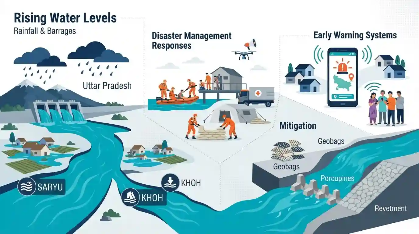
Rivers in Uttar Pradesh have seen rising water levels due to significant rainfall and barrages discharging water, prompting active disaster management responses. While rivers like Saryu and Khoh experienced notable flow increases, structural mitigations such as geobags, porcupines, and revetments are controlling erosion. Early warning systems, notably the Sachet App, are being utilized to alert vulnerable communities.
Key Points
- Water levels in key Uttar Pradesh rivers like Ganga, Saryu, and Khoh have risen following heavy rains and discharges from upstream barrages like Haridwar.
- The Saryu river breached the danger mark at Elgin Bridge in Barabanki, though officials report the overall flood situation is under control.
- Riverbank anti-erosion techniques including geobag studs, porcupines, spurs, and revetment works are being deployed by the Irrigation Department.
- Authorities are using the 'Sachet App' alongside targeted SMS alerts as early warning systems to inform residents of potential flood risks.
Important Terms
Sachet App

An early warning mobile application developed by NDMA providing real-time, geo-tagged disaster alerts in 12 regional languages using the Common Alerting Protocol.
UPSC context
Important for UPPSC GS Paper 3 (Disaster Management) and GS Paper 5 (UP disaster mitigation tools).
Saryu River
A significant river in Uttar Pradesh that often surges during monsoons, causing floods and severe riverbank erosion in districts like Gonda, Barabanki, and Ayodhya.
UPSC context
Relevant for UPPSC GS Paper 1 and 5 (UP Geography, River Systems) and disaster management.
Porcupine Structures
Cost-effective, permeable tetrahedral frames made of concrete or bamboo. Positioned along riverbanks, they dampen water flow velocity and induce sediment deposition to prevent erosion.
UPSC context
Crucial for UPPSC GS Paper 3 and 5 (Disaster Management, UP-specific flood mitigation and river training).
Geobags
Permeable, high-strength geotextile containers filled with sand or soil. They are deployed to stabilize riverbanks, prevent scouring, and act as flexible, eco-friendly flood barriers.
UPSC context
Tests knowledge of modern, sustainable disaster mitigation technology in UPPSC GS Paper 3.
Revetments
Protective facings of impact-resistant materials—such as stones, concrete mats, or vegetation—applied to riverbanks to absorb the energy of incoming water currents and prevent erosion.
UPSC context
Relevant for UPPSC GS Paper 3 (Disaster Management) as an essential structural flood control measure.
Irrigation and Water Resources Department (Uttar Pradesh)
The state's nodal agency responsible for managing water infrastructure, executing extensive flood control projects, constructing embankments, and maintaining canal systems across Uttar Pradesh.
UPSC context
Essential for UPPSC GS Paper 5 and 6 (UP State Administration, Infrastructure, and Water Management).
Prelims Trap
Assuming the 'Sachet App' is a state-specific UP government initiative.
Sachet is a pan-India early warning app launched by the National Disaster Management Authority (NDMA) using the Common Alerting Protocol, not just a UP initiative.
Static Concepts Connected
What is the geographical profile of the Saryu and Khoh rivers in UP?
- Saryu River: Formed by the confluence of Ghaghara and Mahakali (Sarda). The historic city of Ayodhya is situated on its right bank.
- Khoh River: Originates in the Shivalik range, enters the UP plains near Najibabad in Bijnor district, and acts as a major tributary of the Ramganga river.
What are common structural measures for riverbank erosion control?
- Porcupines & Spurs: Permeable groynes extending into the river to reduce water velocity, deflect flow away from the bank, and induce siltation.
- Geobags: Geosynthetic bags filled with locally available sand or soil, placed along riverbanks to prevent scour and stabilize vulnerable slopes.
- Revetments: Sloping, armor-like structures built directly on riverbanks to absorb the kinetic energy of incoming water and prevent soil washing.
Cross-Topic Patterns
Tech + Disaster Early Warning
The deployment of NDMA's Sachet App connects UP seasonal flooding to GS-3 topics on Information Technology in Disaster Management and the pan-India Common Alerting Protocol (CAP).
Colonial Infra + Modern Geography
The Elgin Bridge in Barabanki (built 1896) over the Ghaghara serves as a key flood monitoring site, linking colonial UP history with modern disaster mapping and geographic monitoring.

Expect a Match-the-Following question pairing UP's lesser-known rivers (Khoh) with their parent basins (Ramganga) or entry districts.
Linked PYQs · 3
Linked PYQs · 3
- 2023UPPSC_PRELIMSGS1
Which of the following statement is correct? (1) Ram Ganga river joins the Ganga at Kannauj. (2) River Betwa joins the Yamuna near Prayagraj. Select the correct answer using the code given below –
- 2021UPPSC_PRELIMSGS1
Which one of the following rivers is NOT the part of Indian Ganga river basin ?
- 2018UPPSC_PRELIMSGS1
Which of the following rivers of Uttar Pradesh has been declared a 'Biological Disaster' due to environmental pollution?
