Shallow Focus Earthquakes in Venezuela and Disaster Preparedness
Source:Indian Express ↗
Why It Matters
This event serves as a practical case study for understanding the destructive potential of shallow-focus, rapid-succession earthquakes. It is highly relevant for GS Paper 1 (Geophysics, Seismology) and GS Paper 3 (Disaster Management, Vulnerability and Preparedness).
Summary
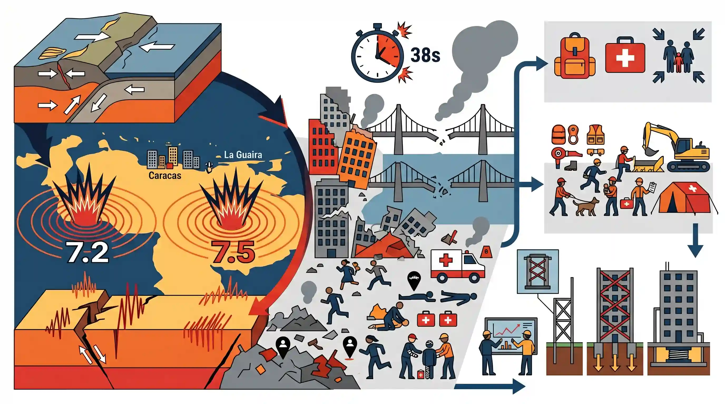
A devastating pair of shallow-focus earthquakes, measuring 7.2 and 7.5 on the Richter scale, struck Venezuela within 38 seconds of each other. The epicenters were near Caracas and La Guaira, leading to massive destruction of property, at least 188 fatalities, and over 1,500 injuries. The shallow depth of the tremors amplified the ground shaking, exposing structural vulnerabilities and emphasizing the critical need for robust disaster preparedness, rapid response mechanisms, and earthquake-resilient infrastructure in highly seismic zones.
Key Points
- Twin earthquakes of magnitudes 7.2 and 7.5 struck Venezuela, primarily affecting the capital Caracas and the coastal state of La Guaira.
- The seismic events occurred in rapid succession with a gap of just 38 seconds, complicating evacuation and immediate response efforts.
- Both quakes had shallow depths (20.3 km and 10 km respectively), which typically causes more intense surface shaking and greater destruction than deep-focus earthquakes.
- The disaster has resulted in at least 188 deaths and over 1,500 injuries, highlighting significant infrastructural vulnerabilities in the affected regions.
Prelims Trap
"Deep-focus earthquakes cause greater surface destruction than shallow-focus ones due to higher accumulated energy."
Shallow-focus earthquakes are actually more destructive. Their seismic waves travel a shorter distance to the surface, experiencing much less energy attenuation (loss) before hitting structures.
Static Concepts Connected
Why are shallow-focus earthquakes generally more destructive than deep-focus ones?
- Depth range: They originate between 0-70 km below the Earth's surface, much closer to human settlement.
- Energy attenuation: Seismic waves travel a shorter distance to the surface, retaining more energy and causing violent ground shaking.
- Aftershock intensity: Shallow quakes typically produce more numerous and intense aftershocks, severely complicating disaster response and rescue efforts.
What tectonic interactions define the seismic profile of northern South America?
- Caribbean Plate boundary: Northern Venezuela sits on a highly active, complex boundary between the Caribbean Plate and the South American Plate.
- Mixed fault types: The region features a volatile combination of transform (strike-slip) faulting and active subduction zones.
- Nazca contrast: Unlike the western Andes formed by the Nazca Plate subduction, the northern coast is driven by this distinct Caribbean interaction.
Cross-Topic Patterns
Micro-zonation in Urban Planning
The rapid succession of "twin quakes" highlights the GS3 focus on disaster-resilient infrastructure and the necessity of seismic micro-zonation for rapidly expanding coastal cities.
Seismicity & Global Energy Supply
Venezuela's northern coastal corridor houses major seaports and oil infrastructure. Disasters here link GS1 tectonic hazards directly to GS2/GS3 international energy market shocks.

Expect a Prelims matching question pairing recent global earthquake epicenters with their specific tectonic plate boundaries.
Linked PYQs · 4
Linked PYQs · 4
- 2021MainsGS3
Discuss about the vulnerability of India to earthquake related hazards. Give examples including the salient features of major disasters caused by earthquakes in different parts of India during the last three decades.
- 2025MainsGS1
Discuss how the changes in shape and sizes of continents and ocean basins of the planet take place due to tectonic movements of the crustal masses.
- 2019MainsGS3
Disaster preparedness is the first step in any disaster management process. Explain how hazard zonation mapping will help disaster mitigation in the case of landslides.
- 2025MainsGS1
What are Tsunamis? How and where are they formed? What are their consequences? Explain with examples.
