Uttarakhand census in snow-bound areas scheduled
Source:etvbharat ↗
Why It Matters
The logistical strategies employed for census enumeration in challenging, high-altitude terrains highlight governance challenges in border districts. The demographics of Uttarkashi, Chamoli, Rudraprayag, and Pithoragarh are frequently tested in UKPSC Prelims, making updates to their population structures highly relevant.
Summary
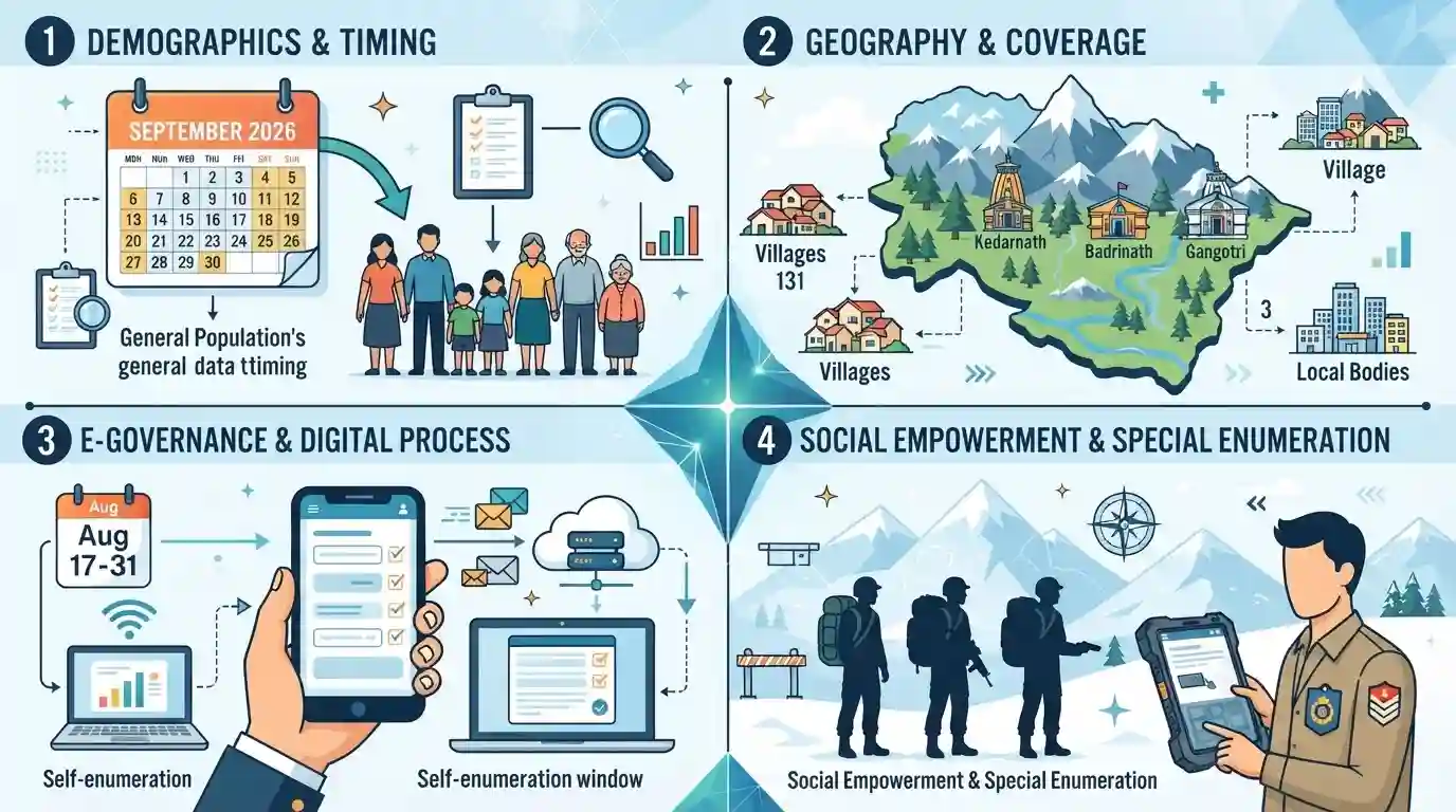
The Uttarakhand government has scheduled the population census for its snow-bound areas from September 1 to September 30, 2026, as part of the broader Census 2026 exercise. The targeted regions include 131 villages and three urban local bodies situated in the high-altitude districts of Uttarkashi, Chamoli, Rudraprayag, and Pithoragarh, which also host the revered Char Dham shrines of Kedarnath, Badrinath, and Gangotri. This phase follows the completion of the general house listing phase in May 2026. The census will emphasize digital data collection, offering a self-enumeration window from August 17 to 31, while defense personnel in these strategic border areas will be enumerated through a dedicated offline process.
Key Points
- Uttarakhand will conduct its population census in snow-bound areas from September 1 to September 30, 2026.
- The snow-bound areas encompass 131 villages and 3 urban local bodies across Uttarkashi, Chamoli, Rudraprayag, and Pithoragarh districts.
- This phase covers crucial pilgrimage centers such as Kedarnath, Badrinath, and Gangotri.
- Self-enumeration via a digital portal is permitted from August 17 to August 31, 2026, marking a shift toward digital data collection.
- Armed forces and paramilitary personnel stationed in these border regions will be counted through a separate offline mechanism.
Important Terms
Census of India

India's decadal population and demographic count, conducted under the Census Act 1948. The 16th Census (2026-27) is the first to be largely digital, executed in two phases.
UPSC context
GS Paper 1 & 2 (Population & Governance). Tests understanding of demographic data collection and socio-economic planning.
Self-Enumeration
A new e-governance feature introduced in the 16th Census, allowing citizens to voluntarily fill out their household and demographic details online via a dedicated portal before an enumerator's field visit.
UPSC context
GS Paper 2 (e-Governance). Relevant for questions on Digital India, governance transparency, and modernization of administrative exercises.
Houselisting Phase
The initial stage of the Indian Census process that maps and collects foundational data on all buildings, housing conditions, household amenities, and possessed assets.
UPSC context
GS Paper 2 (Governance). Tests knowledge of census methodology and foundational socio-economic data sets used for targeted welfare schemes.
Char Dham Shrines
Four revered Hindu pilgrimage sites in Uttarakhand’s Garhwal Himalayas—Yamunotri, Gangotri, Kedarnath, and Badrinath. They close during winter due to heavy snow, necessitating an advanced census schedule.
UPSC context
GS Paper 1 (Culture/Geography). Tests knowledge of Himalayan geography, religious tourism circuits, and regional administrative challenges in border areas.
Prelims Trap
The Indian Census is conducted simultaneously across all states and Union Territories during the population enumeration phase.
False. Snow-bound regions in Uttarakhand, HP, J&K, and Ladakh are enumerated asynchronously (typically in September) ahead of the nationwide February/March exercise to avoid winter disruptions.
Static Concepts Connected
In which districts are the Chota Char Dham shrines located in Uttarakhand?
- Gangotri & Yamunotri: Located in the Uttarkashi district, serving as the geographical sources of the Bhagirathi and Yamuna rivers respectively.
- Kedarnath: Situated in the Rudraprayag district, located in the Garhwal Himalayas along the Mandakini river valley.
- Badrinath: Located in the Chamoli district, situated on the banks of the Alaknanda river.
What is the constitutional and statutory basis of the Indian Census?
- Constitutional Mandate: Article 246 (Union List, Entry 69) places the Census under the exclusive jurisdiction of the Union Government.
- Statutory Backing: Conducted under the Census Act of 1948, which legally guarantees data confidentiality and mandates citizen cooperation.
- Nodal Ministry: Executed by the Office of the Registrar General and Census Commissioner, India (ORGI) under the Ministry of Home Affairs.
Cross-Topic Patterns
Census mapping and Vibrant Villages
Separate enumeration for defense personnel in border areas highlights the strategic overlap between demographic mapping, border security, and infrastructure initiatives like the Vibrant Villages Programme.
Digital Census and DPI penetration
The introduction of a self-enumeration portal tests the real-world reach of India's Digital Public Infrastructure (DPI) in remote, snow-bound Himalayan geographies.

Expect a Prelims statement mixing Uttarakhand's Char Dham district mapping with the asynchronous Census rules for snow-bound Indian regions.
Linked PYQs · 4
Linked PYQs · 4
- 2024UKPSC_PRELIMSGS1
Which of the following statements are true according to census of India 2011 data ? (1) Uttarkashi district has lowest density of population in Uttarakhand. (2) Rudraprayag district has the highest sex ratio in Uttarakhand. (3) U.S. Nagar has the highest % of Muslim population.
- 2025UKPSC_PRELIMSGS1
Consider the following statements according to Uttarakhand Census - 2011 : 1. Rudraprayag district has the least population in Uttarakhand. 2. Nainital district is at the third place in terms of population in state of Uttarakhand. 3. Sex-ratio in Uttarakhand is 963. 4. The population density of Uttarakhand is 189. Which statement/statements is/are correct from above?
- 2024UKPSC_PRELIMSGS1
Districts are arranged in ascending order in terms of female literacy rate. Choose the correct option :
- 2016UKPSC_PRELIMSGS1
Which one of the following shrines of Uttarakhand was visited by maximum number of tourists in the year 2015?
