Uttarakhand Ramps Up High Altitude Glacier Lake Monitoring
Source:hindustan-times ↗
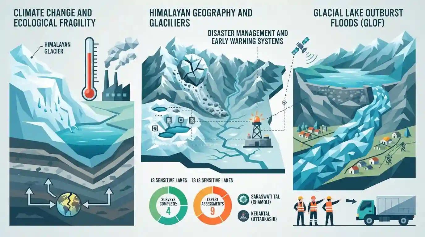
Why It Matters
The fragile Himalayan topography is highly vulnerable to climate change-led glacial retreats and sudden collapses. Past disasters in Uttarakhand (such as Kedarnath 2013 and Chamoli 2021) underscore that preemptive risk-mapping of sensitive lakes (such as Saraswati Tal and Kedartal) and installing real-time early warning sensors are critical for mitigating catastrophic loss of life and river valley infrastructure.
Summary
Following a catastrophic glacial collapse along the Tibet-Nepal border that caused massive flash floods and claimed over 600 lives, Uttarakhand has scaled up its monitoring of glaciers and high-altitude glacial lakes. Chief Minister Pushkar Singh Dhami directed the deployment of early warning systems and advanced sensors. Out of the 13 glacial lakes classified as sensitive in Uttarakhand, surveys for four are complete, and expert assessments are slated for others, including Saraswati Tal (Chamoli) and Kedartal (Uttarkashi), to gauge risks of Glacial Lake Outburst Floods (GLOFs).
Key Points
- A massive glacial collapse and debris flow along the Tibet-Nepal border (initially detected as a seismic event) triggered devastating flash floods, leaving over 626 dead and 2,000 missing.
- In response, Uttarakhand has intensified its glacial and high-altitude lake monitoring along the borders of China and Nepal to preempt similar disasters.
- Uttarakhand has classified 13 glacial lakes as highly sensitive; assessments for four lakes are complete, while assessments for the remaining are planned in phases.
- Expert teams are scheduled to survey Saraswati Tal (in Chamoli district) and Kedartal (in Uttarkashi district) to evaluate water volume, change in lake size, and terrain stability.
- Chief Minister Pushkar Singh Dhami and the Disaster Management Department have ordered the deployment of advanced sensors and early warning systems (EWS) around vulnerable glacial lakes.
- Authorities have been tasked with mapping hazard zones, marking safe evacuation routes, and strengthening local communication systems to safeguard downstream communities.
Important Terms
Glacial Lake Outburst Flood (GLOF)

A sudden, catastrophic release of water from a moraine-dammed or ice-dammed glacial lake, typically triggered by ice avalanches, earthquakes, or rapid melting.
UPSC context
GS Paper III (Geography & Disaster Management); tests understanding of Himalayan hazards and mitigation policies.
Uttarakhand State Disaster Management Authority (USDMA)
The nodal government agency in Uttarakhand tasked with planning, coordinating, and implementing disaster prevention, mitigation, and emergency response frameworks.
UPSC context
GS Paper III (Disaster Management); tests state institutional capacity and responses to natural calamities.
Wadia Institute of Himalayan Geology (WIHG)
An autonomous research institute under India’s Department of Science & Technology based in Dehradun, specializing in Himalayan geology, glaciology, and seismology.
UPSC context
Uttarakhand GK & GS Paper III; tests key regional research institutes and geological monitoring bodies.
National GLOF Risk Mitigation Project (NGRMP)
A centrally funded project designed to reduce risks from glacial floods through early warnings, mapping, and structural interventions across Himalayan states.
UPSC context
GS Paper III (Disaster Management); tests familiarity with federal funding schemes for climate adaptation.
Saraswati Tal
A highly sensitive Class A glacial lake located in the Chamoli district of Uttarakhand, currently prioritized for GLOF vulnerability assessments.
UPSC context
Uttarakhand Geography (Paper VI/GK); tests local geographical features and high-altitude GLOF hotspots.
Kedartal
A pristine high-altitude glacial lake in Uttarkashi district, fed by surrounding peaks like Mt. Thalaysagar, and the source of Kedar Ganga.
UPSC context
Uttarakhand Geography (Paper VI/GK); tests knowledge of river sources, regional terrain, and ecological fragility.
US Geological Survey (USGS)
An agency of the United States federal government that monitors and maps natural hazards, geological formations, and terrain changes globally.
UPSC context
GS Paper III (Science & Tech); tests basic international institutional awareness for global hazard monitoring.
Prelims Trap
Chamoli district contains the highest number of NDMA-classified high-risk glacial lakes in Uttarakhand.
While Chamoli is highly disaster-prone, Pithoragarh district actually has the highest number of sensitive lakes (6 out of 13), whereas Chamoli has 4.
Static Concepts Connected
What are Glacial Lake Outburst Floods (GLOFs) and their primary physical triggers?
- Mechanism: Sudden, catastrophic release of water from moraine-dammed or ice-dammed lakes when the natural barrier fails.
- Key triggers: Induced by rockfalls, ice avalanches, extreme precipitation, or seismic activity fracturing the weak moraine dam.
What is the distribution of key glaciers across Uttarakhand's major river basins?
- Bhagirathi basin: Fed by the Gangotri Glacier (Uttarkashi), the primary source of the Bhagirathi River.
- Alaknanda basin: Fed by Satopanth and Bhagirath Kharak glaciers (Chamoli), feeding the Alaknanda River.
- Kali basin: Fed by Milam and Namik glaciers (Pithoragarh), draining into the Goriganga and Kali rivers.
Cross-Topic Patterns
Eco-tourism vs. Himalayan carrying capacity
Unregulated infrastructural and tourism expansion in ecologically fragile glacial valleys accelerates moraine instability, converting natural GLOF hazards into catastrophic human disasters.
Transboundary diplomacy in disaster mitigation
Since major Himalayan rivers originate in Tibet/Nepal, early warning mechanisms require active bilateral data-sharing frameworks, linking local disaster management to Indian foreign policy.

Match-the-following questions pairing Uttarakhand's high-risk glacial lakes/glaciers with their respective districts are highly probable.
Linked PYQs · 3
Linked PYQs · 3
- 2012UKPSC_PRELIMSGS1
The longest glacier in Uttarakhand is
- 2016UKPSC_PRELIMSGS1
Where is Khatling glacier situated?
- 2024UKPSC_PRELIMSGS1
'Untadhura Pass' is situated near which one of the following glaciers of Uttarakhand ?
