IMD Issues Red Alert as Heavy Rains Swell Rivers Across Uttarakhand
Source:livemint ↗
Why It Matters
Uttarakhand's drainage system, river origins/confluences (such as Mandakini and Alaknanda), and its high susceptibility to landslides and climate change-induced flash floods are key recurrent topics in the UKPSC PCS Prelims. Understanding IMD alert levels and local river patterns is essential for state-level geography and disaster management questions.
Summary
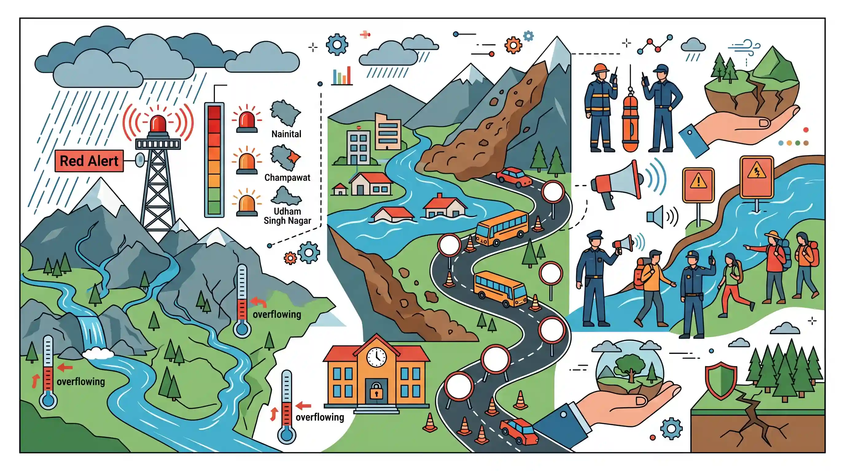
Relentless monsoon rains have triggered severe flash flood and landslide warnings across Uttarakhand, with the IMD issuing a Red Alert for multiple districts including Nainital, Champawat, and Udham Singh Nagar. Rivers like the Alaknanda, Mandakini, and Baldi (at Sahastradhara) are overflowing near their warning levels, leading to school closures in Rudraprayag and severe traffic disruptions across 107 routes. Local administrations have warned residents and pilgrims to stay away from water bodies, highlighting the state's extreme ecological and geological vulnerability to climate-induced hazards.
Key Points
- The India Meteorological Department (IMD) issued a Red Alert warning of extremely heavy to very heavy rain for several districts in Uttarakhand including Udham Singh Nagar, Nainital, Champawat, Dehradun, Tehri, Pauri, and Haridwar.
- Crucial state rivers like the Alaknanda and Mandakini in the Rudraprayag region are swelling close to their danger marks, posing an active flash flood risk.
- The Baldi River, which flows through the famous tourist spot of Sahastradhara in Dehradun (known for its sulphur springs), is in spate due to heavy local downpours.
- The Mandakini river's water levels at Gaurikund and Ganganagar neared their designated danger marks, prompting warnings for pilgrims and tourists to stay away from river banks.
- Uttarakhand is highly vulnerable to climate change-induced disasters, with landslides and flash floods constituting the most devastating natural calamities in the state's fragile Himalayan ecosystem.
Important Terms
India Meteorological Department (IMD)

The principal government agency under the Ministry of Earth Sciences responsible for meteorological observations, weather forecasting, and seismology in India.
UPSC context
GS Paper I (Geography) and GS III (Disaster Management); tests knowledge of weather tracking and climate institutions.
Flash Flood
A rapid, highly localized flooding of dry land, typically occurring within six hours of heavy rainfall, cloudbursts, or sudden water releases.
UPSC context
GS Paper I (Geography) and GS III (Disaster Management); tests understanding of rapid-onset hazards and mitigation.
Alaknanda River
A major Himalayan river originating near the Satopanth glacier; it is a vital headstream of the Ganga and forms the sacred Panch Prayag.
UPSC context
GS Paper I (Geography); critical for questions on Himalayan drainage systems and river confluences.
Color-Coded Weather Warnings
A four-level warning system (Green, Yellow, Orange, Red) used by the IMD to communicate the severity of meteorological hazards to administrations and citizens.
UPSC context
GS Paper III (Disaster Management); tests early warning systems and administrative response protocols.
Disaster Risk Reduction (DRR)
A systematic framework to identify, assess, and reduce disaster risks through proactive planning, structural defenses, and non-structural measures like floodplain zoning.
UPSC context
GS Paper III (Disaster Management); tests strategies shifting from post-disaster relief to proactive resilience.
Prelims Trap
All rivers draining the Doon Valley flow westwards to join the Yamuna basin.
Dehradun's Doon Valley has a central water divide; eastern rivers (Song, Baldi) flow southeast to the Ganga, while only western rivers (Asan) flow west to the Yamuna.
Static Concepts Connected
What are the five holy confluences (Panch Prayag) of Uttarakhand?
- Vishnuprayag: Alaknanda meets the Dhauliganga river at Vishnuprayag.
- Nandaprayag: Alaknanda meets the Nandakini river at Nandaprayag.
- Karnaprayag: Alaknanda meets the Pindar river at Karnaprayag.
- Rudraprayag: Alaknanda meets the Mandakini river (from Chorabari Glacier) at Rudraprayag.
How do karst features and sulphur springs form in Himalayas?
- Limestone Dissolution: Rainwater dissolves calcium carbonate in limestone formations, creating classic karst features like stalactites.
- Sulphur Enrichment: Deep-seated groundwater circulating through sulfate-rich rock beds (like gypsum) gets enriched with therapeutic hydrogen sulfide.
Cross-Topic Patterns
Tourism infrastructure vs Himalayan carrying capacity
Unregulated infrastructure development for the Char Dham Yatra directly clashes with the ecological carrying capacity of the highly fragile, landslide-prone Garhwal and Kumaon Himalayas.
Geothermal indicators and tectonic active zones
Hydro-geological mapping of Himalayan hot and sulphur springs links tectonic stress zones with geothermal energy potential and mineral-rich ecosystem services.

Prelims 2026 is highly likely to pair West-to-East Himalayan river sequences with their specific glacial origins and Panch Prayag junctions.
Linked PYQs · 4
Linked PYQs · 4
- 2007UKPSC_PRELIMSGS1
Name the river which flows between Kedarnath | Rudra Prayag?
- 2025UKPSC_PRELIMSGS1
Which of the following is the correct order of rivers from west to east in Uttarakhand?
- 2025UKPSC_PRELIMSGS1
Consider the following statements and select the correct answer from the options given below : Statement 1 : Uttarakhand is highly vulnerable to climate change. Statement 2 : Climate change is causing water stress and depleting biodiversity in Uttarakhand.
- 2007UKPSC_PRELIMSGS1
Which of the following Natural Calamity has the most devastating impact in Uttarakhand State?
