Uttarakhand Issues Red Alert Amid Heavy Rains and Landslides
Source:The Hindu ↗
Why It Matters
This development highlights the vulnerability of the ecologically sensitive Himalayan region to extreme weather, landslides, and flooding. For civil services aspirants, it provides real-world context for disaster management protocols (IMD alerts, SEOC coordination under the Disaster Management Act), the geography of Himalayan river networks, and the challenges of infrastructure development in mountainous terrains.
Summary
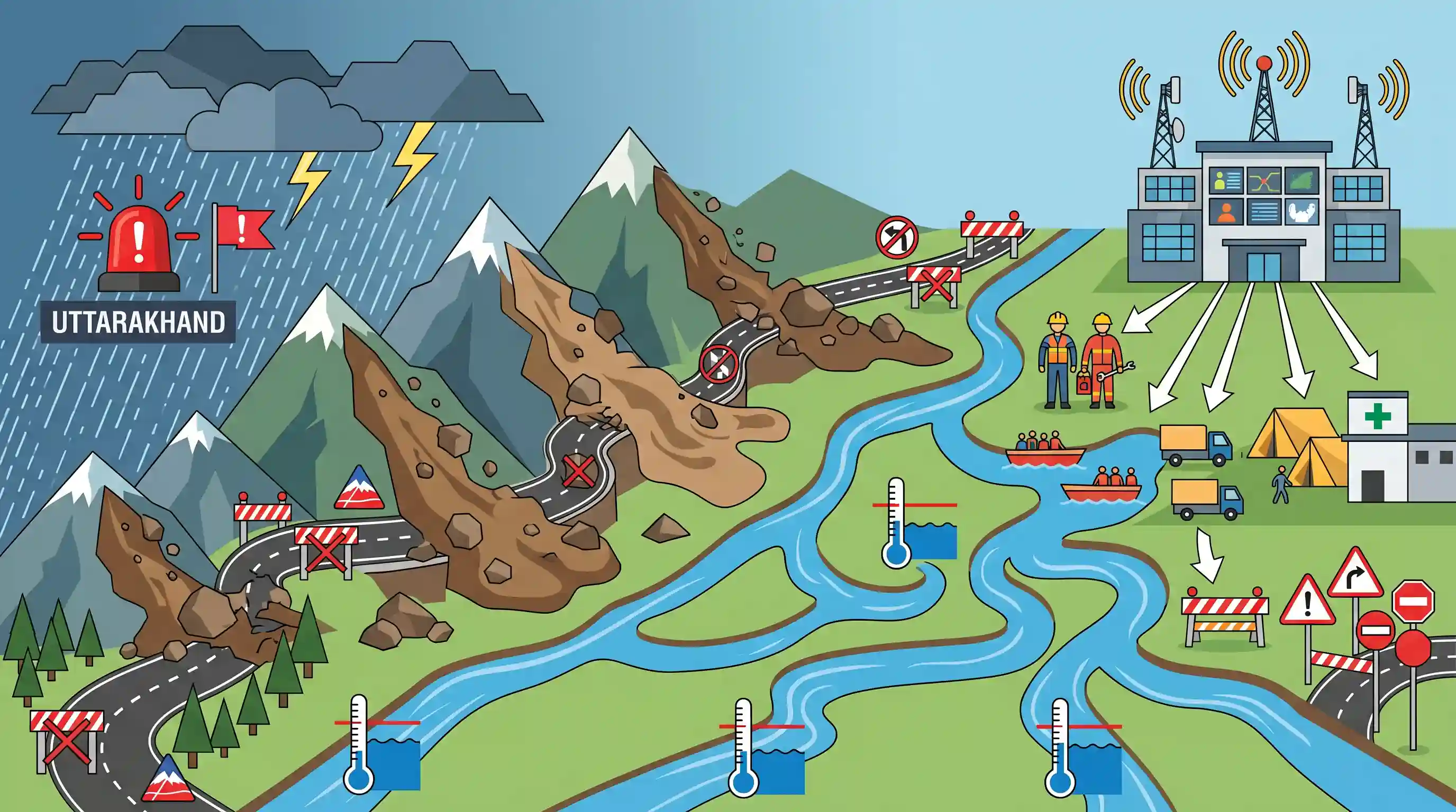
Continuous and heavy rainfall in Uttarakhand has triggered a 'Red Alert' in seven districts, leading to extensive landslides and rockfalls that have blocked 107 routes, including critical state highways and a Border Roads Organisation (BRO) road. While water levels in major Himalayan rivers like the Alaknanda, Pindar, Ganga, Kali, and Saryu are rising, they remain below danger levels. The State Emergency Operation Centre (SEOC) is actively coordinating precautionary measures, evacuations, and travel advisories to manage disaster risks.
Key Points
- Continuous heavy monsoon rainfall has prompted the Meteorological Centre in Dehradun to issue a 'Red Alert' for seven districts in Uttarakhand, expecting heavy to extremely heavy rainfall.
- Landslides and rockfalls have disrupted traffic on 107 routes, including nine state highways and one Border Roads Organisation (BRO) road, demonstrating the physical vulnerability of mountain infrastructure.
- Water levels are rising across major Himalayan rivers and tributaries, including the Alaknanda (at Srinagar), Pindar (at Karnaprayag), Ganga (at Devprayag), Kali (at Dharchula), Saryu (at Pithoragarh), and Gauri (at Jauljibi), though they currently remain below the official danger mark.
- The State Emergency Operation Centre (SEOC) is directing disaster response, issuing safety advisories, coordinating with District DMs, closing educational institutions, and carrying out precautionary evacuations in high-risk zones.
Important Terms
Disaster Management Act 2005

Landmark Indian legislation providing a comprehensive legal and institutional framework for natural and man-made disasters, shifting India's focus from post-disaster relief to proactive preparedness, mitigation, and capacity building.
UPSC context
GS Paper III (Disaster Management). Crucial for understanding India's institutional disaster response architecture and governance mechanisms during national emergencies.
India Meteorological Department
India's principal government agency under the Ministry of Earth Sciences, responsible for meteorological observations, weather forecasting, climate monitoring, and early warnings for severe weather phenomena like cyclones and monsoons.
UPSC context
GS Paper I (Geography) and GS Paper III (Disaster Management). Tests knowledge of weather patterns, monsoons, and early warning systems.
State Emergency Operation Centre (SEOC)
A centralized control hub established at the state level to coordinate disaster response, manage resource allocation, communicate early warnings, and streamline operations among local and national agencies during crises.
UPSC context
GS Paper III (Disaster Management). Tests understanding of localized disaster mitigation, decentralized emergency governance, and institutional coordination.
Central Water Commission (CWC)
India's premier technical organization in water resources, functioning under the Ministry of Jal Shakti, responsible for flood forecasting, river basin planning, and coordinating schemes for conservation and utilization.
UPSC context
GS Paper I (Geography/Water Resources) and GS Paper III (Disaster Management). Evaluates flood mitigation strategies and river water governance.
Border Roads Organisation (BRO)
A road construction and infrastructure development body under the Ministry of Defence, tasked with building and maintaining critical roads, bridges, and tunnels in India's strategically sensitive and remote border areas.
UPSC context
GS Paper III (Internal Security/Disaster Management). Important for topics on border infrastructure, regional connectivity, and strategic military mobility.
Prelims Trap
The Kali River, defining the India-Nepal boundary under the Treaty of Sugauli, originates in the Tibetan plateau.
The Kali River originates near the Lipulekh Pass/Kalapani region in Uttarakhand, India, not in Tibet.
Static Concepts Connected
What are the five sacred confluences (Panch Prayag) of the Alaknanda River?
- Vishnu & Nanda: Vishnuprayag is where Alaknanda meets Dhauliganga; Nandaprayag is the confluence with Nandakini.
- Karna & Rudra: Karnaprayag marks the confluence with the Pindar River, while Rudraprayag is the meeting point with Mandakini.
- Devprayag: The final confluence where Alaknanda merges with Bhagirathi to officially form the Ganga River.
What is the National Landslide Susceptibility Mapping (NLSM) programme?
- Nodal Agency: Executed by the Geological Survey of India (GSI) to map 0.42 million sq. km of landslide-prone terrain in India.
- Mapping Scale: Prepares GIS-based susceptibility maps at a 1:50,000 scale to guide regional development and land-use planning.
Cross-Topic Patterns
Strategic Infrastructure vs. Himalayan Ecology
Evaluates how Border Roads Organisation (BRO) projects in high-altitude zones challenge the carrying capacity of fragile slopes, requiring a balance between national security and ecological stability.
Transboundary Rivers & Sugauli Geopolitics
Shows how monsoon disasters along the Kali river basin affect bilateral disaster preparedness and territorial dispute management between India and Nepal under the Sugauli treaty.

Mains 2026 may contrast strategic border connectivity (BRO) with the ecological carrying capacity of the fragile Indian Himalayan Region.
Linked PYQs · 3
Linked PYQs · 3
- 2019MainsGS3
Disaster preparedness is the first step in any disaster management process. Explain how hazard zonation mapping will help disaster mitigation in the case of landslides.
- 2021MainsGS3
Describe the various causes and the effects of landslides. Mention the important components of the National Landslide Risk Management Strategy.
- 2024PrelimsGS1
With reference to the Himalayan rivers joining the Ganga downstream of Prayagraj from West to East, which one of the following sequences is correct? (a) Ghaghara – Gomati - Gandak – Kosi (b) Gomati - Ghaghara - Gandak – Kosi (c) Ghaghara - Gomati - Kosi - Gandak (d) Gomati – Ghaghara - Kosi – Gandak
