Dehradun Bridge Approach Road Collapse Exposes Engineering Flaws
Source:ndtv ↗
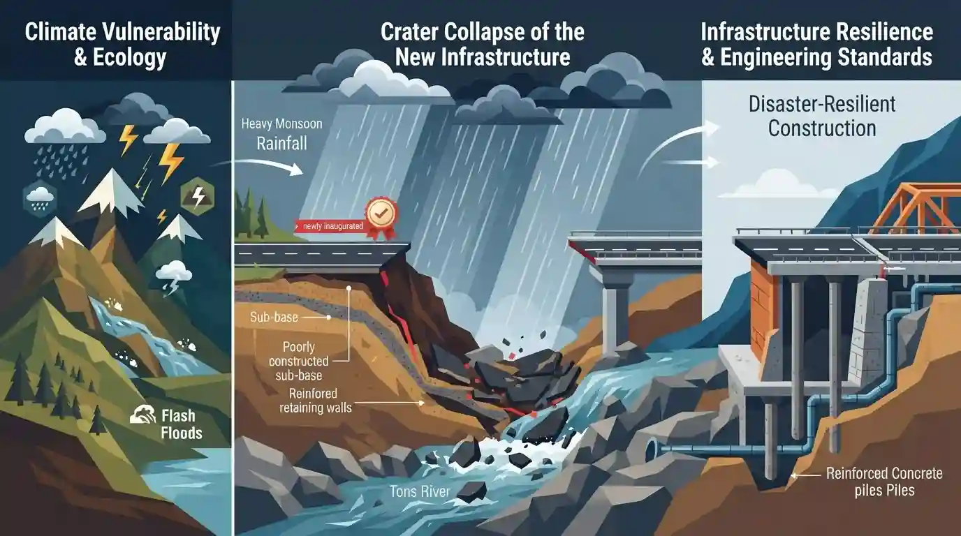
Why It Matters
The rapid failure of new infrastructure in Uttarakhand highlights the acute need for disaster-resilient engineering, proper drainage systems, and climate adaptation strategies in the geographically fragile Himalayan region.
Summary
Heavy monsoon rainfall in Uttarakhand led to a massive crater collapse on the approach road of a newly inaugurated bridge over the Tons River at Nanda Ki Chowki in Dehradun. Occurring just 16 days after the ₹16 crore project was opened, the infrastructure failure severed crucial connectivity between Dehradun, Vikasnagar, and Paonta Sahib in Himachal Pradesh. This rapid degradation of new infrastructure underscores significant concerns regarding engineering standards, drainage design, and the broader lack of disaster-resilient construction in the ecologically fragile and climate-vulnerable Himalayan state.
Key Points
- A massive crater collapsed on the approach road to a newly built ₹16 crore bridge over the Tons River in Dehradun, just 16 days after its inauguration.
- The cave-in was triggered by heavy overnight monsoon rainfall, completely severing the vital transport link between Dehradun, Vikasnagar, and Paonta Sahib.
- The incident exposes critical flaws in drainage planning, engineering quality, and infrastructure resilience in the ecologically sensitive and disaster-prone Himalayan region.
- It highlights Uttarakhand's severe vulnerability to climate-induced extreme weather events, necessitating disaster-resilient urban planning and stricter construction audits.
Important Terms
Tons River

The largest tributary of the Yamuna River, originating from the Bandarpunch mountain in Uttarakhand and merging with the Yamuna near Kalsi in Dehradun.
UPSC context
High yield for UKPSC Prelims and Mains Paper 5 (Uttarakhand Geography and River Systems).
Nanda Ki Chowki Bridge
A newly inaugurated ₹16-crore bridge over the Tons River in Dehradun whose approach road collapsed shortly after opening due to heavy monsoon rains.
UPSC context
Relevant as a case study for UKPSC Mains Paper 3 (Infrastructure Development and Engineering Standards).
Disaster-Resilient Infrastructure
Construction methods and designs aimed at ensuring critical infrastructure like roads and bridges can withstand extreme weather, floods, and Himalayan geological vulnerabilities.
UPSC context
Essential for UKPSC Mains Paper 3 (Disaster Management) and assessing state developmental policies.
U-PREPARE Project
The Uttarakhand Disaster Preparedness and Resilience Project, a World Bank-supported initiative enhancing state capabilities in emergency response, climate resilience, and public infrastructure protection.
UPSC context
Highly relevant for UKPSC Mains Paper 5 (Uttarakhand-specific Disaster Management and Governance).
Prelims Trap
"The Yamuna River carries a larger volume of water than the Tons River prior to their confluence."
False. The Tons River actually carries a significantly larger volume of water discharge than the Yamuna before they merge near Kalsi in Dehradun.
Static Concepts Connected
What is the geographical course and significance of the Tons River?
- Origin / Formation: It is formed by the confluence of the Rupin and Supin rivers at Naitwar in Uttarkashi district.
- Natural Boundary: It forms the westernmost major river in Uttarakhand and acts as a natural border between Uttarakhand and Himachal Pradesh.
- Yamuna Confluence: It merges with the Yamuna River near Kalsi in the Dehradun district.
What defines the geological vulnerability of 'Dun' valleys like Dehradun?
- Longitudinal Valleys: They are longitudinal tectonic valleys situated between the Lesser Himalayas and the Shivalik (Outer Himalayas) ranges.
- Unconsolidated Sediments: Filled with unconsolidated gravel, boulders, and alluvium, these valleys are highly prone to rapid erosion and subsidence during heavy monsoon flooding.
Cross-Topic Patterns
Himalayan Geology + Infrastructure Failures
Infrastructure failures like this mirror the Joshimath subsidence crisis, linking haphazard construction and poor drainage to the fragile geology of the Himalayan region.
Extreme Weather + Urban Drainage
The rapid washout highlights the increasing frequency of localized extreme rainfall altering river carrying capacities in the Tons and Yamuna catchments, testing urban resilience.

Multi-statement question likely on Tons River's hydrology (Rupin-Supin, Kalsi confluence) paired with Shivalik ecological vulnerability.
Linked PYQs · 3
Linked PYQs · 3
- 2021UKPSC_PRELIMSGS1
'Govind National Park' includes :
- 2025UKPSC_PRELIMSGS1
Consider the following statements and select the correct answer from the options given below : Statement 1 : Uttarakhand is highly vulnerable to climate change. Statement 2 : Climate change is causing water stress and depleting biodiversity in Uttarakhand.
- 2012UKPSC_PRELIMSGS1
Which are called 'Duns' in Uttarakhand?
