Uttarakhand PWD bars firm after Tons bridge damage
Source:aninews ↗
Why It Matters
Highlights the interplay between natural disasters (flash floods) and infrastructure vulnerability in Uttarakhand's fragile ecosystem. It touches upon local geography (Tons River, NH-72) which is frequently tested in UKPSC Prelims.
Summary
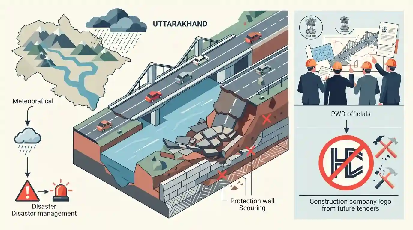
The Uttarakhand Public Works Department (PWD) has taken strict action against Himalayan Construction by suspending the company and barring it from future tenders. This follows the collapse of the approach road to a bridge over the Tons River on the Dehradun-Paonta Sahib Highway (NH-72) near Nanda Ki Chowki. The damage was triggered by heavy rainfall and flash floods, exposing severe infrastructural vulnerabilities and poor construction quality, specifically related to scouring under the protection wall. The meteorological department concurrently issued a heavy rain alert for several districts, highlighting the state's ongoing challenges with extreme weather and disaster management.
Key Points
- Uttarakhand PWD suspended Himalayan Construction and barred them from tender processes after the approach road of a bridge over the Tons River collapsed.
- The incident occurred near Nanda Ki Chowki on the Dehradun-Paonta Sahib Highway (NH-72) following heavy rainfall and flash floods.
- The failure was attributed to scouring beneath the upstream protection wall, suggesting inadequate infrastructure resilience.
- The IMD issued heavy rain alerts for Bageshwar, Pithoragarh, and Chamoli, indicating continued vulnerability to extreme weather events.
Important Terms
Tons River

The largest tributary of the Yamuna River, originating from the Bandarpunch mountain in Uttarakhand. It merges with the Yamuna near Kalsi, Dehradun, often carrying more water than the Yamuna itself.
UPSC context
Highly relevant for GS Paper 1 (Geography). Frequently tested in prelims regarding Himalayan river systems, tributaries, and regional drainage basins.
Flash Floods
Sudden, highly localized flooding events that occur within six hours of intense precipitation like cloudbursts. They generate rapid, destructive surges of water and are increasingly common in Himalayan regions.
UPSC context
Essential for GS Papers 1 and 3 (Geography, Disaster Management). Tests knowledge of climate extremes, structural vulnerabilities, and disaster mitigation.
Bridge Scouring
The localized erosion of sediment or soil around a bridge's foundation, piers, or protection walls by fast-flowing water. It severely compromises structural stability and is a leading cause of infrastructure failure.
UPSC context
Important for GS Paper 3 (Infrastructure Resilience). It highlights the need for climate-proof engineering and robust disaster management during floods.
India Meteorological Department (IMD)
The nodal agency under the Ministry of Earth Sciences responsible for meteorological observations, climate forecasting, and issuing critical early warnings for extreme weather events in India.
UPSC context
Vital for GS Paper 3 (Disaster Management). Aspirants must understand its forecasting models, early warning mechanisms, and role in adaptation.
Prelims Trap
"The Tons River is a major tributary of the Ganga river system originating near the Gangotri glacier."
The Tons River is actually the largest tributary of the Yamuna, not the Ganga. It originates from the Bandarpunch massif and merges with the Yamuna near Kalsi.
Static Concepts Connected
What is the geographical profile of the Tons River?
- Origin: It originates from the Bandarpunch massif in Uttarakhand, formed by the confluence of the Rupin and Supin streams.
- Yamuna Tributary: It is the largest and longest tributary of the Yamuna, joining it below Kalsi near Dehradun.
- State Boundary: It acts as a natural geographical border between Himachal Pradesh (Sirmaur) and Uttarakhand (Dehradun).
What is 'bridge scouring' in the context of infrastructure failure?
- Definition: The erosive removal of stream bed material (sand, gravel) from around bridge piers and abutments by swift-moving water.
- Mechanism: During flash floods, increased water velocity creates scour holes that undermine the foundation of the bridge, causing it to collapse.
- Himalayan Vulnerability: Himalayan rivers are highly susceptible due to steep gradients, high water velocity, and large sediment loads during extreme rain.
Cross-Topic Patterns
Himalayan Geology & Infrastructure
Recent collapses (Silkyara tunnel, Tons bridge) highlight the conflict between aggressive infrastructure development and the fragile, young fold mountain ecology of the Himalayas.
Flash Floods & Micro-catchments
Increased extreme precipitation in smaller catchments (like Tons and Teesta) triggers catastrophic downstream structural damage, shifting disaster mitigation focus from main rivers to micro-watershed management.

Tons river geography (Bandarpunch origin, Govind National Park, Yamuna confluence) is prime for a 2026 map-based tributary question.
Linked PYQs · 3
Linked PYQs · 3
- 2021UKPSC_PRELIMSGS1
'Govind National Park' includes :
- 2025UKPSC_PRELIMSGS1
Consider the following statements and select the correct answer from the options given below : Statement 1 : Uttarakhand is highly vulnerable to climate change. Statement 2 : Climate change is causing water stress and depleting biodiversity in Uttarakhand.
- 2025UKPSC_PRELIMSGS1
Which of the following is the correct order of rivers from west to east in Uttarakhand?
