Uttarakhand Plans Drone and Satellite Surveillance for Glacial Lakes
Source:new-indian-express ↗
Why It Matters
Understanding Uttarakhand's vulnerability to GLOFs, landslide management, and climate-change-induced hazards is a major recurring theme in UKPSC PCS exams. Knowledge of early warning technologies, state response mechanisms, and past disasters (such as the 2013 Kedarnath disaster) is essential for aspirants.
Summary
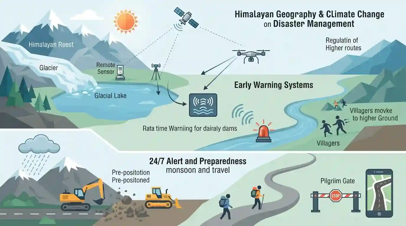
The Government of Uttarakhand is set to implement a comprehensive real-time monitoring network using satellite data, remote sensors, and drone surveys to track high-altitude glacial lakes. Reviewed by Disaster Management Minister Madan Kaushik, the initiative aims to establish early-warning systems to protect downstream valleys from devastating Glacial Lake Outburst Floods (GLOFs) caused by rapid warming and fragile Himalayan geology. Additionally, the state has put its disaster-management machinery on 24/7 alert to manage heavy monsoon rainfall, pre-position landslide-clearing equipment, and regulate pilgrim travel routes based on real-time road conditions.
Key Points
- Uttarakhand plans to deploy an advanced scientific surveillance grid using satellite imagery, remote sensing, drones, and sensor-based systems to monitor vulnerable high-altitude glacial lakes in real time.
- The monitoring system will track changes in water levels, surface areas, and storage capacities to predict and mitigate the risk of Glacial Lake Outburst Floods (GLOFs) exacerbated by climate change.
- Early-warning systems will be installed in at-risk zones to ensure timely alerts reach downstream communities before emergencies escalate.
- Uttarakhand's Disaster Management Minister Madan Kaushik directed scientific institutions and departments (including NDRF, SDRF, and PWD) to maintain 24/7 coordination and pre-position machinery like excavators at landslide-prone areas.
- State authorities will strictly regulate pilgrimages and general travel based on real-time weather forecasts and road conditions to prevent tourist entrapment during intense monsoon downpours.
Important Terms
National GLOF Risk Mitigation Programme

A ₹150 crore NDMA national initiative approved in 2024 to assess, monitor, and mitigate risks across 195 highly vulnerable glacial lakes in the Indian Himalayas, focusing on early warning systems and community preparedness.
UPSC context
Paper III (Technology & Disaster Management); tests strategies to mitigate high-altitude glacial lake hazards and protect downstream communities.
Uttarakhand Action Plan on Climate Change (UAPCC)
A comprehensive policy framework aligned with India's NAPCC to build climate resilience across key state sectors like disaster management, forests, and agriculture, addressing Himalayan warming, erratic monsoons, and glacial melt.
UPSC context
Paper III (Environment & Climate Change); tests state-level adaptation policies, sustainable development, and sector-specific climate strategies.
State Disaster Response Force (SDRF) Uttarakhand
An elite, specialized search and rescue force of the Uttarakhand Police formed to serve as immediate first responders during natural disasters like landslides, flash floods, and cloudbursts in the state.
UPSC context
Paper III (Disaster Management); tests state-level executive machinery and emergency response capabilities in disaster-prone Himalayan zones.
National Disaster Response Force (NDRF)
India's specialized, multi-disciplinary federal force constituted under the Disaster Management Act, 2005, tasked with executing rapid-response search, rescue, and relief operations during severe natural and man-made disasters.
UPSC context
Paper III (Disaster Management); tests the national institutional framework, disaster governance, and federal coordination during catastrophic emergencies.
State Emergency Operations Centre (SEOC) Uttarakhand
Located in Dehradun, this 24/7 centralized command facility serves as the state’s nerve center for real-time monitoring, collecting meteorological alerts, coordinating rescue efforts with district emergency offices, and managing public helplines.
UPSC context
Paper III (Disaster Management); tests the administrative setup, communication chains, and real-time coordination mechanisms during state crises.
Wadia Institute of Himalayan Geology (WIHG)
An autonomous research organization under the Department of Science and Technology, India, located in Dehradun, focusing on geological processes, glaciology, seismology, and natural hazards in the Himalayan region.
UPSC context
Paper II & III (Geography; S&T); tests Himalayan geological evolution, glaciology research, and disaster mitigation strategies.
Prelims Trap
Chamoli district hosts the highest number of NDMA-identified high-risk glacial lakes in Uttarakhand.
Chamoli dominates disaster news (e.g., 2021 Rishi Ganga GLOF), but Pithoragarh actually hosts the highest number (6 out of 13) of high-risk glacial lakes identified by NDMA.
Static Concepts Connected
What is a Glacial Lake Outburst Flood (GLOF) and its triggers?
- Definition: Sudden release of water from moraine-dammed or ice-dammed lakes due to dam failure.
- Triggers: Rapid ice/snow melt, calving of glaciers, earthquakes, or rock avalanches displacing water over the dam.
- Himalayan Vulnerability: Young, tectonically active mountains with loose moraine dams lacking structural cohesion.
How is climate change action governed and coordinated in Uttarakhand?
- State Council (SCCC): Established in 2011 to oversee climate policies, vulnerability assessments, and inter-departmental action plans.
- UAPCC Drafting: Drafted by SCCC and environment/planning bodies, not the State Revenue Department.
- Nodal Agency: Wadia Institute of Himalayan Geology (WIHG), Dehradun acts as the primary scientific coordinator for Category A lakes.
Cross-Topic Patterns
Chardham Yatra safety and GLOF monitoring
Unregulated pilgrim influx in fragile high-altitude zones like Kedarnath and Gangotri increases vulnerability, demanding real-time early warning integration with state tourism regulatory systems.
Space tech in Himalayan hazard mapping
Collaborations between ISRO (IIRS Dehradun) and state disaster bodies showcase the shift from reactive relief to space-tech-driven proactive monitoring in federal disaster frameworks.

Expect a multi-statement UKPSC question matching Category-A glacial lakes (e.g., Vasudhara Tal, Mabang) with their basins/districts.
Linked PYQs · 3
Linked PYQs · 3
- 2025UKPSC_PRELIMSGS1
Consider the following statements and select the correct answer from the options given below : Statement 1 : Uttarakhand is highly vulnerable to climate change. Statement 2 : Climate change is causing water stress and depleting biodiversity in Uttarakhand.
- 2024UKPSC_PRELIMSGS1
Match the hydroelectric projects with the river on which they are constructed : | Name of Project | River | |---|---| | A. Koteshwar | 1. Asan | | B. Kulhal | 2. Alaknanda | | C. Tapoban Vishnugad | 3. Bhagirathi | | D. Vishnuprayag | 4. Dhalui | A B C D
- 2012UKPSC_PRELIMSGS1
Kedar valley disaster of June, 2013, was cause by heavy rains in the catchment area of a river, which was:
