Uttarakhand Flash Flood Warning and Road Closures
Source:newindianexpress ↗
Why It Matters
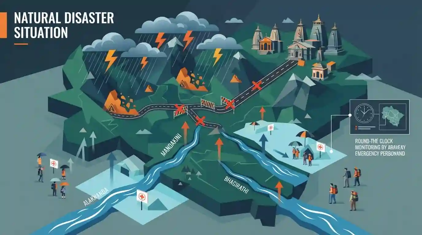
The article demonstrates the geographical fragility of the Uttarakhand Himalayas, illustrating how extreme weather (flash floods, landslides) disrupts infrastructure, river basins, and the vital Char Dham pilgrimage circuit. This is a highly recurring theme in UKPSC examinations concerning the state's geography and disaster preparedness.
Summary
Uttarakhand has been placed on high alert as the IMD issued severe warnings for flash floods and heavy rains across eight districts. The intense monsoon activity has triggered multiple landslides, leading to the closure of 102 roads, including sections of the critical Badrinath national highway. Key river systems—such as the Alaknanda, Mandakini, Bhagirathi, and Saryu—are swelling near danger levels. The State Emergency Operation Centre has mandated round-the-clock monitoring to protect residents and Char Dham pilgrims from the compounding natural hazards.
Key Points
- The IMD issued a severe flash flood and heavy rain warning covering eight districts of Uttarakhand due to relentless monsoon downpours.
- Monsoon-induced landslides have blocked 102 state roads, including crucial segments of the Badrinath national highway.
- Major regional rivers such as Alaknanda, Mandakini, Bhagirathi, Saryu, Kali, and Gori are flowing perilously close to the danger mark.
- Authorities and the SEOC are maintaining strict surveillance to safeguard the local population and Char Dham pilgrims.
Important Terms
India Meteorological Department (IMD)

The principal Indian government agency under the Ministry of Earth Sciences responsible for meteorological observations, forecasting, and issuing early warnings for natural hazards like heavy rainfall and cyclones.
UPSC context
GS-I (Geography) and GS-III (Disaster Management). Tests knowledge of early warning systems, monsoon forecasting, and climate resilience.
State Emergency Operation Centre (SEOC)
A 24-hour command and communication hub at the state level that disseminates early warnings, coordinates disaster response activities, and liaises between national, state, and district disaster management authorities.
UPSC context
GS-III (Disaster Management). Evaluates understanding of India's institutional framework for crisis response, mitigation, and emergency coordination.
Flash Floods
Rapid, destructive floods occurring usually within six hours of heavy precipitation, cloudbursts, or sudden water releases like glacial lake outbursts, exacerbated by steep terrain and poor drainage.
UPSC context
GS-I (Geography) and GS-III (Disaster Management). Tests climate change impacts, vulnerability of mountain ecosystems, and urban flood preparedness.
Char Dham
A sacred Hindu pilgrimage circuit in the Garhwal Himalayas of Uttarakhand, encompassing four holy shrines: Badrinath, Kedarnath, Gangotri, and Yamunotri, drawing massive annual footfalls.
UPSC context
GS-I (Culture/Geography) and GS-III (Environment). Tests the balance between religious tourism, infrastructure development, and ecological preservation.
Alaknanda River
A major Himalayan river in Uttarakhand originating near the Satopanth Glacier. It forms the Panch Prayag confluences and joins the Bhagirathi River at Devprayag to officially form the Ganga.
UPSC context
GS-I (Geography). Essential for mapping questions, understanding Himalayan drainage systems, and assessing regional hydropower and ecological vulnerabilities.
Prelims Trap
The Mandakini river merges with the Alaknanda river at Devprayag to officially form the river Ganga.
The Mandakini meets the Alaknanda at Rudraprayag. It is the confluence of the Bhagirathi and Alaknanda at Devprayag that officially forms the Ganga.
Static Concepts Connected
What constitutes the Panch Prayag in the Alaknanda river system?
- Upper Confluences: The Alaknanda river meets the Dhauliganga at Vishnuprayag, and the Nandakini river at Nandaprayag.
- Middle Confluences: The Alaknanda converges with the Pindar river at Karnaprayag, and the Mandakini river at Rudraprayag.
- Devprayag: The final confluence where the Alaknanda meets the Bhagirathi, after which the combined river is officially termed the Ganga.
Why are the Himalayas highly susceptible to frequent landslides?
- Tectonic Fragility: The Himalayas are young fold mountains characterized by steep gradients and active tectonic fault lines like the Main Boundary Thrust.
- Anthropogenic Stress: Unregulated slope-cutting and deforestation for projects like the Char Dham highway weaken structurally unstable rock formations.
- Climatic Triggers: Intense southwest monsoon rains and localized cloudbursts act as the primary immediate trigger for massive debris flows.
Cross-Topic Patterns
Border Infrastructure vs. Himalayan Ecology
The Char Dham road project illustrates the tension between strategic Indo-China border connectivity and the exacerbation of landslides in geologically fragile Himalayan zones.
Rivers as International Borders
The swelling Kali River serves as a crucial geographical reminder of the natural boundaries in the subcontinent, demarcating India's Kumaon region from Nepal.

Expect a paired-matching Prelims question linking Himalayan glaciers (Milam, Satopanth) to their originating rivers (Gori, Alaknanda).
Linked PYQs · 4
Linked PYQs · 4
- 2025UKPSC_PRELIMSGS1
Which of the following is the correct order of rivers from west to east in Uttarakhand?
- 2025UKPSC_PRELIMSGS1
Consider the following statements and select the correct answer from the options given below : Statement 1 : Uttarakhand is highly vulnerable to climate change. Statement 2 : Climate change is causing water stress and depleting biodiversity in Uttarakhand.
- 2016UKPSC_PRELIMSGS1
Which one of the following shrines of Uttarakhand was visited by maximum number of tourists in the year 2015?
- 2012UKPSC_PRELIMSGS1
In which of the following rivers' confluence is Gobindghat located?
