Geospatial Mapping Identifies Disaster Prone Border Zones
Source:etv-bharat ↗
Why It Matters
Disaster management and the unique geographical vulnerabilities of Uttarakhand's border districts are high-yield topics for UKPSC PCS Prelims. Recognizing specific prone areas and the tools used (like geospatial mapping) is crucial for both objective questions and descriptive answers on Himalayan disaster mitigation.
Summary
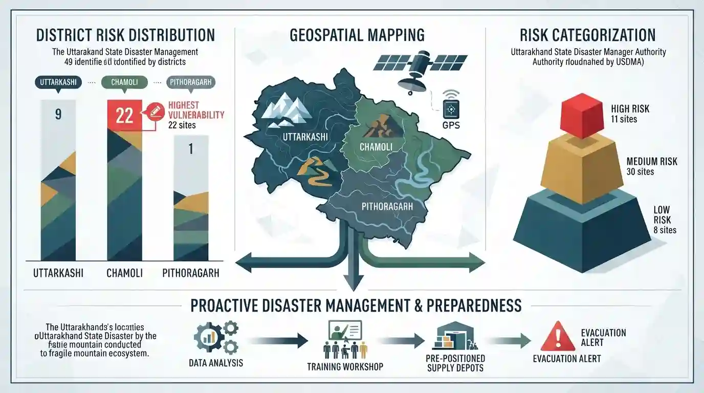
The Uttarakhand State Disaster Management Authority (USDMA) has conducted geospatial mapping to identify 49 potential disaster and hazard-prone locations across the border districts of Uttarkashi, Chamoli, and Pithoragarh. Factoring in risks related to glaciers, landslides, and river drainage, the authority categorized 11 areas as high risk, 30 as medium risk, and 8 as low risk. Chamoli recorded the highest vulnerability with 22 identified sites. This mapping aims to bolster proactive disaster mitigation and preparedness in the fragile Himalayan ecosystem.
Key Points
- The Uttarakhand State Disaster Management Authority (USDMA) has mapped 49 disaster and hazard-prone locations in the border districts of Uttarkashi, Chamoli, and Pithoragarh.
- Geospatial mapping categorized these locations into 11 high hazard, 30 medium hazard, and 8 low hazard-prone areas.
- Chamoli district has the highest number of vulnerable locations (22), followed by Pithoragarh (16) and Uttarkashi (11).
- The vulnerability assessment analyzed glaciers, rivers, catchment areas, and drainage channels to identify risks like landslides and floods.
- Among the identified high-risk locations are Hanuman Chatti, Jalam, Sayanchatti, Sobla, Pulna, and Ghastoli.
Important Terms
Uttarakhand State Disaster Management Authority (USDMA)

A statutory state-level body established under the Disaster Management Act, 2005. It coordinates disaster mitigation, risk assessment, and emergency response across Uttarakhand's fragile landscapes.
UPSC context
GS Paper 3 (Disaster Management). Tests knowledge of state-level institutional frameworks for disaster preparedness.
Geospatial Mapping
The integration of location data, GIS, and remote sensing to visualize terrain and environmental risks. It allows authorities to proactively map hazard-prone zones, optimizing resource allocation and disaster resilience.
UPSC context
GS Paper 3 (Science & Tech, Disaster Management). Tests applications of space technology in crisis mapping.
Debris Flow
A rapid, gravity-driven mass movement of loose soil, rock, water, and debris down a mountain slope. Common in the Himalayas, it severely threatens downstream infrastructure, roads, and settlements.
UPSC context
GS Paper 1 & 3 (Physical Geography, Disaster Management). Tests understanding of mass wasting and geomorphic hazards.
Hazard and Vulnerability Assessment
A systematic evaluation combining topographical, environmental, and demographic data to identify regions susceptible to disasters. It categorizes areas into risk levels (high/medium/low) to guide proactive mitigation efforts.
UPSC context
GS Paper 3 (Disaster Management). Tests the understanding of pre-disaster preparedness and the Sendai Framework priorities.
Fragile Himalayan Ecosystem
The ecologically sensitive and geologically young environment of the Himalayas. Its unstable slopes, retreating glaciers, and steep gradients make it highly susceptible to climate change and natural disasters.
UPSC context
GS Paper 3 (Environment & Ecology). Tests knowledge of regional ecological vulnerabilities and the impacts of unplanned development.
Prelims Trap
"The entire state of Uttarakhand is categorized under Seismic Zone V."
Uttarakhand is divided between Seismic Zones IV and V. It is a common trap to assume the entire state is in the highest-risk Zone V.
Static Concepts Connected
What are Glacial Lake Outburst Floods (GLOFs)?
- Lake Formation: Retreating glaciers leave behind meltwater lakes, typically dammed by loose, unconsolidated moraine or ice.
- Trigger Mechanisms: Breaches occur due to earthquakes, avalanches, or rapid ice melting overflowing the unstable natural dams.
- Catastrophic Impact: Causes sudden, high-velocity downstream flooding, devastating settlements, hydro-projects, and infrastructure.
How is Geospatial Tech applied in Disaster Risk Reduction?
- Pre-Disaster: GIS and remote sensing are used for hazard zonation mapping, identifying vulnerable settlements, and catchment modeling.
- During Event: Real-time satellite imagery assists in immediate damage assessment and routing for search and rescue teams.
- Post-Disaster: Enables precise reconstruction planning and tracking ecological recovery in affected areas over time.
Cross-Topic Patterns
Ecological Fragility vs. Border Security
Disasters in border districts like Chamoli constantly threaten strategic infrastructure (e.g., BRO roads), linking GS3 disaster management with border security logistics.
Sendai Framework + Proactive Mitigation
Preemptive mapping reflects the Sendai Framework’s Priority 1 ('Understanding disaster risk'), shifting focus from reactive relief to proactive mitigation in climate-vulnerable zones.

Expect a 2026 GS3 question linking geospatial hazard mapping of Himalayan glaciers with border infrastructure and climate change.
Linked PYQs · 4
Linked PYQs · 4
- 2024UKPSC_PRELIMSGS1
Durmital is located in which of the following district of Uttarakhand ?
- 2025UKPSC_PRELIMSGS1
Which of the following is the correct order of rivers from west to east in Uttarakhand?
- 2016UKPSC_PRELIMSGS1
Where is Khatling glacier situated?
- 2021UKPSC_PRELIMSGS1
Remote Sensing uses which of the following in its applications?
