Cloudburst flash flood damages Niti Valley border bridge in Chamoli
Source:indiatoday ↗
Why It Matters
The incident underscores the vulnerability of Uttarakhand's border infrastructure (built by BRO) to extreme weather events like cloudbursts and flash floods. It highlights the recurring geographical and environmental challenges in the Dhauli Ganga and Niti Valley regions, which is directly relevant to the state's geography and disaster management syllabus.
Summary
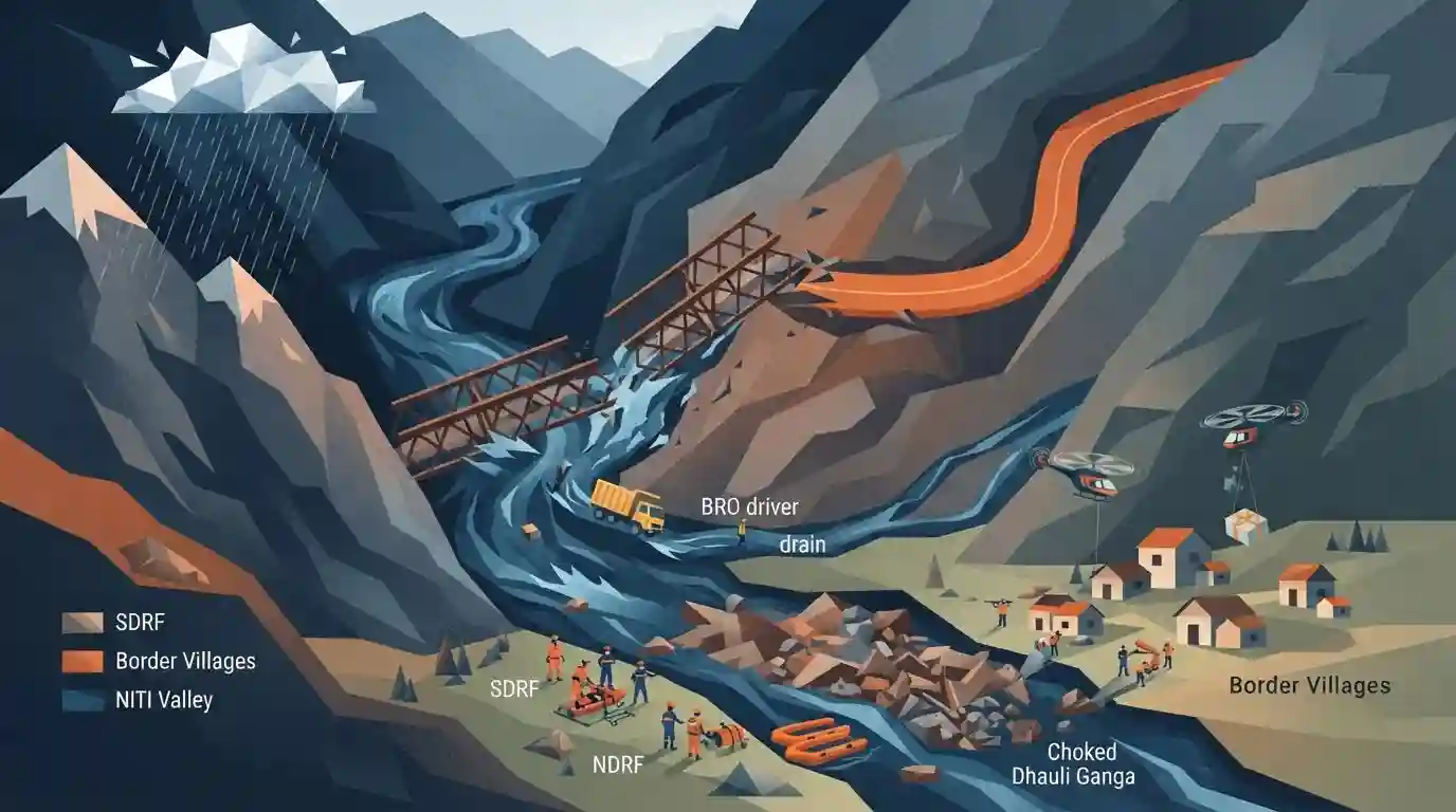
A cloudburst-triggered flash flood in Uttarakhand's Chamoli district swept away a crucial Bailey bridge on the Malari-Niti National Highway, severing connectivity to border villages in the Niti Valley. A BRO driver and a vehicle were washed away in the Tamak drain. Disaster response forces including SDRF and NDRF have been deployed, while authorities race to restore access and provide essential supplies. The region has seen repeated disruptions due to heavy rainfall and debris choking the nearby Dhauli Ganga river.
Key Points
- A sudden surge of floodwaters triggered by cloudbursts and intense monsoon rains swept away a Bailey bridge on the Malari-Niti National Highway in Uttarakhand's Chamoli district.
- The collapse of the bridge over the Tamak drain has cut off connectivity to several frontier villages, including Jumma and Niti, in the border area.
- A Border Roads Organisation (BRO) driver and a vehicle were washed away in the flash flood.
- The SDRF, NDRF, and district administration teams were mobilized for rescue and relief operations, with authorities working on alternative road arrangements.
- In recent years, frequent floods and landslides in the Tamak drain have disrupted the Joshimath-Niti route and caused debris accumulation in the nearby Dhauli Ganga river.
Important Terms
National Disaster Response Force (NDRF)

India’s specialized disaster response force constituted under the Disaster Management Act, 2005. It conducts rescue and relief operations during natural and man-made disasters, functioning under the National Disaster Management Authority (NDMA).
UPSC context
Relevant to GS Paper 3 (Disaster Management). Evaluates knowledge of institutional frameworks, statutory bodies, and crisis response mechanisms in India.
Cloudburst
An intense, sudden rainfall event, exceeding 100 mm per hour over a small area (20-30 sq. km). Mostly occurs in mountainous terrain like the Himalayas due to orographic lifting and atmospheric instability.
UPSC context
Crucial for GS Paper 1 (Geography) and GS Paper 3 (Disaster Management). Tests understanding of extreme weather events and Himalayan ecology.
Border Roads Organisation (BRO)
A statutory body under the Ministry of Defence responsible for developing and maintaining strategic road infrastructure in India's border areas and friendly neighboring nations, enhancing defense mobility and regional development.
UPSC context
Important for GS Paper 3 (Security Challenges, Infrastructure) and GS Paper 2 (International Relations). Connects to border management and defense infrastructure.
Dhauli Ganga River
A tributary of the Alaknanda River originating near the Niti Pass in Uttarakhand. It flows through the Nanda Devi National Park and meets the Alaknanda at Vishnuprayag.
UPSC context
Important for GS Paper 1 (Indian Geography - Drainage Systems). Often tested in mapping questions and environmental disasters (e.g., flash floods).
Niti Valley
A remote, high-altitude valley in the Garhwal Himalayas (Chamoli, Uttarakhand) near the Indo-China border. Drained by the Dhauli Ganga, it falls within the Nanda Devi Biosphere Reserve.
UPSC context
Highly relevant for GS Paper 1 (Geography) and GS Paper 3 (Internal Security - Border areas). Tests spatial awareness and border region significance.
Prelims Trap
"Any sudden, devastating heavy rainfall event causing flash floods in hilly terrains is officially classified as a cloudburst."
IMD strictly defines a cloudburst as rainfall of 100 mm (10 cm) or more in a single hour over a localized geographical area of 20-30 sq. km.
Static Concepts Connected
What is the geographical sequence of the Panch Prayag?
- Vishnuprayag: Confluence of the Alaknanda and Dhauliganga rivers (Dhauliganga originates near Niti pass).
- Nandaprayag & Karnaprayag: Confluence of the Alaknanda with the Nandakini and Pindar rivers, respectively.
- Rudraprayag & Devprayag: Confluence of the Alaknanda with the Mandakini and Bhagirathi rivers; forms the main Ganga river.
What is the administrative control and mandate of the BRO?
- Ministry Control: Brought entirely under the Ministry of Defence in 2015 (previously received funds from MoRTH) to accelerate border infrastructure.
- Strategic Mandate: Constructs and maintains strategic roads and modular structures (like Bailey bridges) to ensure rapid military mobility in frontier zones.
Cross-Topic Patterns
Security vs. Himalayan Ecology
The destruction of border roads highlights the tension between strategic infrastructure upgrades (like the Vibrant Villages Programme) and the inherent geological fragility of the Himalayas.
Doppler Radars and Terrain Blind Spots
Steep Himalayan topography creates radar blind spots, severely hindering IMD's capacity to issue precise early warnings for localized extreme weather events like cloudbursts.

Expect a 2026 prelims question mapping Uttarakhand passes (Niti, Mana) to their river valleys, combined with IMD's strict cloudburst metrics.
Linked PYQs · 3
Linked PYQs · 3
- 2021UKPSC_PRELIMSGS1
At which place in Uttarakhand did the Indian, Meteorological Department install a Doppler Weather Radar?
- 2025UKPSC_PRELIMSGS1
Which of the following is the correct order of rivers from west to east in Uttarakhand?
- 2024UKPSC_PRELIMSGS1
Which of the following is a point of confluence of river Jadganga and Bhagirathi ?
