Kanpur Records Highest Rainfall Among Uttar Pradesh Districts
Source:rediff ↗
Why It Matters
Monsoon dynamics, regional rainfall distribution, and physical geography of Uttar Pradesh's districts (e.g., Lalitpur, Kanpur) are frequent subjects of state-specific physical geography questions in the UPPSC PCS Prelims. Knowing which districts receive high precipitation and their location-specific characteristics is essential for the exam.
Summary
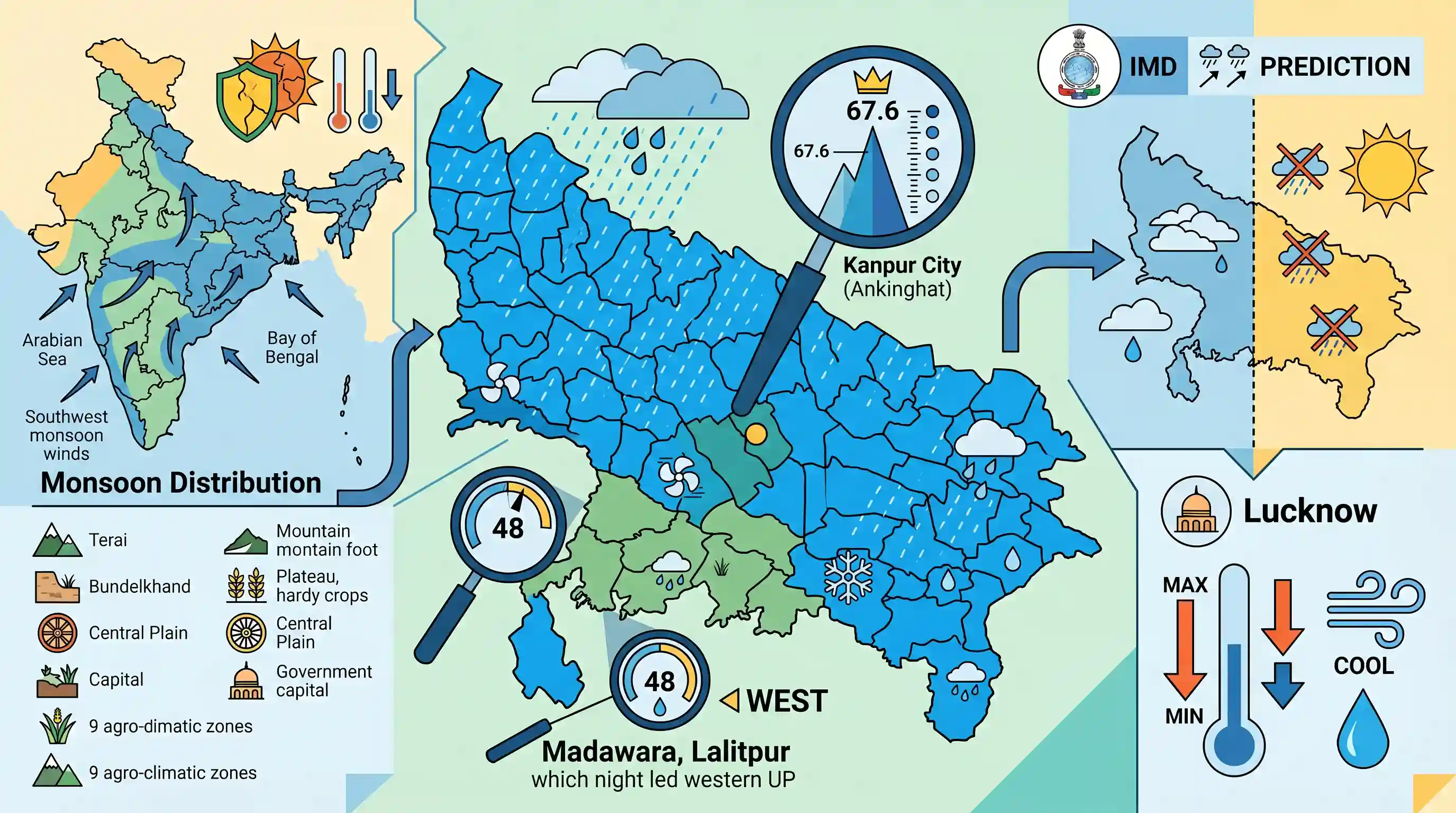
In June 2026, widespread monsoon-related rainfall across Uttar Pradesh brought relief from high temperatures. Kanpur City (Ankinghat) recorded the highest rainfall in the state at 67.6 mm, while Madawara in Lalitpur district led western UP with 48 mm of rainfall. The India Meteorological Department (IMD) predicted further isolated rain in western UP and largely dry conditions in eastern UP, alongside a notable drop in maximum and minimum temperatures in Lucknow.
Key Points
- Kanpur City recorded the highest rainfall in Uttar Pradesh during this spell, with Ankinghat registering 67.6 mm, Kanpur IAF 42 mm, and Kanpur Observatory 38.4 mm.
- In Western Uttar Pradesh, Madawara in Lalitpur district recorded the highest rainfall at 48 mm, followed by Govardhan in Mathura (39 mm) and Agra (37 mm).
- Lucknow recorded a temperature drop of over 4 degrees Celsius below normal, with the maximum temperature settling at 34.7 degrees Celsius and minimum at 21.3 degrees Celsius after experiencing rainfall.
- The IMD's short-term forecast predicted rain and thundershowers at isolated places over western Uttar Pradesh, while conditions were expected to remain mainly dry over eastern parts of the state.
Important Terms
India Meteorological Department (IMD)

India's principal government agency under the Ministry of Earth Sciences responsible for meteorological observations, weather forecasting, seismology, and early warnings for weather-related hazards.
UPSC context
GS Paper I (Geography) & GS III (Disaster Management). Tests monsoon mechanisms, cyclone warnings, and climate policies.
Southwest Monsoon
The primary rainy season in India occurring from June to September, driven by land-sea differential heating, which accounts for over 75% of the country's annual precipitation.
UPSC context
GS Paper I (Geography) & GS III (Agriculture). Tests monsoon onset mechanisms, distribution patterns, and climate change variability.
Agro-climatic Zones
Land units classified on major climatic factors like soil, temperature, rainfall, and water availability, used to optimize crop suitability and resource planning. UP has nine zones.
UPSC context
GS Paper III (Agriculture) & State PCS. Tests agricultural diversification, regional geographical patterns, and sustainable resource management.
Kanpur IAF
A localized weather monitoring station situated at the Indian Air Force base in Kanpur, which records microclimatic parameters, temperature extremes, and precipitation for regional and defense aviation.
UPSC context
GS Paper I (Physical Geography). Illustrates regional microclimate variations and localized weather data integration in civil/defense forecasting.
Kanpur Observatory
A regional meteorological monitoring station (located at CSA University) that collects localized weather data, supporting agricultural planning, division-level forecasting, and climate monitoring in Uttar Pradesh.
UPSC context
GS Paper III (Agro-meteorology). Tests understanding of localized weather data systems and their relevance to regional cropping patterns.
Prelims Trap
The 'Purva' winds of Uttar Pradesh are westerly winds originating from the Arabian Sea branch of the monsoon.
Purva represents the Bay of Bengal branch deflected westward by the Himalayas, making them easterly winds blowing from east to west.
Static Concepts Connected
What are the characteristics of Uttar Pradesh's Agro-Climatic Zones?
- Nine Distinct Zones: Uttar Pradesh is divided into exactly nine distinct agro-climatic zones based on soil, rainfall, temperature, and water resources.
- Rainfall Gradient: Rainfall progressively decreases from the humid Tarai and Eastern Plain zones to the semi-arid Western Plain and Bundelkhand zones.
Why does the Southwest Monsoon blow from the East in Northern India?
- Himalayan Deflection: The Himalayas act as a massive physical barrier, deflecting the Bay of Bengal branch of the Southwest Monsoon westward.
- Easterly Wind Origin: This deflection forces the monsoonal winds to blow from the east along the Indo-Gangetic plain, earning the local name 'Purva' or 'Purvaiya'.
Cross-Topic Patterns
Topographic deflection and drought profiles
The deflection of the Bay of Bengal monsoonal branch explains why eastern UP districts (like Gorakhpur) receive triple the precipitation of rain-shadow-like western districts (like Mathura).

UPSC may link the topographic deflection of the Bay of Bengal monsoon branch with regional soil types and agro-climatic zoning in UP.
Linked PYQs · 3
Linked PYQs · 3
- 2014UPPSC_PRELIMSGS1
The number of agro-climate zones in Uttar Pradesh is
- 2025UPPSC_PRELIMSGS1
Which of the following districts of Uttar Pradesh shares its boundary with only one other district of Uttar Pradesh ? 1. Lalitpur 2. Saharanpur 3. Sonbhadra Select the correct answer from the code given below :
- 2022UPPSC_PRELIMSGS1
Consider the following cities of Uttar Pradesh and arrange them in descending order in terms of their population. I. Ghaziabad II. Kanpur III. Agra IV. Lucknow Select the correct answer from the code given below :
