Uniform Civil Code provisions and NavIC satellite navigation system
Source:Indian Express ↗
Why It Matters
This multi-dimensional article covers core static and dynamic UPSC topics across GS2 (Polity/Constitution & IR) and GS3 (Space Technology & Energy Security). It connects current events with foundational concepts like Article 44 (UCC) and indigenous strategic assets (NavIC).
Summary
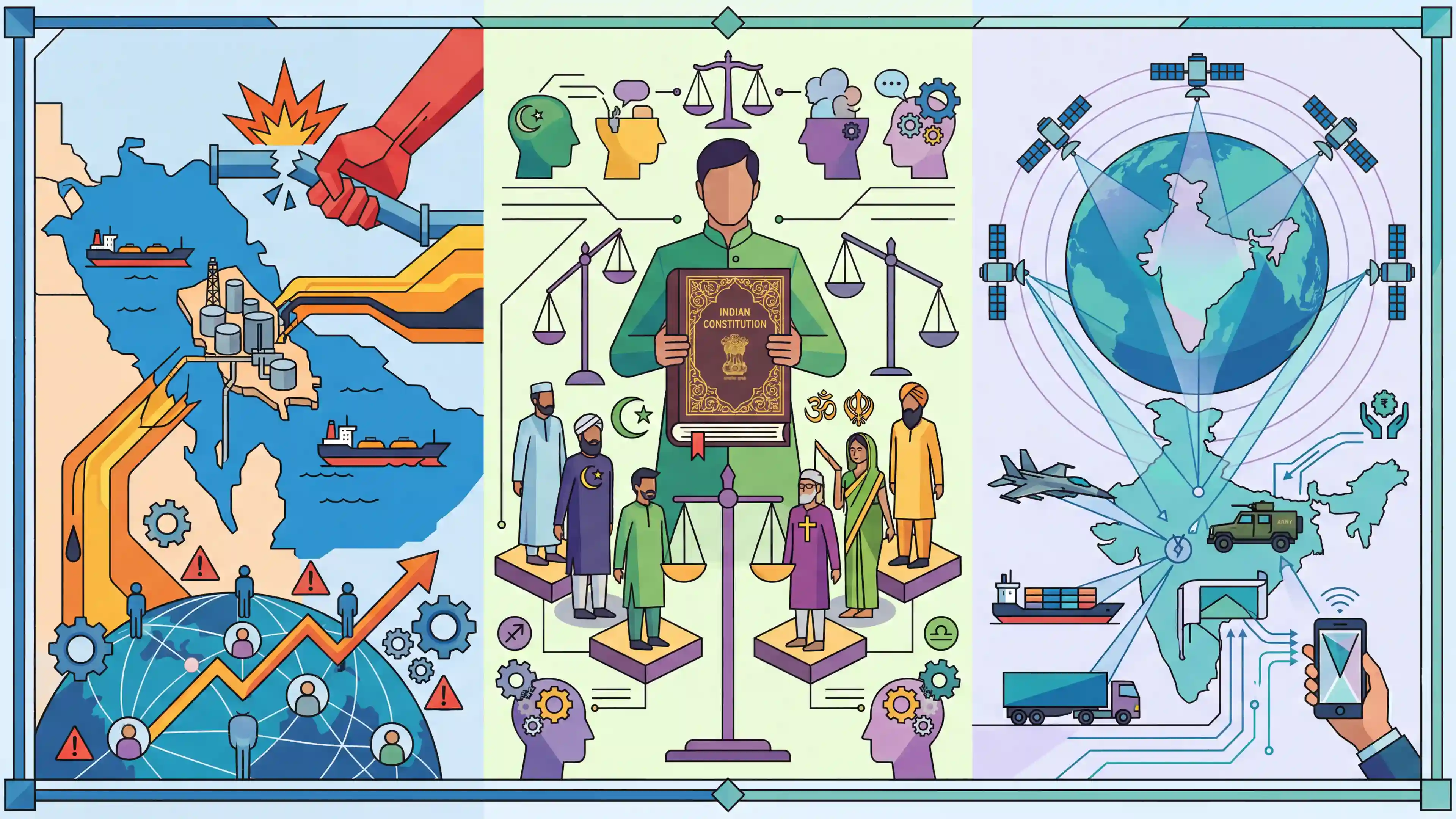
The article highlights three significant UPSC-relevant topics: the geopolitical vulnerability and energy security implications of potential strikes on Iran's Kharg Island in the Persian Gulf, the constitutional and socio-political dimensions of implementing a Uniform Civil Code (UCC) in India, and the strategic importance of NavIC (IRNSS), India's indigenous regional satellite navigation system.
Key Points
- Kharg Island, located in the Persian Gulf, is Iran\'s most critical oil export terminal; any military strikes against it would cause major disruptions to global energy markets and affect India\'s energy security.
- The Uniform Civil Code (UCC), mentioned under Article 44 of the Directive Principles of State Policy, aims to establish a common set of civil laws for all Indian citizens, regardless of religion, sparking debates around secularism and cultural rights.
- NavIC (IRNSS) is India\'s indigenous regional satellite navigation system consisting of seven satellites, developed by ISRO to reduce strategic reliance on foreign systems like the US GPS.
Important Terms
Uniform Civil Code (UCC)

A proposed common set of civil laws for all Indian citizens, regardless of religion, governing personal matters like marriage, divorce, and inheritance, replacing diverse religious personal laws.
UPSC context
GS Paper II (Polity); tests understanding of secularism, gender justice, and Directive Principles of State Policy.
NavIC (IRNSS)
India’s indigenous regional satellite navigation system developed by ISRO. It provides precise positioning services over India and 1,500 km beyond, ensuring strategic autonomy from foreign systems like GPS.
UPSC context
GS Paper III (Science & Technology); critical for understanding indigenous technology, strategic autonomy, and regional security.
Kharg Island
A strategic Iranian island in the Persian Gulf acting as the nation’s primary oil export hub, handling roughly 90% of Iran’s crude oil exports.
UPSC context
GS Paper II (IR) and GS Paper III (Energy Security); relevant for West Asia conflicts and global supply chain disruptions.
Article 44
A Directive Principle of State Policy (DPSP) in the Indian Constitution that mandates the State to endeavor to secure a Uniform Civil Code for all citizens.
UPSC context
GS Paper II (Polity); fundamental for questions on constitutional mandates, legal uniformity, and the role of non-justiciable principles.
ISRO (Indian Space Research Organisation)
India’s national space agency tasked with developing space technology. It is the architect of the NavIC system and various indigenous satellite and launch capabilities.
UPSC context
GS Paper III (Science & Technology); central to topics on space missions, technological achievements, and national development.
Prelims Trap
"NavIC covers the entire globe and uses only geostationary satellites."
NavIC is purely regional (India + 1500km boundary) and uses a mix of 3 geostationary and 4 geosynchronous satellites, not just geostationary.
Static Concepts Connected
How does Article 44 (UCC) intersect with Fundamental Rights?
- Article 44 (DPSP): Directs the State to endeavor to secure a Uniform Civil Code for citizens across India's territory.
- Article 25 (Rights): Guarantees the freedom to profess, practice, and propagate religion, creating a constitutional tension with uniform secular civil laws.
- Harmonious Construction: Supreme Court precedents (like Shah Bano) advocate balancing secular civil governance with religious freedom, noting secular state functions aren't bound by religious personal laws.
Why is Kharg Island critical for global energy security?
- Geographic Location: A strategic coral island situated in the northern Persian Gulf, governed by Iran.
- Export Dominance: Functions as Iran's primary maritime terminal, handling approximately 90% of the nation's crude oil exports.
- Chokepoint Vulnerability: Disruptions here or at the nearby Strait of Hormuz directly threaten India's macroeconomic stability due to massive reliance on Middle Eastern crude and LNG imports.
Cross-Topic Patterns
Persian Gulf + Red Sea Chokepoints
Attacks on Kharg parallel Houthi disruptions in the Red Sea. UPSC often combines these into a map-based West Asian chokepoints question testing the Strait of Hormuz against Bab-el-Mandeb.
Space Tech + Defense Indigenization
With electronic warfare and GPS spoofing rising in global conflicts, NavIC’s encrypted restricted service (RS) for military use links civilian space technology directly to sovereign defense capabilities.

Expect a paired map question on Kharg/Hormuz, plus a multi-statement NavIC question focusing on its precise orbital configuration.
Linked PYQs · 3
Linked PYQs · 3
- 2018PrelimsGS1
With reference to the Indian Regional Navigation Satellite System (IRNSS), consider the following statements: 1. IRNSS has three satellites in geostationary and four satellites in geosynchronous orbits. 2. IRNSS covers entire India and about 5500 sq. km beyond its borders. 3. India will have its own satellite navigation system with full global coverage by the middle of 2019. Which of the statements given above is/are correct?
- 2015MainsGS3
What do you understand by 'Standard Positioning Systems' and 'Precision Positioning Systems' in the GPS era? Discuss the advantages India perceives from its ambitious IRNSS programme employing just seven satellites.
- 2024MainsGS2
Discuss India as a secular state and compare with the secular principles of the US constitution.
