Moderate Earthquakes Strike Chamba and Kangra in Himachal Pradesh
Source:the-print ↗
Why It Matters
Understanding the seismic zones of India is crucial for disaster preparedness. Himachal Pradesh, falling largely in Seismic Zone IV and V, is highly susceptible to earthquakes, which frequently appear in state-level geographical context questions.
Summary
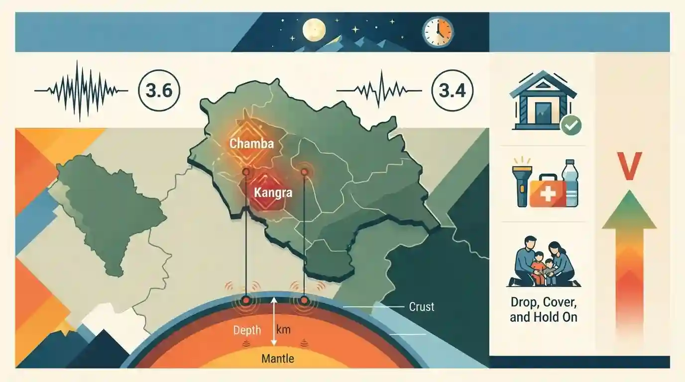
Two moderate-intensity earthquakes struck the Chamba and Kangra districts of Himachal Pradesh on a Monday night, with magnitudes of 3.6 and 3.4, respectively. Both tremors originated at a shallow depth of 5 km, with no reported damage or casualties. The state, particularly these districts, lies in Seismic Zone V, making it highly vulnerable to seismic activities.
Key Points
- Two moderate-intensity earthquakes of magnitudes 3.6 and 3.4 struck Chamba and Kangra districts of Himachal Pradesh, respectively.
- The epicenter of the Chamba earthquake was located near Kareri, with a depth of 5 km.
- The Kangra earthquake also originated at a depth of 5 km.
- No loss of life or property was reported from the tremors.
- Most regions of Himachal Pradesh, including Chamba and Kangra, are classified under Seismic Zone V, which implies a very high risk of seismic damage.
Important Terms
National Center for Seismology

The Government of India's nodal agency under the Ministry of Earth Sciences for monitoring earthquake activity. It maintains the National Seismological Network for 24x7 real-time seismic monitoring and hazard assessments.
UPSC context
Crucial for GS-1 (Geophysics) and GS-3 (Disaster Management) to understand India's institutional framework for earthquake monitoring and mitigation.
Seismic Zone V
The highest earthquake hazard category in India's seismic mapping, covering areas susceptible to devastating earthquakes. Due to Himalayan tectonic activity, states like Himachal Pradesh lie entirely within this highly vulnerable zone.
UPSC context
Essential for GS-1 (Geography) and GS-3 (Disaster Management) to assess regional tectonic vulnerabilities and formulate strict building code regulations.
India Meteorological Department
The principal agency under the Ministry of Earth Sciences responsible for meteorological observations and weather forecasting. It operates impact-based, multi-hazard early warning systems to mitigate severe weather event risks.
UPSC context
Relevant for GS-3 (Disaster Management) and GS-1 (Geography) focusing on weather forecasting, early warning networks, and climate preparedness.
Prelims Trap
"The entire state of Himachal Pradesh falls under Seismic Zone V (Very High Risk)."
While highly vulnerable, HP is divided between Zone V (Kangra, Chamba, Kullu, Mandi) and Zone IV (Shimla, Solan, Sirmaur). "Entire state" is factually incorrect.
Static Concepts Connected
Which seismic zones cover Himachal Pradesh and what causes this vulnerability?
- Zone V: Covers districts like Chamba, Kangra, Kullu, Mandi, and Hamirpur. It denotes the highest seismic risk (MSK IX or greater).
- Zone IV: Covers remaining regions including Shimla, Solan, Sirmaur, Lahaul-Spiti, and Kinnaur. It denotes high damage risk.
- Tectonic Faults: HP's vulnerability is driven by major active fault lines like the Main Central Thrust (MCT) and Main Boundary Thrust (MBT) traversing the Himalayas.
What are the landmark historical earthquakes in Himachal Pradesh's history?
- 1905 Kangra Quake: An 8.0 magnitude tremor on April 4, 1905, which claimed over 20,000 lives and devastated Kangra Valley, including the Kangra Fort.
- 1975 Kinnaur Quake: A 6.8 magnitude event triggered by intense tectonic activity along the Kaurik-Chango fault line, causing severe damage in Kinnaur and Spiti.
Cross-Topic Patterns
Seismic zones + Dam safety constraints
Chamba and Kangra host massive hydroelectric projects (like Chamera and Pong). Recurring shallow-focus tremors in Zone V test the limits of reservoir-induced seismicity and dam safety frameworks.
Earthquakes + Kath-Kuni architecture
High seismic vulnerability in HP's geography links to its cultural heritage, explaining why indigenous Kath-Kuni (interlaced wood and stone) construction evolved specifically for earthquake resistance.

Multi-statement questions often match HP districts with Seismic Zones (IV vs V) and link historical quakes (1905, 1975) to specific faults.
Linked PYQs · 2
Linked PYQs · 2
- 2024HPAS_PRELIMSGS1
Consider the following statements : (1) Monkey valley lies in Chamba. (2) Kiarda Dun valley lies in Kangra. (3) The Great Himalayas are referred as Alpine zone in Himachal Pradesh. (4) Churadhar pertain to Zanskar range in Himachal Pradesh Choose the correct answer from the options given below :
- 2016HPAS_PRELIMSGS1
In which two Districts of H.P. will the H.P. Forest Ecosystem Climate Proofing Project be implemented ?
