NABARD Loan Granted for Jal Jeevan Mission Implementation in Kerala
Source:The Hindu ↗
Why It Matters
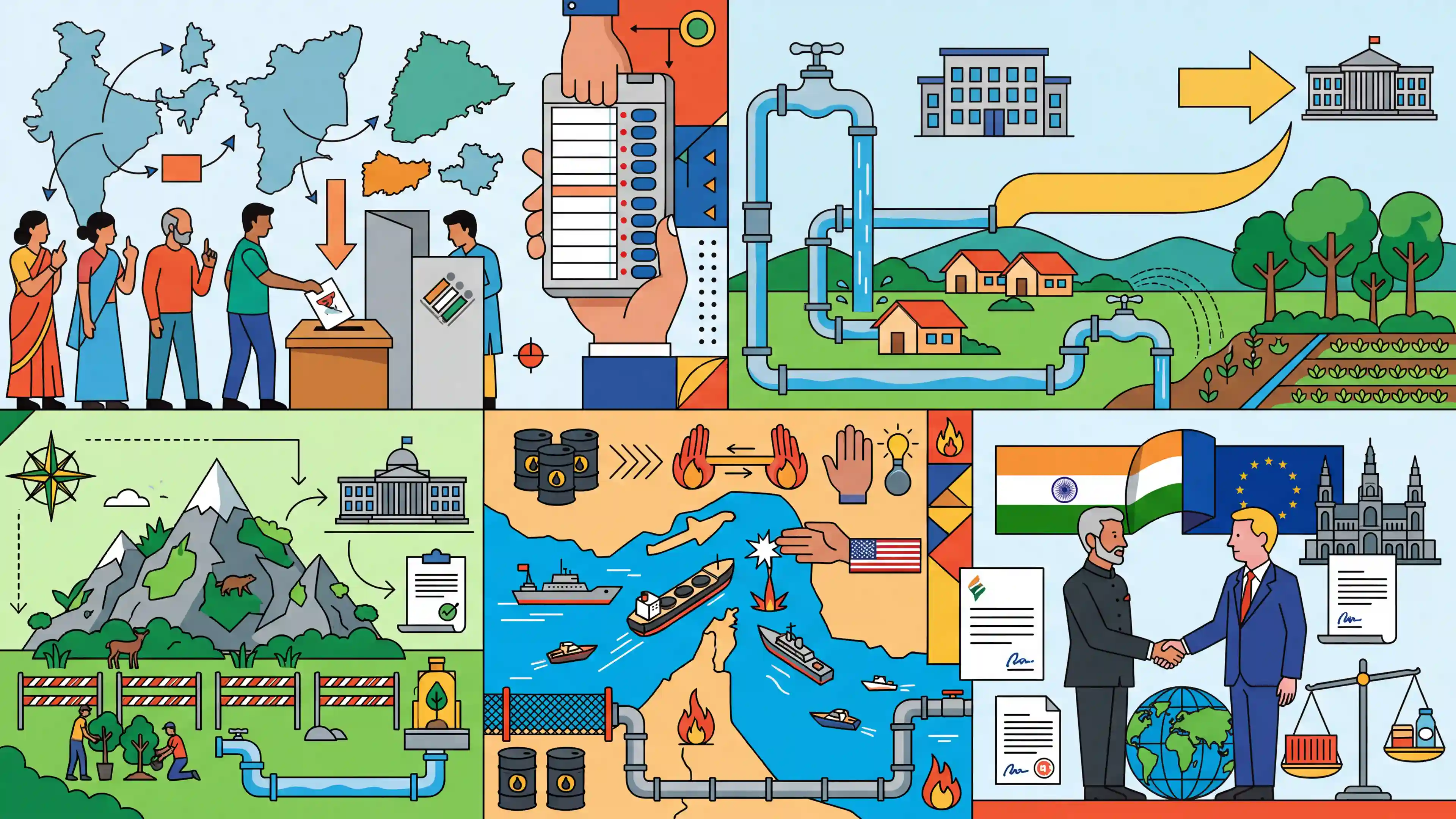
This daily compilation touches on several core UPSC themes. The Aravalli hills conservation directly connects to GS1 (Geography) and GS3 (Environment). The Jal Jeevan Mission and NABARD funding reflect critical rural infrastructure and governance (GS2/GS3). Finally, the Strait of Hormuz maritime security issue and India-EU FTA talks are classic GS2 International Relations and GS3 Economic Development topics.
Summary
The March 15, 2026 news cycle highlights critical developments across domestic politics, environmental policy, and international relations. Domestically, assembly elections are set for five states/UTs, and the Kerala Water Authority secured a major ₹4,000 crore NABARD loan for the Jal Jeevan Mission. Environmentally, the Union Ministry endorsed a formal definition of the Aravalli hills to aid conservation. On the global front, External Affairs Minister S. Jaishankar pursued Free Trade Agreement talks in Brussels, while Middle East tensions surged with Iran's actions in the Strait of Hormuz and US diplomatic resistance.
Key Points
- Assembly elections announced for West Bengal, Assam, Kerala, Tamil Nadu, and Puducherry, with West Bengal clearing DA arrears ahead of polls.
- Kerala Water Authority to receive a ₹4,000 crore loan from NABARD for implementing the Jal Jeevan Mission.
- Ministry of Environment endorses a 10-member committee's definition of the Aravalli hills, a critical step for conservation.
- Escalating Middle East tensions as Iran seizes ships in the Strait of Hormuz and the US resists an end to the conflict.
- External Affairs Minister S. Jaishankar engages in talks in Brussels to advance the India-EU Free Trade Agreement.
Important Terms
Jal Jeevan Mission (JJM)

A centrally sponsored scheme launched by the Ministry of Jal Shakti to provide 55 litres of safe drinking water per person per day through Functional Household Tap Connections (FHTCs) to every rural household.
UPSC context
GS Paper II (Government Policies) & III (Infrastructure); tests understanding of rural development goals and water resource management.
NABARD
India’s apex development bank, established in 1982 to provide credit, refinance support, and policy planning for agriculture, small-scale industries, and rural infrastructure to ensure sustainable rural development.
UPSC context
GS Paper III (Indian Economy); focuses on rural financial institutions and agricultural credit mechanisms.
India-EU Free Trade Agreement (FTA)
A comprehensive trade pact concluded in early 2026 aimed at removing tariffs on over 99% of goods and enhancing professional mobility and service sector access between India and the European Union.
UPSC context
GS Paper II (International Relations); evaluates bilateral trade diplomacy, global supply chain resilience, and economic integration.
Strait of Hormuz
A critical maritime chokepoint between the Persian Gulf and the Gulf of Oman through which approximately 20% of global oil and a third of global LNG exports pass.
UPSC context
GS Paper II (International Relations); essential for understanding West Asian geopolitics and India’s energy security vulnerabilities.
Aravalli Hills
One of the world’s oldest fold mountain ranges; recently subject to a uniform legal definition (e.g., 100-meter elevation) to regulate mining and prevent the eastward expansion of the Thar Desert.
UPSC context
GS Paper I (Geography) & III (Environment); relates to desertification, conservation laws, and the role of mountain buffers in climate regulation.
Model Code of Conduct (MCC)
A set of guidelines issued by the Election Commission of India to regulate the conduct of political parties and candidates during elections to ensure free and fair polls.
UPSC context
GS Paper II (Polity); tests knowledge of the electoral process and the powers of the Election Commission under Article 324.
Prelims Trap
NABARD's Rural Infrastructure Development Fund (RIDF) is funded directly by the Union Budget.
RIDF is not funded by direct budget allocations. It is maintained by contributions from scheduled commercial banks that fall short of their Priority Sector Lending (PSL) targets.
Static Concepts Connected
What are the key maritime chokepoints in the Middle East?
- Strait of Hormuz: Links the Persian Gulf to the Gulf of Oman and Arabian Sea. Bordered by Iran, Oman, and the UAE.
- Bab-el-Mandeb: Links the Red Sea to the Gulf of Aden and Arabian Sea. Bordered by Yemen, Djibouti, and Eritrea.
- Suez Canal: An artificial sea-level waterway in Egypt linking the Mediterranean Sea to the Red Sea.
Why is the Aravalli Range geographically and ecologically significant?
- Geological Age: It is one of the world's oldest fold mountain belts, formed during the Proterozoic era.
- Climatic Divide: Acts as a crucial natural barrier preventing the eastward expansion of the Thar Desert into the Gangetic plains.
- Geographical Extent: Stretches approximately 670 km from Gujarat, across Rajasthan and Haryana, terminating in Delhi.
Cross-Topic Patterns
India-EU FTA vs. CBAM
India's FTA negotiations with the EU frequently hit roadblocks over non-trade barriers, particularly the EU's impending Carbon Border Adjustment Mechanism (CBAM) and stringent labor and environmental standards.
Legal definitions impacting desertification
Excluding lower Aravalli ridges from the 100-meter height definition weakens mining regulations, directly threatening its role as a barrier and potentially accelerating Thar desertification (UNCCD syllabus link).
Energy security via maritime chokepoints
Over 20% of global oil and a majority of Qatar's LNG traverse the Strait of Hormuz, tying Middle East maritime security directly to India's inflation and Current Account Deficit.

Expect a 2026 MCQ pairing Middle East chokepoints (Hormuz, Bab-el-Mandeb) with bordering nations and their impact on global LNG transit.
Linked PYQs · 5
Linked PYQs · 5
- 2019MainsGS1
How can the mountain ecosystem be restored from the negative impact of development initiatives and tourism?
- 2023PrelimsGS1
Consider the following statements: 1. Amarkantak Hills are at the confluence of Vindhya and Sahyadri Ranges. 2. Biligirirangan Hills constitute the easternmost part of Satpura Range. 3. Seshachalam Hills constitute the southernmost part of Western Ghats. How many of the statements given above are correct?
- 2018MainsGS2
In what ways would the ongoing US-Iran Nuclear Pact Controversy affect the national interest of India? How should India respond to this situation?
- 2014PrelimsGS1
Turkey is located between
- 2024MainsGS2
Poverty and malnutrition create a vicious cycle, adversely affecting human capital formation. What steps can be taken to break the cycle ?
