IMD Issues Heavy Rain Alert Across Districts of Bihar
Source:navbharat-times ↗
Why It Matters
Understanding seasonal monsoon variations, spatial distribution of rainfall across Bihar's districts, and extreme climate events like heatwaves (along with their scientific/IMD criteria) is critical for geography and climatology topics frequently tested in BPSC Prelims.
Summary
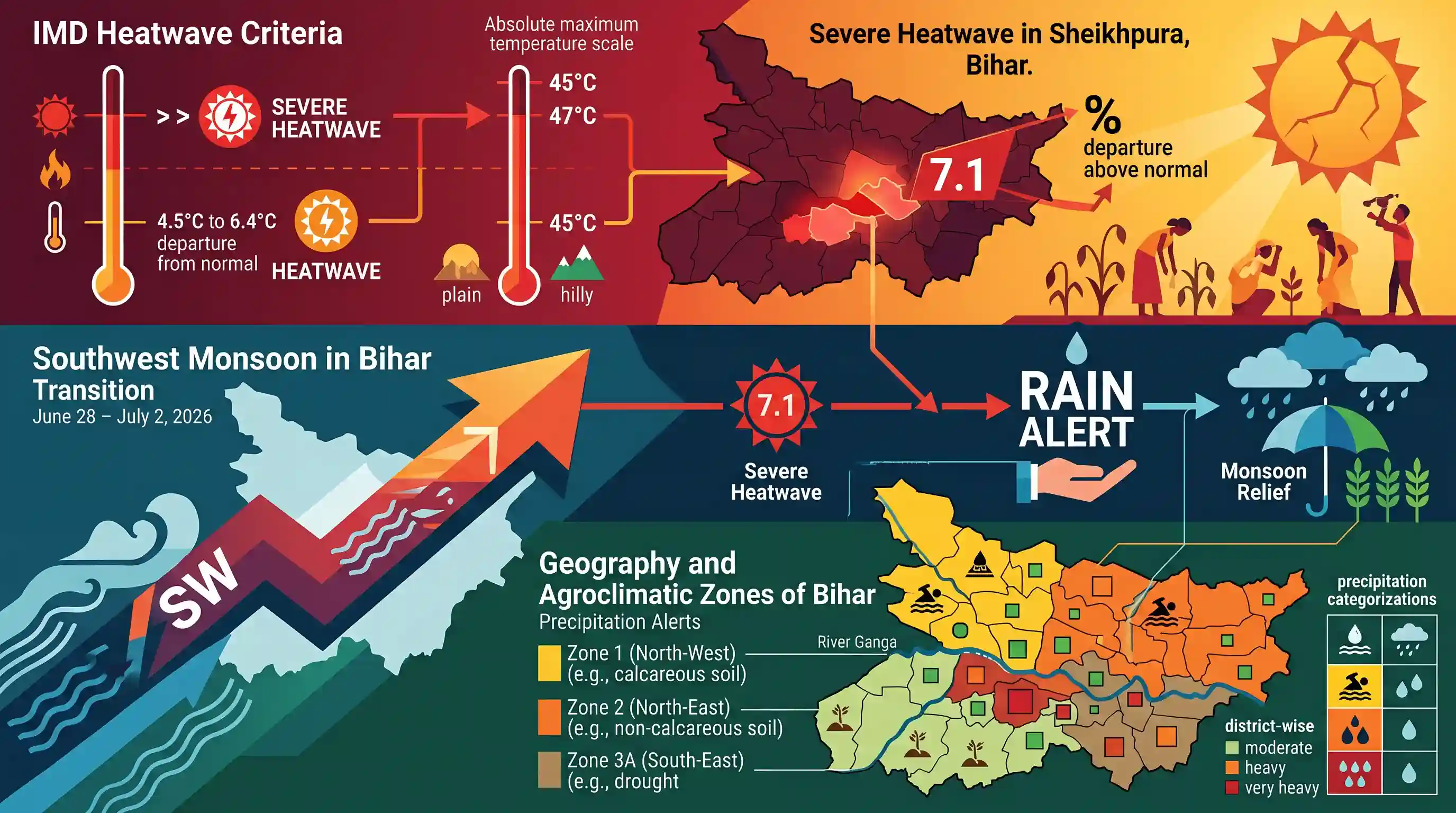
The India Meteorological Department (IMD) issued a heavy rainfall alert across Bihar from June 28 to July 2, 2026, marking the active advancement of the southwest monsoon. This transition brings essential relief after severe heatwave conditions gripped several districts, notably Sheikhpura, where temperatures reached 7.1°C above normal. Precipitation alerts have been categorized on a district-wise basis over the late June period.
Key Points
- Monsoon progression in Bihar from June 28 to July 2, 2026, is expected to bring widespread heavy rainfall and a 3°C to 5°C drop in temperature, providing relief from severe heat.
- District-wise alerts include: June 28 (Bhagalpur, Katihar, Purnia), June 29 (Araria, Katihar, Kishanganj), and June 30 (Arwal, Bhojpur, Jehanabad, Katihar, Nalanda, Purnia).
- Prior to the monsoon relief, severe heatwave (loo) conditions affected several districts, with Sheikhpura recording an extreme temperature deviation of 7.1°C above normal.
- Other southern and western districts affected by severe heatwave conditions include Kaimur, Buxar, Dehri, Gaya, and Aurangabad.
Important Terms
India Meteorological Department (IMD)

The national agency under the Ministry of Earth Sciences, established in 1875, responsible for meteorological observations, weather forecasting, and early warnings for natural disasters.
UPSC context
GS Paper I (Geography) & GS Paper III (Disaster Management). Tests institutional frameworks for disaster risk reduction and climate forecasting.
Southwest Monsoon
A seasonal wind system blowing from the southwest over the Indian Ocean from June to September, bringing over 75% of India's annual rainfall and driving its agriculture.
UPSC context
GS Paper I (Physical Geography). Tests mechanisms of monsoon onset, branches, and their socio-economic and agricultural impacts.
Heatwave Criteria
Standardized temperature thresholds defined by the IMD (e.g., maximum temperature reaching 40°C in plains) with specific departures from normal to declare an official heatwave.
UPSC context
GS Paper I (Geography) & GS Paper III (Disaster Management). Tests understanding of extreme weather events, climate change, and disaster warnings.
Agroclimatic Zones of Bihar
Four distinct regions in Bihar categorized by soil, rainfall, temperature, and topography, which guide agricultural practices and crop suitability across the state.
UPSC context
GS Paper I (Geography of India) & GS Paper III (Agriculture). Tests regional classification, soil profiles, and cropping patterns.
Prelims Trap
A severe heatwave is declared in plains when the temperature reaches 40°C, regardless of normal historical deviations.
Plains require both an absolute minimum of 40°C and specific deviation criteria (deviation >6.4°C from normal) to qualify as a severe heatwave.
Static Concepts Connected
What are the criteria used by IMD to declare a Heatwave and Severe Heatwave?
- Plain Areas: Requires a minimum temperature of 40°C; heatwave deviation is 4.5°C to 6.4°C; severe heatwave deviation is >6.4°C.
- Hills & Coasts: Hill stations require a threshold of 30°C, while coastal areas require a threshold of 37°C.
- Absolute Threshold: Declared when actual maximum temperature reaches >=45°C (heatwave) or >=47°C (severe heatwave) regardless of normal temperature.
How is Bihar classified under the Köppen system and what characterizes its monsoon dynamics?
- Köppen Class: Subtropical Monsoon (Cwa), featuring mild, dry winters, hot summers, and highly seasonal monsoonal rains.
- Monsoon Gradient: Rainfall decreases along an East-to-West gradient, with eastern districts like Kishanganj receiving the highest precipitation.
Cross-Topic Patterns
Monsoon variability + IOD
Monsoon transitions in eastern states like Bihar are highly sensitive to ENSO and Indian Ocean Dipole phases, directly impacting crop sowing windows.
Heatwaves + Urban heat islands
Severe heatwaves stress the human hypothalamus, forcing municipalities to implement local Heat Action Plans under NDMA guidelines to protect vulnerable populations.

IMD heatwave criteria (plains vs hills) combined with Köppen's Cwa climate features of Indo-Gangetic plains likely to be tested in 2026.
Linked PYQs · 3
Linked PYQs · 3
- 2025BPSC_PRELIMSGS1
Most of the Bihar comes under which of the following climate type?
- 2023BPSC_PRELIMSGS1
Consider the following statements regarding ‘heat wave’: 1. Heat wave is considered if the maximum temperature of a station reaches at least 30 °C or more for plains. 2. Heat wave is considered if the maximum temperature of a station reaches at least 40 °C or more for hilly regions.
- 2022BPSC_PRELIMSGS1
Which agroclimatic region of Bihar has the highest number of districts?
