Space Tech for Urban 3D Reconstruction in Indian Cities
Source:The Hindu ↗
Why It Matters
Highlights the practical socio-economic and governance applications of space technology, specifically how remote sensing and private sector participation contribute to modern urban planning and smart cities in India.
Summary
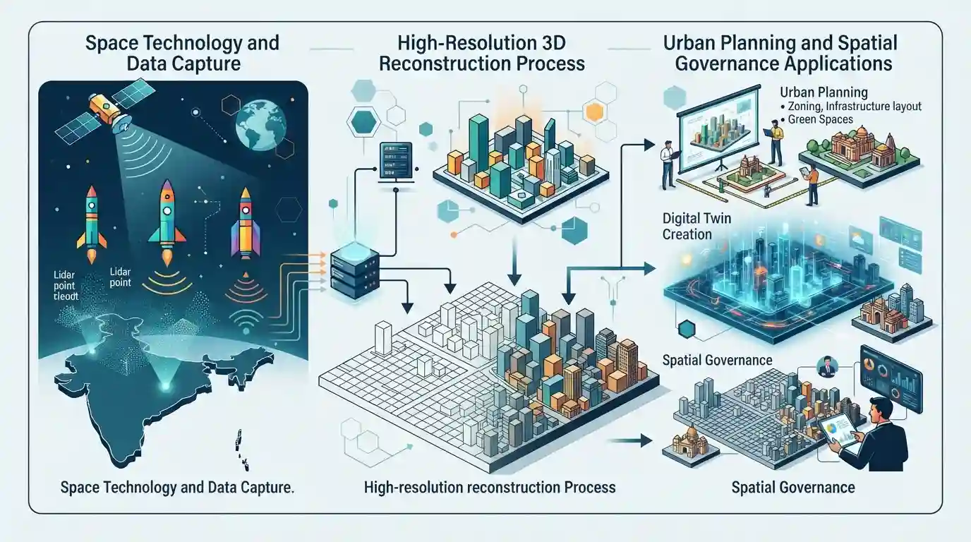
Three space companies have been selected to develop high-resolution 3D reconstruction techniques for Indian cities, enhancing urban planning, digital twin creation, and spatial governance using advanced space technology applications.
Key Points
- Three space companies have been selected to develop high-resolution 3D reconstruction techniques for Indian cities.
- The initiative aims to improve urban planning, infrastructure development, and spatial data management using advanced remote sensing and 3D modeling.
- Reflects the growing integration of commercial space firms and startups in national development and governance applications under India's evolving space policy.
Important Terms
Indian Space Research Organisation (ISRO)

India's apex space agency responsible for planning, executing, and promoting space missions, remote sensing applications, and scientific research for national development.
UPSC context
UPSC GS Paper III (Science and Technology - Space Tech). Tests understanding of India's institutional framework for space exploration and remote sensing governance.
IN-SPACe (Indian National Space Promotion and Authorization Centre)
An autonomous single-window nodal agency under the Department of Space tasked with promoting, enabling, and authorizing space activities for private industry participation in India.
UPSC context
UPSC GS Paper III (Science and Technology - Space Policy). Tests reforms in India's space sector and commercialization of space tech.
Digital Twin
A digital, high-fidelity virtual replica of a physical city environment that simulates urban dynamics, infrastructure, and spatial changes in real time for efficient municipal management.
UPSC context
UPSC GS Paper III (Infrastructure and Governance / IT). Tests applications of emerging technologies like AI, IoT, and GIS in smart cities.
Static Concepts Connected
What is the mandate of IN-SPACe under India's Space Sector Reforms?
- Mandate: IN-SPACe acts as a single-window autonomous agency under DOS to promote, enable, and supervise private space activities in India.
- Interface Role: It bridges ISRO and private industry, allowing non-governmental entities to use national space infrastructure and data.
Cross-Topic Patterns
Space tech meets urban governance
Integration of IN-SPACe private firms into urban digital twins bridges Space Tech and Smart Cities governance.
Geospatial data policy and autonomy
Using indigenous satellite data for sensitive municipal mapping ties spatial data policy with national security.

IN-SPACe's role in commercializing spatial data for urban digital twins will feature in GS-3 Space Tech or Governance.
Linked PYQs · 2
Linked PYQs · 2
- 2016MainsGS3
Discuss India's achievements in the field of Space Science and Technology. How the application of this technology has helped India in its socio-economic development?
- 2015PrelimsGS1
In which of the following activities are Indian Remote Sensing (IRS) satellites used? 1. Assessment of crop productivity 2. Locating groundwater resources 3. Mineral exploration 4. Telecommunications 5. Traffic studies Select the correct answer using the code given below.
