Godavari River Flood Management and Evacuation in Eluru
Source:The Hindu ↗
Why It Matters
River basin geography (Godavari, Krishna) and state infrastructure projects (Polavaram) are highly frequent topics in APPSC Prelims. The article directly ties physical geography and major state river nodes (Bhadrachalam, Dummugudem, Konaseema) to real-time administrative disaster response frameworks (NDRF, CWC).
Summary
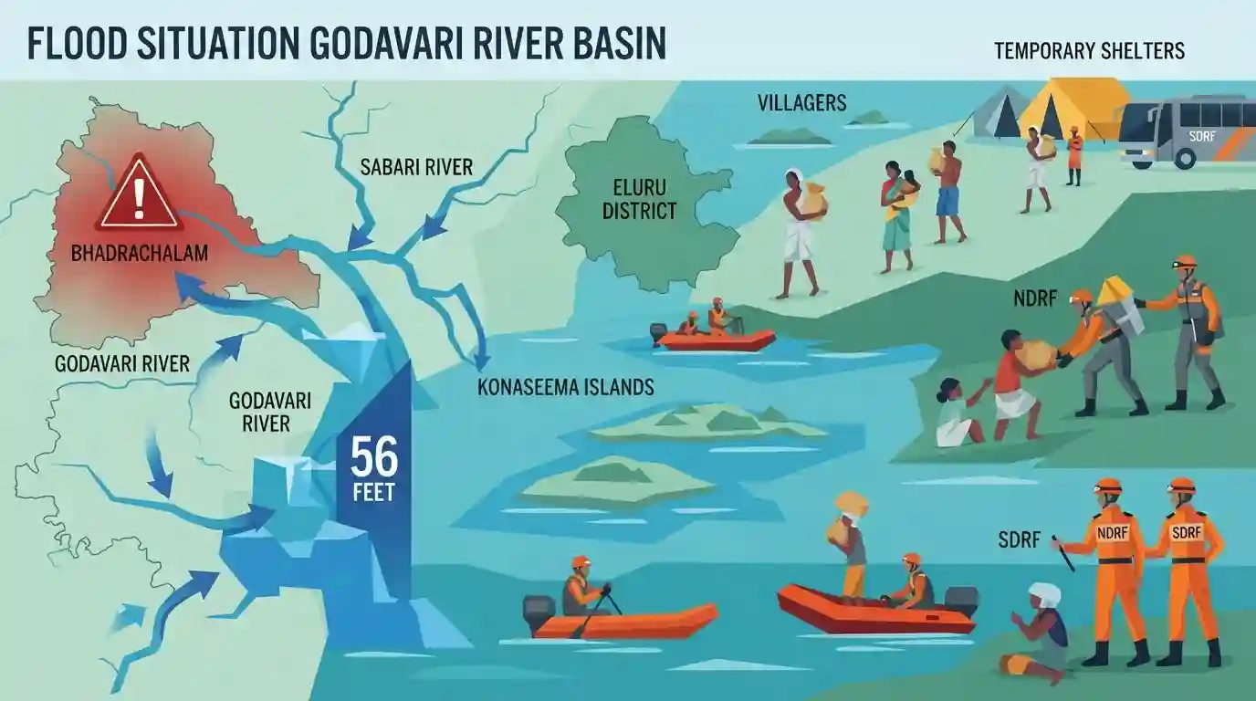
Severe flooding in the Godavari River triggered a third warning at Bhadrachalam as water levels crossed 56 feet, prompting massive evacuations in vulnerable mandals of Eluru district, Andhra Pradesh. The NDRF and SDRF have been deployed as rising waters, compounded by inflows from tributaries like the Sabari, threaten multiple villages and the Konaseema islands, highlighting vital state geography and disaster management mechanisms.
Key Points
- The Godavari river crossed the 56-foot mark at Bhadrachalam, resulting in a third-level flood warning and massive downstream discharges exceeding 15 lakh cusecs.
- Emergency evacuations were initiated in Eluru district, targeting vulnerable tribal hamlets in Velerupadu and Kukunoor mandals affected by the rising backwaters and Polavaram project submergence.
- The Central Water Commission (CWC) actively monitored alarming water levels across multiple nodes including Dummugudem, Eturunagaram, and Kaleswaram.
- Disaster management operations saw the active deployment of NDRF, SDRF, and District Response Forces to secure riverside villages and the Konaseema islands against inundation.
Important Terms
National Disaster Response Force (NDRF)

A specialized, multi-skilled Indian force established under the Disaster Management Act, 2005. It provides immediate, high-tech tactical response to natural and man-made disasters under the Ministry of Home Affairs.
UPSC context
GS Paper III (Disaster Management); tests administrative preparedness, specialized rescue frameworks, and national response capabilities during crises.
State Disaster Response Force (SDRF)
The state-level counterpart to the NDRF, created by state governments to handle rescue operations during disasters. It strengthens local response capacity using a civil defense model.
UPSC context
GS Paper III (Disaster Management); tests state-level institutional frameworks, decentralized disaster response, and Center-state cooperative federalism.
Central Water Commission (CWC)
A premier technical organization in water resources under the Ministry of Jal Shakti. It designs conservation schemes, manages hydrological data, and serves as India's nodal agency for flood forecasting.
UPSC context
GS Paper I (Geography) and GS III; tests flood mitigation, river governance, and water resource management.
District Response Force (DRF)
A localized first-response unit managed by district administrations or police. It handles immediate search-and-rescue, debris clearance, and coordination during local emergencies and floods.
UPSC context
GS Paper III (Disaster Management); tests district-level decentralization, first-responder coordination, and grassroots emergency administrative strategies.
Prelims Trap
The Union Government is mandated to fund 100% of all components, including power generation, of the Polavaram National Project.
Only the irrigation component of the Polavaram multipurpose project is eligible for 100% Central funding under its designated National Project status.
Static Concepts Connected
What are the key geographical and hydrological features of the Godavari River basin?
- Origin & Course: Rises in Trimbakeshwar, Nashik district of Maharashtra, draining nearly 10% of India's total geographical area.
- Tributaries: Includes left-bank (Dharna, Pranhita, Indravati, Sabari) and right-bank (Pravara, Manjira, Manair) tributaries.
- Deltaic Split: Splits into the Gautami and Vasishta distributaries, creating the fertile deltaic region of Konaseema.
How is the 'National Project' status for water resources projects governed in India?
- Eligibility Criteria: Projects with potential >2 lakh ha, or those addressing interstate/international disputes, are eligible for this designation.
- Funding Scope: Central assistance is restricted to the irrigation and drinking water components; power components are generally not eligible.
- Polavaram Mandate: The AP Reorganisation Act 2014 legally bound the Centre to execute and fund the Polavaram project's irrigation component.
Cross-Topic Patterns
Polavaram + Tribal Displacement Rights
Flooding in Velerupadu tribal hamlets intersects with FRA 2006 and LARR Act 2013, highlighting the human cost of large-scale river-valley projects.
CWC + Disaster Federalism
Coordination between CWC (Central) and SDRF (State) during catastrophic basin floods tests the institutional strength of disaster federalism.

Godavari left-bank tributaries and the financial/rehabilitation mandates of Polavaram National Project are highly probable 2026 areas.
Linked PYQs · 4
Linked PYQs · 4
- 2023APPSC_PRELIMSGS1
Polavaram Project is a
- 2024APPSC_PRELIMSGS1
Within India, Ganga river basin has the largest catchment area. After that, following is the correct sequence in the decreasing order:
- 2023APPSC_PRELIMSGS1
Apex Council of Godavari and Krishna river water resources and their management consists of
- 2012APPSC_PRELIMSGS1
Disaster Management Team should include
