Landslide Vulnerability and Border Infrastructure Security
Source:Indian Express ↗
Why It Matters
It effectively connects two major syllabus areas—environmental disaster management (landslides) and internal security (border infrastructure and the strategic importance of the Siliguri Corridor).
Summary
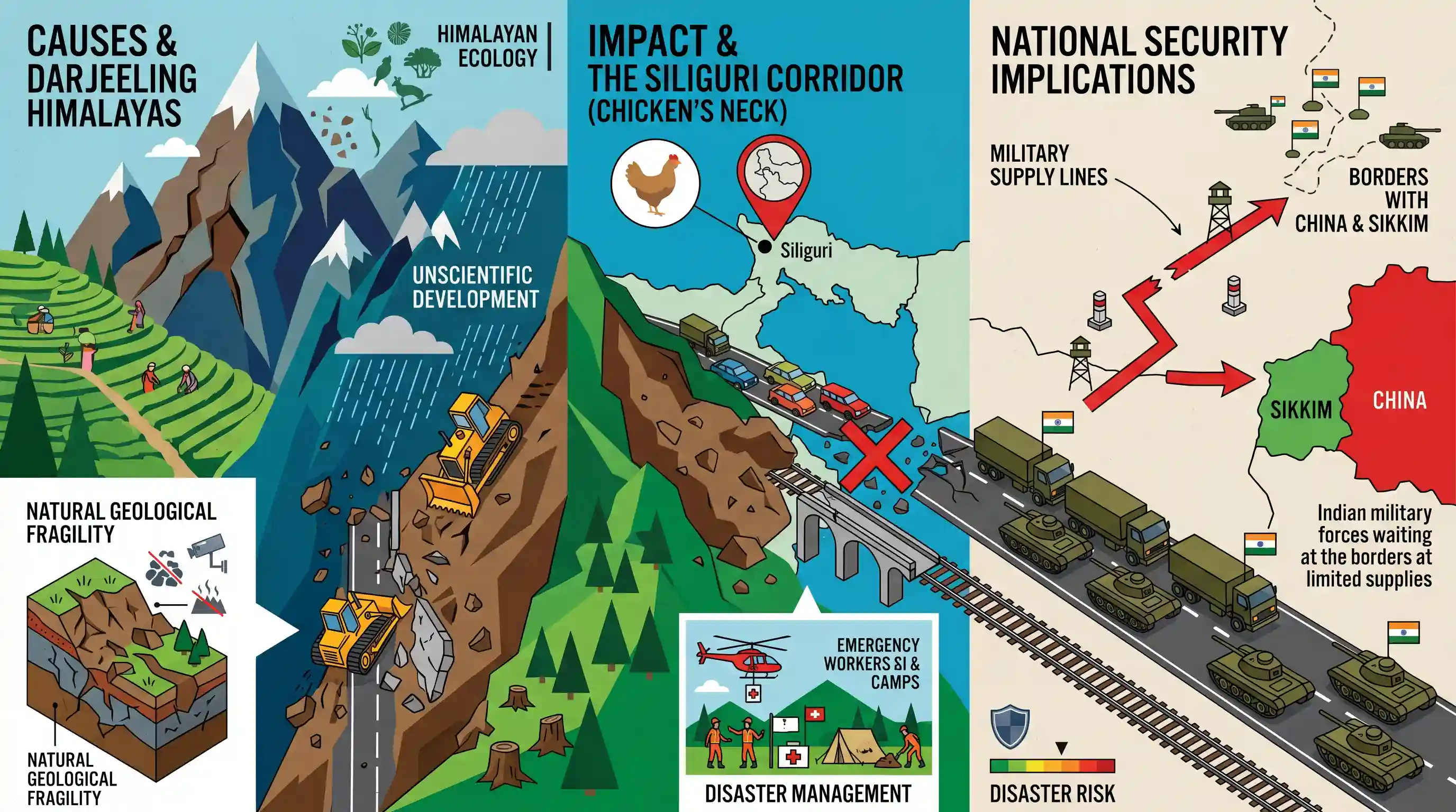
The article examines the escalating threat of landslides in the Darjeeling Himalayas, driven by a combination of natural geological fragility and unscientific infrastructure development. It highlights how frequent landslides disrupt vital connectivity—particularly around the strategic Siliguri Corridor (Chicken's Neck)—posing severe national security implications by threatening military supply lines to the borders with China and Sikkim.
Key Points
- The Darjeeling Himalayan region is inherently susceptible to landslides due to its fragile geology, steep gradients, and heavy monsoon rainfall.
- Unplanned urbanization, deforestation, and unscientific slope-cutting for infrastructure significantly exacerbate the landslide vulnerability.
- Landslides frequently block critical arterial routes, severing essential transport connectivity to Sikkim and sensitive border areas.
- These disruptions in and around the Siliguri Corridor (Chicken's Neck) pose severe national security implications by hampering military movements and supply lines to the China border.
Important Terms
National Landslide Risk Management Strategy

A 2019 NDMA framework for landslide mitigation involving hazard mapping, early warning systems, and strictly regulated construction on slopes to enhance community resilience in hilly terrains.
UPSC context
GS Paper 3: Disaster Management. Tests knowledge of structural and non-structural mitigation measures for mountain-specific hazards.
Siliguri Corridor (Chicken's Neck)
A narrow 22-km strip of land in West Bengal connecting mainland India to eight Northeastern states, surrounded by Nepal, Bhutan, Bangladesh, and China.
UPSC context
GS Paper 3: Internal Security. Evaluates understanding of geo-strategic vulnerabilities and the importance of border connectivity.
Border Roads Organisation (BRO)
A Ministry of Defence agency responsible for constructing and maintaining strategic road infrastructure in India's border areas and difficult Himalayan terrains.
UPSC context
GS Paper 3: Security Challenges and their Management in Border Areas. Focuses on infrastructure as a component of defense preparedness.
National Disaster Management Authority (NDMA)
The apex statutory body for disaster management in India, headed by the Prime Minister, mandated to formulate policies and guidelines for disaster response.
UPSC context
GS Paper 3: Disaster Management. Central to questions on institutional frameworks and administrative responses to natural calamities.
Border Area Development Programme (BADP)
A centrally sponsored scheme aimed at providing infrastructure, livelihood opportunities, and a sense of security to populations living near international land borders.
UPSC context
GS Paper 3: Border Management. Relevant for discussing socio-economic development as a tool for internal security.
Prelims Trap
The Siliguri Corridor shares direct international land boundaries with Nepal, Bangladesh, Bhutan, and China.
Aspirants conflate strategic proximity with contiguity. The corridor is dangerously close to China's Chumbi Valley, but it only shares direct borders with Nepal, Bhutan, and Bangladesh.
Static Concepts Connected
Why is the Siliguri Corridor a critical strategic chokepoint?
- Geographical bottleneck: A narrow land strip (20-22 km wide at its narrowest) serving as the sole geographical land bridge to India's eight Northeastern states.
- Proximity to China: Located precariously close to the Chumbi Valley and Doklam plateau, increasing its vulnerability to transborder multi-domain threats.
- Logistics lifeline: It acts as the exclusive overland route for troop reinforcements and military supplies to the LAC in Sikkim and Arunachal Pradesh.
What causes extreme landslide vulnerability in the Darjeeling Himalayas?
- Tectonic fragility: Located in the young, seismically active Himalayan fold mountains characterized by steep gradients and highly fragmented rock structures.
- Hydrological triggers: Intense monsoonal rainfall rapidly saturates topsoil, lubricating slope materials and triggering massive soil and rock movements.
- Anthropogenic stress: Unscientific toe-cutting for infrastructure, widespread deforestation, and ignoring NDMA mandates like the 30-degree slope construction ban exacerbate instability.
Cross-Topic Patterns
Ecological Security vs. Border Logistics
Disaster management in border zones is now a core internal security issue, as ecological disasters like landslides directly threaten critical LAC logistics lines managed by the BRO.
Carrying Capacity & Hill Urbanization
Darjeeling’s slope failures mirror Joshimath's subsidence, highlighting the systemic failure of implementing carrying capacity assessments and ignoring NDMA guidelines in fragile Himalayan ecosystems.

Expect a GS-3 question linking Himalayan landslides directly to the strategic vulnerability of the Siliguri Corridor and LAC logistics.
Linked PYQs · 4
Linked PYQs · 4
- 2021MainsGS3
Describe the various causes and the effects of landslides. Mention the important components of the National Landslide Risk Management Strategy.
- 2019MainsGS3
Disaster preparedness is the first step in any disaster management process. Explain how hazard zonation mapping will help disaster mitigation in the case of landslides.
- 2024MainsGS3
India has a long and troubled border with China and Pakistan fraught with contentious issues. Examine the conflicting issues and security challenges along the border. Also give out the development being undertaken in these areas under the Border Area Development Programme (BADP) and Border Infrastructure and Management (BIM) Scheme.
- 2012PrelimsGS1
When you travel in Himalayas, you will see the following: 1. Deep gorges 2. U-turn river courses 3. Parallel mountain ranges 4. Steep gradients causing land-sliding Which of the above can be said to be the evidences for Himalayas being young fold mountains?
