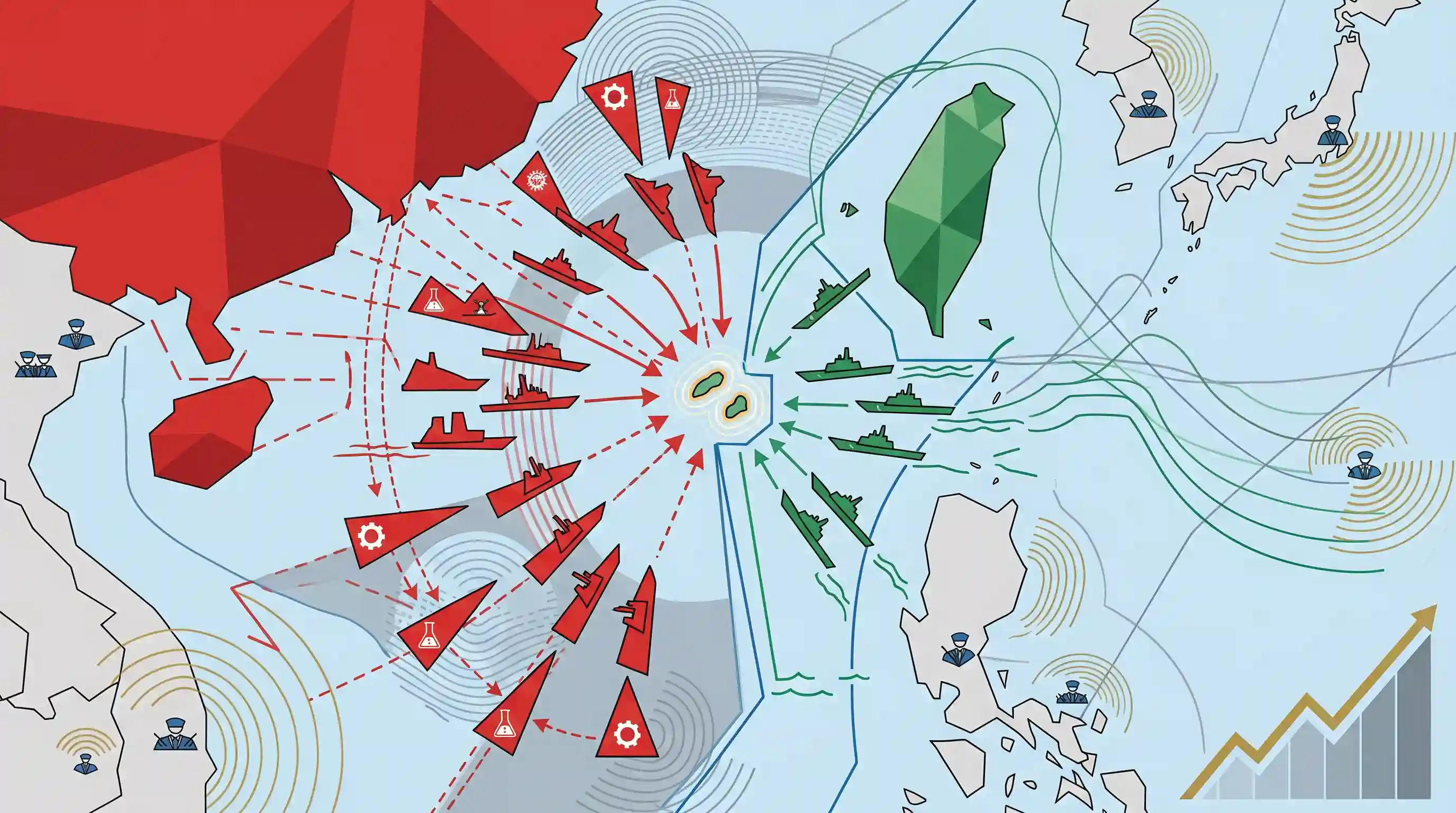
Chinese maritime incursions near Pratas Islands in South China Sea
Source:The Hindu ↗
Why It Matters
The South China Sea and Taiwan Strait are critical global maritime choke points. Escalations between China and Taiwan using 'gray zone' tactics hold major implications for Indo-Pacific stability, freedom of navigation, and India's Act East policy. It frequently appears in UPSC questions covering IR, maritime security, and geographical mappings.
Summary
Taiwan reported that Chinese coast guard and oceanographic research vessels conducted a coordinated operation near the Pratas Islands, a strategically vital Taiwanese-controlled territory in the South China Sea. This signifies an escalation in Beijing's "gray zone" tactics and maritime pressure against Taiwan since President Lai Ching-te took office. Taiwan's Coast Guard actively challenged the incursions to defend its sovereignty. The incident highlights the persistent geopolitical volatility, territorial disputes, and maritime security challenges shaping the broader Indo-Pacific region.
Key Points
- Taiwan reported an unprecedented coordinated incursion by Chinese coast guard and research ships near the Taiwanese-controlled Pratas Islands.
- The Pratas Islands hold immense strategic value due to their location between southern Taiwan and Hong Kong in the northern sector of the South China Sea.
- Beijing has escalated military and gray-zone pressure on Taiwan following the inauguration of President Lai Ching-te, whom China labels a 'separatist'.
- The event underscores broader regional tensions regarding freedom of navigation, territorial sovereignty, and maritime security in the Indo-Pacific.
Important Terms
Gray Zone Tactics

Coercive actions that fall below the threshold of open warfare, designed to achieve strategic goals through ambiguity, deniability, and gradual pressure while avoiding a traditional military response.
UPSC context
GS2/GS3; tests understanding of non-traditional security threats and modern hybrid warfare strategies in the Indo-Pacific.
Pratas Islands
Also known as Dongsha Islands, these strategically located atolls in the northern South China Sea are controlled by Taiwan but claimed by the People’s Republic of China.
UPSC context
Geography/Mapping (Prelims); significant for maritime security, trade routes, and territorial disputes in East Asia.
China Coast Guard (CCG)
The world's largest maritime law enforcement agency, now a paramilitary force under China's Central Military Commission, used to enforce sovereignty and conduct gray zone operations.
UPSC context
GS2 (International Relations); relevant for maritime security challenges and China's assertive tactics in disputed waters.
Republic of China (Taiwan)
The formal name of the self-governing democracy on Taiwan, established in 1949 following the Chinese Civil War; it currently lacks universal diplomatic recognition.
UPSC context
GS2 (Bilateral Relations); tests knowledge of the 'One-China Policy' and India's unofficial strategic ties with Taipei.
People's Republic of China (PRC)
The government established in Beijing in 1949, which claims sole legitimacy over all of China, including Taiwan, as an inalienable province.
UPSC context
GS2; central to Indo-Pacific geopolitics and India’s complex bilateral relationship with a regional hegemon.
Indo-Pacific
A strategic construct linking the Indian and Pacific Oceans as a single maritime space focused on freedom of navigation, trade, and a rules-based order.
UPSC context
GS2; the primary theater for India's maritime strategy, SAGAR vision, and QUAD participation.
Prelims Trap
The Pratas Islands are administered by China and located in the East China Sea.
The Pratas Islands are located in the northern South China Sea, not the East China Sea, and are actively administered by Taiwan (Republic of China), not Beijing.
Static Concepts Connected
What constitutes the First and Second Island Chains?
- First Island Chain: Extends from the Kuril Islands, through Japan, Taiwan, and the Philippines, down to Borneo. It is the primary geopolitical containment line against Chinese maritime expansion.
- Second Island Chain: Formed by the Bonin, Marianas (Guam), and Caroline Islands. It serves as the primary strategic defense and staging line for US forces in the Pacific.
- Taiwan's Role: Taiwan forms the anchor of the First Island Chain. Breaking this chain allows China to project 'blue-water' naval power freely into the broader Pacific.
What are 'Gray Zone' tactics in international relations?
- Definition: Coercive state actions that fall between routine diplomacy and open warfare, designed to alter the status quo without crossing the threshold of armed conflict.
- Maritime Application: Using Coast Guard or civilian militia instead of Navy ships to assert territorial claims, complicating the target nation's legal and military response options.
- Salami Slicing: Also known as 'salami slicing,' it involves incremental actions (like building artificial islands or minor border incursions) that gradually change realities on the ground over time.
Cross-Topic Patterns
Act East Policy & Maritime Chokepoints
Over 50% of India's international trade passes through the South China Sea. Maritime security and freedom of navigation here are foundational to India's Act East Policy and economic resilience.
Dual-Use Assets & Civil-Military Fusion
China routinely uses civilian 'research' vessels to map ocean floors for future submarine warfare routes, illustrating its Civil-Military Fusion strategy blurring lines between civilian science and military intelligence.

Expect a Prelims map question matching East/South China Sea flashpoints (Pratas, Senkaku, Paracels) to their administering states in 2026.
Linked PYQs · 3
Linked PYQs · 3
- 2022PrelimsGS1
With reference to the United Nations Convention on the Law of Sea, consider the following statements : 1. A coastal state has the right to establish the breadth of its territorial sea up to a limit not exceeding 12 nautical miles, measured from baseline determined in accordance with the convention. 2. Ships of all states, whether coastal or land-locked, enjoy the right of innocent passage through the territorial sea. 3. The Exclusive Economic Zone shall not extend beyond 200 nautical miles from the baseline from which the breadth of the territorial sea is measured. Which of the statements given above are correct?
- 2014MainsGS2
With respect to the South China sea, maritime territorial disputes and rising tension affirm the need for safeguarding maritime security to ensure freedom of navigation and over flight throughout the region. In this context, discuss the bilateral issues between India and China.
- 2021MainsGS2
The newly tri-nation partnership AUKUS is aimed at countering China's ambitions in the Indo-Pacific region. Is it going to supersede the existing partnerships in the region? Discuss the strength and impact of AUKUS in the present scenario.
