Tadoba Tiger Reserve deploys sensor waterhole monitoring system
Source:The Hindu ↗
Why It Matters
Important for MPSC aspirants tracking regional environmental innovations, wildlife management strategies, and developments in Maharashtra's premier tiger reserves.
Summary
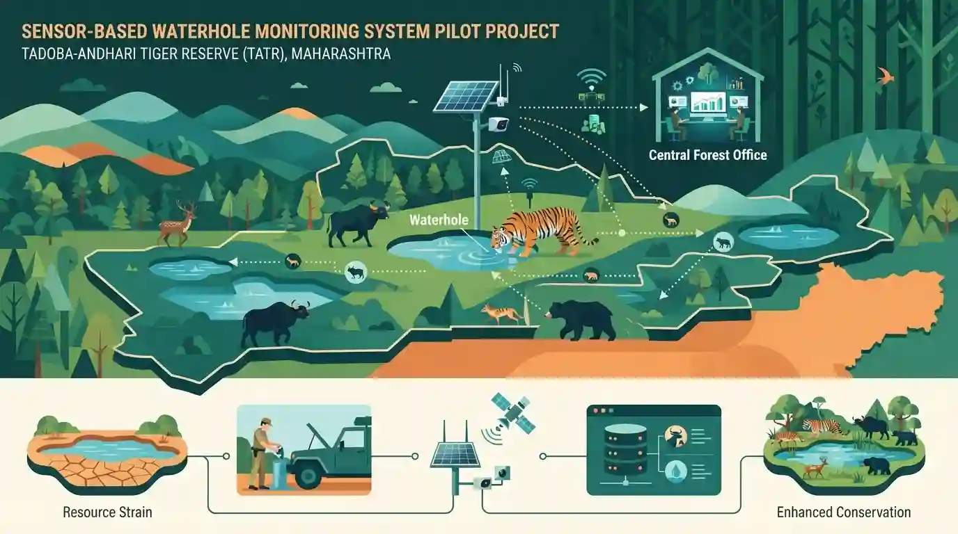
The Tadoba-Andhari Tiger Reserve (TATR) in Maharashtra has launched a pilot project deploying a sensor-based waterhole monitoring system to optimize water resource management and track wildlife activity, enhancing conservation efforts in the region.
Key Points
- Tadoba-Andhari Tiger Reserve (TATR) in Maharashtra has initiated a pilot project using a sensor-based waterhole monitoring system.
- The system aims to efficiently manage water resources and track wildlife movement across waterholes using modern technology.
- It addresses critical conservation challenges during peak summer months when water scarcity impacts wildlife behavior and management.
Important Terms
Tadoba-Andhari Tiger Reserve (TATR)

Maharashtra's oldest and largest tiger reserve, situated in the Chandrapur district, known for its rich biodiversity, dense teak forests, and successful conservation initiatives.
UPSC context
Important for MPSC Geography and Environment (Paper 1 & Paper 3), focusing on Maharashtra's protected areas, wildlife sanctuaries, and tiger conservation projects.
Forest Department
State government body responsible for the protection, conservation, and management of forests and wildlife resources across Maharashtra, including protected areas and tiger reserves.
UPSC context
Relevant for MPSC Governance, Administration, and Environment sections, testing knowledge of state-level environmental implementation bodies.
Static Concepts Connected
What are the key facts about Tadoba-Andhari Tiger Reserve (TATR) in Maharashtra?
- Location & Status: Located in the Chandrapur district of Maharashtra, it is the state's oldest and largest national park.
- Etymology: Derived its name from 'Tadoba' or 'Taru' (the local deity) and 'Andhari' (the river flowing through the forest).
- Terrain & Flora: Comprises the Chimur hills, Moharli and Kolsa ranges, and features tropical dry deciduous forest.
Cross-Topic Patterns
Wildlife Technology + Protected Area Management
Sensor-based wildlife monitoring links modern conservation tech with Maharashtra's geography and administrative grid management under the Wildlife Protection Act, 1972.

TATR sensor waterhole pilot + tiger reserve geography (Chandrapur) likely to feature in MPSC environment statements.
Linked PYQs · 3
Linked PYQs · 3
- 2025MPSC_PRELIMSGS1
Which of the following animal is not declared as a critically endangered species of reptile and amphibian of India ?
- 2026MPSC_PRELIMSGS1
Match the following forest circles with their share in percentage to total forest area of Maharashtra. | (Forest circles of Maharashtra) | (Percentage to total forest area Economic survey of Maharashtra (2024)) | |---|---| | (a) Gadchiroli | (1) 12.5 | | (b) Nagpur | (2) 20.8 | | (c) Dhule | (3) 9.5 | | (d) Thane | (4) 10.4 | Code: (a) (b) (c) (d)
- 2024MPSC_PRELIMSGS1
Coal is found at which of the following place in Chandrapur district ? (a) Bandar (b) Ghoggus (c) Telwasa (d) Wani
