Purulia JICA Water Project Aims to Combat Jangal Mahal Scarcity
Source:indianmasterminds ↗
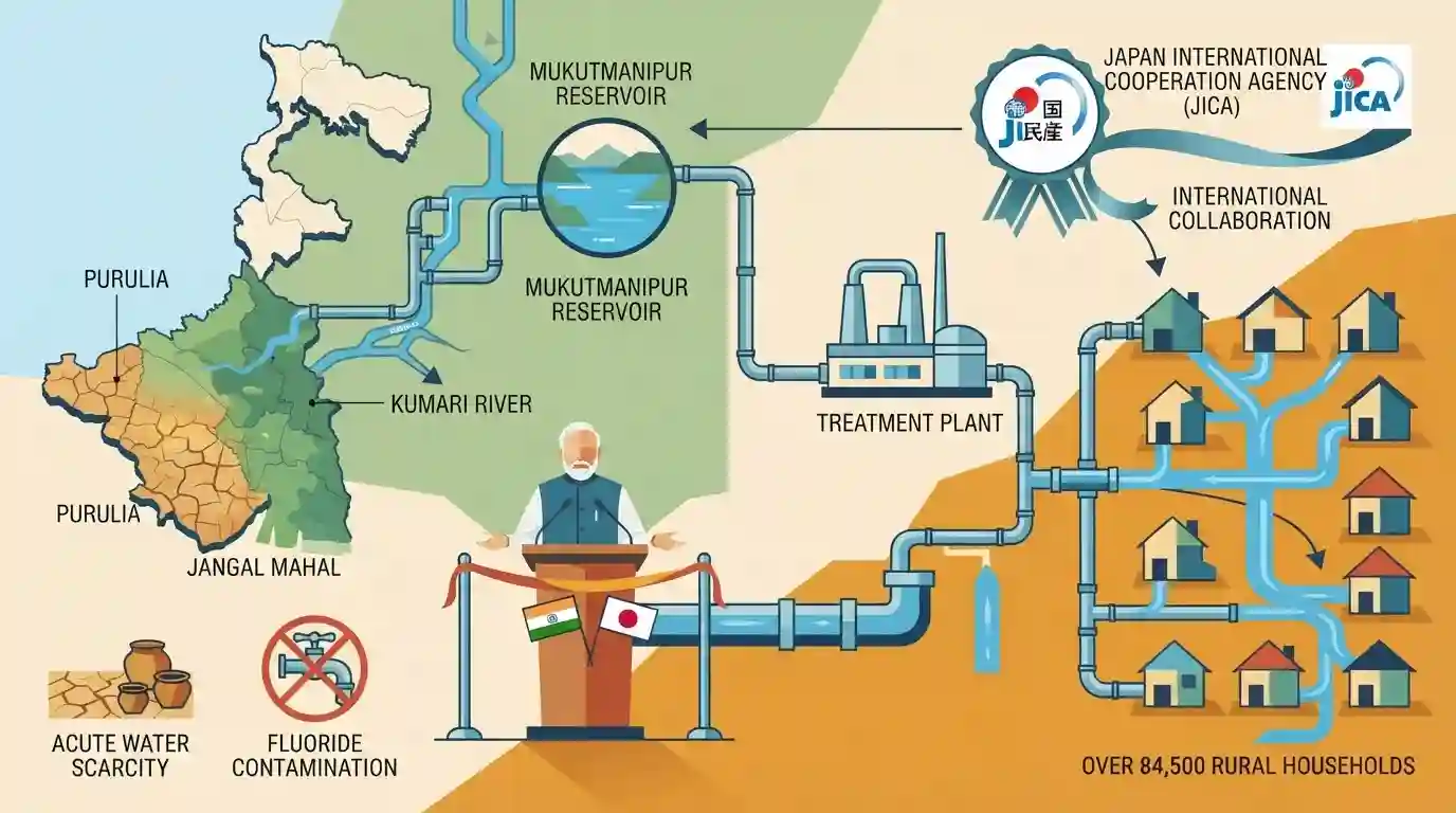
Why It Matters
Highlights a major infrastructure project in West Bengal funded by an international organization (JICA). It emphasizes regional geography, specifically the Mukutmanipur Dam and the Kumari River, which have been direct subjects of past WBCS Prelims questions. It also underscores government efforts to combat water scarcity and fluoride contamination in the Jangal Mahal region.
Summary
West Bengal Chief Minister Suvendu Adhikari has launched a ₹1,296-crore drinking water project in Purulia, aimed at providing safe piped water to over 84,500 rural households. Supported by the Japan International Cooperation Agency (JICA), the project utilizes water sourced from the Mukutmanipur Reservoir on the Kumari River. The initiative is critical for the arid Jangal Mahal region, historically plagued by acute water scarcity and severe fluoride contamination in its groundwater, ensuring sustainable drinking water infrastructure for local communities.
Key Points
- West Bengal Chief Minister Suvendu Adhikari launched a ₹1,296-crore piped water project in Purulia district.
- Supported by the Japan International Cooperation Agency (JICA), the project will supply safe drinking water to over 84,500 rural households.
- The project sources its water from the Mukutmanipur Reservoir on the Kumari River.
- It addresses chronic water scarcity and mitigates the issue of fluoride contamination in groundwater across the arid Jangal Mahal region.
Important Terms
West Bengal Piped Water Supply Project (Purulia)

A ₹1,296.25 crore drinking water infrastructure initiative to supply safe piped water to over 84,500 rural households across five arid blocks in Purulia district.
UPSC context
Important for WB Geography and Infrastructure, highlighting state efforts to combat water scarcity and groundwater contamination in arid regions.
Japan International Cooperation Agency (JICA)
The Japanese governmental agency coordinating official development assistance internationally. It is providing major financial support for West Bengal's Purulia piped water supply project.
UPSC context
Relevant to International Relations and Economy, testing knowledge of foreign funding and bilateral development partnerships in state-level infrastructure.
West Bengal Public Health Engineering Department
The state government department responsible for rural and urban water supply and sanitation, acting as the implementing agency for the JICA-backed Purulia water project.
UPSC context
Pertinent to State Administration, assessing awareness of specific governmental bodies executing public health and large-scale utility schemes.
Mukutmanipur Reservoir
A large reservoir formed by the Kangsabati Dam at the confluence of the Kangsabati and Kumari rivers. It acts as the water source for the Purulia project.
UPSC context
Crucial for West Bengal Geography, testing knowledge of major dams, reservoirs, and water resource management in the western plateau region.
Kumari River
An eastward-flowing tributary of the Kangsabati River originating in the Ajodhya Hills. It merges at Mukutmanipur, contributing significantly to the reservoir's volume.
UPSC context
Vital for West Bengal Geography, assessing understanding of the state's drainage systems, tributaries, and their role in regional water supply.
Jangal Mahal
An arid, forested region in western West Bengal encompassing Purulia and surrounding districts, historically challenged by water scarcity, lateritic soils, and fluoride contamination.
UPSC context
Essential for WB Geography and Social Issues, focusing on regional socio-economic disparities, tribal development, and localized environmental challenges.
Prelims Trap
"The Mukutmanipur Dam is located in Purulia district."
Aspirants naturally assume the dam is in Purulia because it supplies the district's water scheme. It is actually located in the Khatra subdivision of Bankura district.
Static Concepts Connected
What are the key geographical features of the Mukutmanipur Dam?
- Location: Situated in the Khatra subdivision of Bankura district, at the confluence of the Kangsabati (Kasai) and Kumari rivers.
- Scale & History: Commissioned in 1956 under Dr. B.C. Roy, it stands as India's second-longest earthen dam, spanning 11.27 km.
- Kumari River: The Kumari River is a prominent right-bank tributary of the Kangsabati, draining the eastern fringes of the Chhota Nagpur plateau.
How does groundwater contamination geographically differ across West Bengal?
- Western Plateau: The western dry plateau districts (Purulia, Bankura, Birbhum) suffer primarily from natural fluoride contamination due to regional granitic rock structures.
- Gangetic Plains: The eastern Gangetic plains (Nadia, Hooghly, North 24 Parganas, Malda) face severe arsenic contamination in alluvial aquifers.
Cross-Topic Patterns
JICA's expanding footprint in Bengal
Japan's JICA is systematically funding key West Bengal infrastructure, linking this Purulia water project with other major investments like the Kolkata East-West Metro and the Turga Pumped Storage Project.
Geology, Fluorosis, and Jal Swapna
This project addresses a historical public health crisis (fluorosis) in the arid Jangal Mahal region, tying into the state's broader 'Jal Swapna' mission for universal rural piped water access.

Expect a match-the-following on WB dams (Kumari-Kangsabati/Mukutmanipur) or a statement question contrasting Fluoride vs Arsenic zones.
Linked PYQs · 1
Linked PYQs · 1
- 2021WBCS_PRELIMSGS1
Mukutmanipur Dam is located across the following river :
