Legal plea for declaring Ram Setu as a national heritage monument
Source:The Hindu ↗
Why It Matters
The issue highlights the intersection of coastal geography (limestone shoals, gulf dynamics), cultural heritage conservation, and large-scale infrastructure projects (Sethusamudram). It is highly relevant for GS1 Geography and History/Heritage, as well as GS3 Environment.
Summary
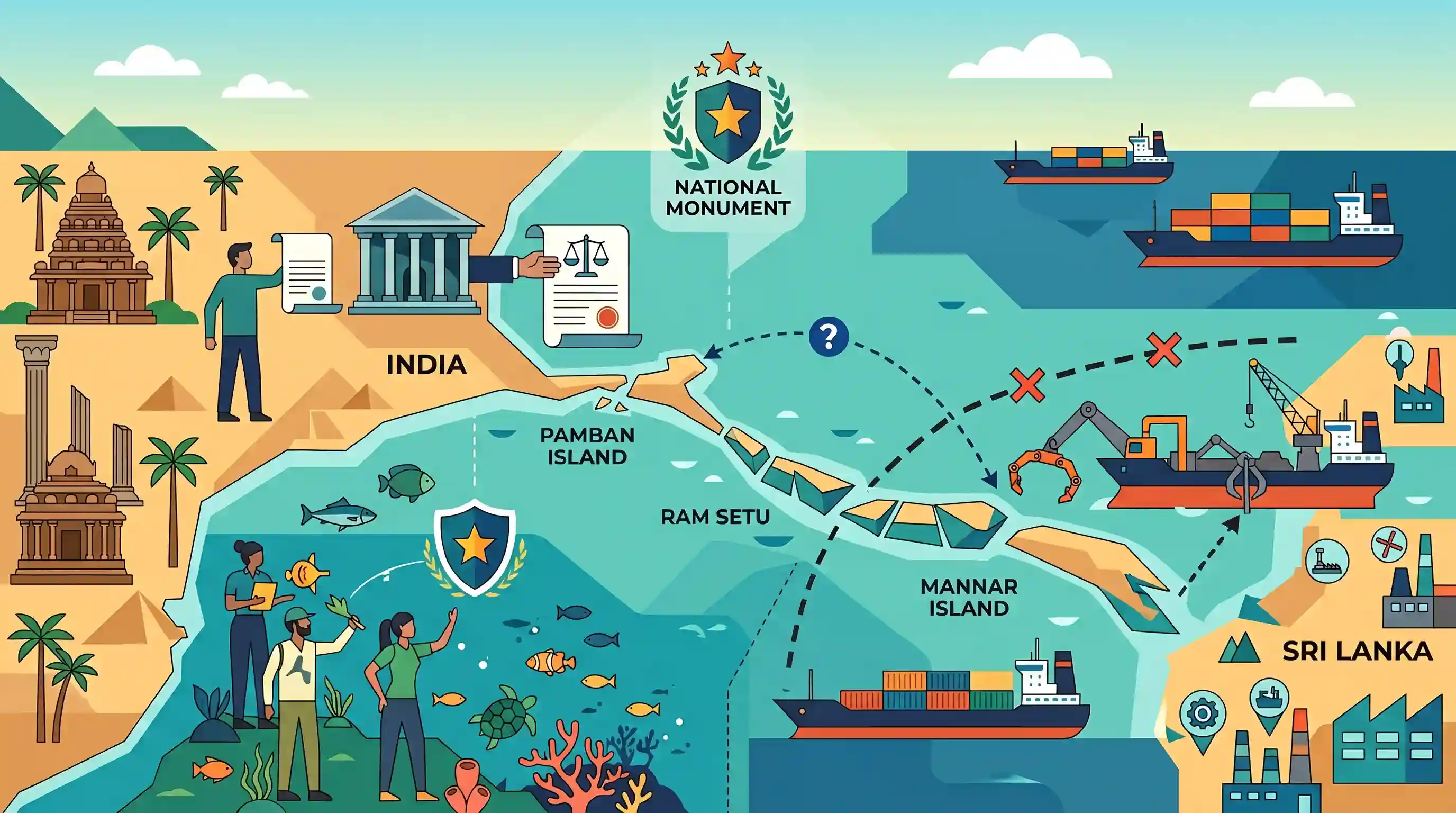
The Supreme Court has issued a notice to the Union Government regarding a Public Interest Litigation (PIL) filed by Subramanian Swamy seeking the declaration of Ram Setu (Adam's Bridge) as a national monument. Ram Setu is a continuous chain of limestone shoals spanning 56 kilometers between India's Pamban Island and Sri Lanka's Mannar Island. While the petitioner argues that space technology proves the existence of the bridge, the government maintains that satellite imagery alone cannot pinpoint its exact origin or age. The structure has been a subject of long-standing debate, notably leading to the Supreme Court staying the Sethusamudram Ship Channel project in 2007 to prevent dredging through the historic and ecological site.
Key Points
- The Supreme Court of India issued a notice to the Union government regarding a PIL seeking to declare Ram Setu (Adam's Bridge) a national monument.
- Ram Setu is a 56-km-long chain of limestone shoals connecting Pamban Island in Tamil Nadu to Mannar Island in Sri Lanka.
- The government informed Parliament that while space technology identified islands and shoals, satellite imagery cannot definitively establish the origin and age of the structure.
- The Sethusamudram Ship Channel project, which aimed to create a navigable route through the area, was stayed by the Supreme Court in 2007 following petitions to protect the bridge.
Important Terms
Ram Setu (Adam's Bridge)

A 48-56 km chain of limestone shoals and coral reefs connecting India's Pamban Island and Sri Lanka's Mannar Island, separating the Gulf of Mannar from the Palk Strait.
UPSC context
Relevant for GS Paper I (Geography: Geomorphology) and Art & Culture (Heritage). Tests knowledge of transboundary geographical features.
Sethusamudram Ship Channel Project
A proposed 83-km shipping canal project to link the Gulf of Mannar and Palk Bay, intended to reduce navigation time between India’s east and west coasts by avoiding circumventing Sri Lanka.
UPSC context
Significant for GS Paper III (Infrastructure and Environment). Tests the conflict between developmental projects and ecological/cultural preservation.
Public Interest Litigation (PIL)
A legal mechanism allowing any public-spirited individual to approach the court for the protection of public interest, relaxing the traditional rule of 'locus standi'.
UPSC context
Core concept for GS Paper II (Polity and Governance). Tests understanding of judicial activism and constitutional remedies under Articles 32 and 226.
Ancient Monuments and Archaeological Sites and Remains (AMASR) Act, 1958
The primary Indian legislation for preserving ancient monuments, archaeological sites, and remains of national importance, typically requiring a structure to be at least 100 years old.
UPSC context
Important for GS Paper I (Heritage Conservation). Tests knowledge of statutory frameworks protecting India's cultural and historical assets.
National Monuments Authority (NMA)
A statutory body under the Ministry of Culture established by the AMASR (Amendment) Act, 2010, responsible for heritage conservation and regulating construction near protected monuments.
UPSC context
Relevant for GS Paper II (Statutory Bodies) and GS Paper I (Art & Culture). Tests knowledge of institutional roles in heritage management.
Limestone Shoals
Submerged or partially exposed ridges of limestone or sand in shallow water, often formed by coral accumulation or geological sedimentation processes.
UPSC context
Relevant for GS Paper I (Physical Geography). Tests conceptual understanding of coastal geomorphology and marine landforms.
Prelims Trap
Ram Setu is a continuous coral reef connecting the Palk Bay and the Gulf of Mannar.
It is technically a chain of limestone shoals (not just coral reefs) that geographically *separates* (not connects) the Palk Bay from the Gulf of Mannar.
Static Concepts Connected
What is the geographical composition and significance of Ram Setu?
- Limestone shoals: It is a continuous 56-km chain of limestone shoals (sandbanks) naturally formed by sedimentation and ocean currents.
- Marine barrier: It acts as a physical barrier separating the shallow Palk Bay in the northeast from the deeper Gulf of Mannar in the southwest.
- Shallow bathymetry: Its extremely shallow waters (1-10 metres deep) inherently prevent navigation by large commercial vessels, necessitating long detours around Sri Lanka.
How is a Monument of National Importance protected in India?
- AMASR Act 1958: These sites receive statutory protection under the Ancient Monuments and Archaeological Sites and Remains (AMASR) Act, 1958.
- Prohibited Zone: The Act enforces a strict 100-metre radius around the monument where no new construction is permitted.
- Regulated Zone: It mandates an additional 200-metre zone where any development or construction requires prior permission from the National Monuments Authority.
Cross-Topic Patterns
Heritage vs Maritime Infrastructure logistics
The Sethusamudram project highlights a recurring UPSC theme: balancing economic logistics (reducing maritime shipping distances) with historical conservation and ecological protection under the AMASR Act 1958.
Ram Setu & Dugong Conservation
The shoals border the Gulf of Mannar Marine Biosphere Reserve. Any dredging directly threatens the fragile coral-seagrass ecosystems that act as the primary habitat for the endangered Dugong.

Map-based questions linking Ram Setu, Palk Bay, Gulf of Mannar, and the AMASR Act's statutory protection zones are highly probable in 2026.
Linked PYQs · 3
Linked PYQs · 3
- 2024PrelimsGS1
Consider the following information (Archaeological Site — State — Description): 1. Chandraketugarh — Odisha — Trading port town 2. Inamgaon — Maharashtra — Chalcolithic site 3. Mangadu — Kerala — Megalithic site 4. Salihundam — Andhra Pradesh — Rock-cut cave shrines In which of the above rows is the given information correctly matched?
- 2023MainsGS1
Comment on the resource potentials of the long coastline of India and highlight the status of natural hazard preparedness in these areas.
- 2023MainsGS1
Explain the role of geographical factors towards the development of Ancient India.
