Supreme Court Bans New Mining Leases in Aravali Region
Source:The Hindu ↗
Why It Matters
This ruling is highly relevant for GS3 (Environmental Conservation and Mining Hazards) and GS1 (Desertification and Physical Geography). It provides a concrete example of judicial intervention to mandate sustainable mining and recognize the ecological significance of a major mountain range in preventing desertification.
Summary
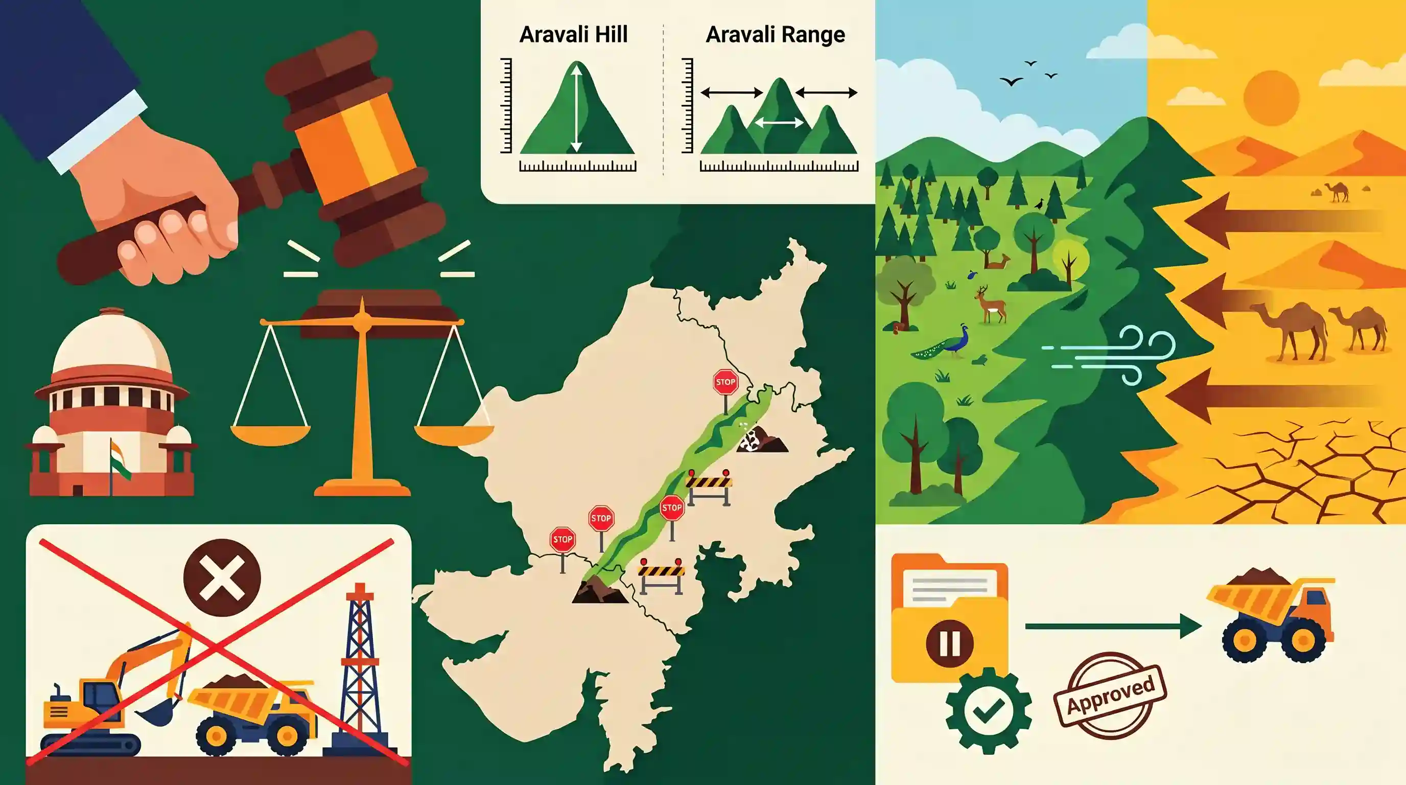
The Supreme Court of India has approved the Centre’s definition of 'Aravali Hills' and instituted a blanket ban on all new mining leases in the Aravali region, covering Delhi, Haryana, Rajasthan, and Gujarat. An 'Aravali Hill' is now defined as a landform with an elevation of at least 100 meters above its local relief, with an 'Aravali Range' comprising two or more such hills within a 500-meter radius. Recognizing the Aravalis as a vital "green barrier" against the eastward expansion of the Thar desert, the Court mandated that no fresh mining leases be granted until the MoEF&CC finalizes a Management Plan for Sustainable Mining (MPSM). This landmark decision reinforces the judicial commitment to balancing resource extraction with the conservation of critical ecological corridors.
Key Points
- The Supreme Court accepted the Centre's definition of 'Aravali Hills' (landforms ≥100m above local relief) and 'Aravali Range' (two or more such hills within 500m of each other).
- A blanket ban has been imposed on granting fresh mining leases in the Aravali areas across Delhi, Haryana, Rajasthan, and Gujarat.
- The ban will remain until the MoEF&CC finalizes a Management Plan for Sustainable Mining (MPSM) based on a report by the ICFRE.
- The Court emphasized the critical role of the Aravalis as a "green barrier" that prevents the eastward spread of the Thar desert and sustains regional biodiversity and groundwater.
- Existing legal mining operations can continue only if they fall outside the newly defined Aravali Hills/Range and Eco-Sensitive Zones, subject to statutory clearances.
Important Terms
Management Plan for Sustainable Mining (MPSM)

A science-based framework mandated by the Supreme Court to regulate mining. It identifies permissible zones, restoration priorities, and ecologically sensitive areas based on the region's carrying capacity.
UPSC context
GS Paper III: Environment and Mineral Resources; tests knowledge of sustainable development frameworks and judicial intervention in mining.
Indian Council of Forestry Research and Education (ICFRE)
An autonomous council under the MoEF&CC tasked with conducting forestry research. It is the technical agency responsible for preparing the MPSM for the Aravali landscape.
UPSC context
GS Paper III: Environment; tests understanding of the role of specialized scientific bodies in environmental governance.
Survey of India
India’s central engineering agency in charge of mapping and surveying. It is responsible for the mandatory marking of the newly defined Aravali hills and ranges on official maps.
UPSC context
GS Paper I: Indian Geography; tests technical understanding of landform mapping and administrative boundary demarcation.
Supreme Court of India
The apex judicial body whose rulings, particularly in the T.N. Godavarman and M.C. Mehta cases, serve as the primary legal framework for environmental protection and resource management in India.
UPSC context
GS Paper II: Polity/Judiciary; tests knowledge of judicial activism and the 'Public Trust Doctrine' in environmental conservation.
Ministry of Environment, Forest and Climate Change (MoEF&CC)
The nodal ministry for planning, promotion, and coordination of environmental and forestry programs. It leads the committee that proposed the uniform technical definition of the Aravali Hills.
UPSC context
GS Paper II: Governance; tests knowledge of the executive’s role in implementing environmental laws and court mandates.
Prelims Trap
"An Aravali Hill is defined as a landform with an elevation of at least 100 meters above Mean Sea Level."
The criteria is based on 100 meters above *local relief*, not Mean Sea Level. MSL would incorrectly classify much of the Indo-Gangetic plain.
Static Concepts Connected
What are the core geographical characteristics of the Aravali Range?
- Formation: One of the world's oldest fold mountains, formed in the Precambrian era, now existing as highly eroded relict or residual mountains.
- Extent: Stretches approximately 800 km from Palanpur in Gujarat, passing through Rajasthan and Haryana, and terminating at the Delhi Ridge.
- Ecological Role: Acts as a major water divide between the Indus and Ganga river systems and physically blocks the eastward expansion of the Thar Desert.
How are Eco-Sensitive Zones (ESZs) regulated in India?
- Legal Backing: They are notified by the MoEF&CC under the Environment (Protection) Act, 1986, though the term 'Eco-Sensitive Zone' is not explicitly mentioned in the Act.
- Purpose & Bans: They act as a 'shock absorber' or transition zone around Protected Areas. Commercial mining and highly polluting industries are strictly prohibited within ESZs.
Cross-Topic Patterns
UNCCD commitments & the Green Wall
The Aravalis' role as a desertification barrier directly links to India's UNCCD COP14 target to restore 26 million hectares of degraded land and the proposed 'Great Green Wall of India'.
Judicial Environmentalism vs Policy
This SC ban mirrors historical interventions like the Godavarman case, illustrating the continued reliance on the judiciary to enforce Article 21's right to a healthy environment over resource extraction.

Aravali geography (GJ to DL), the '100m local relief' criteria, and the UNCCD desertification link will likely form a 2026 Prelims MCQ.
Linked PYQs · 3
Linked PYQs · 3
- 2025MainsGS3
Mineral resources are fundamental to the country's economy and these are exploited by mining. Why is mining considered an environmental hazard? Explain the remedial measures required to reduce the environmental hazard due to mining.
- 2013MainsGS3
What are the consequences of Illegal mining ? Discuss the Ministry of Environment and Forests' concept of GO AND NO GO zones for coal mining sector.
- 2020MainsGS1
The process of desertification does not have climatic boundaries. Justify with examples.
