Satellite assessment reveals widespread year-round PM25 pollution
Source:The Hindu ↗
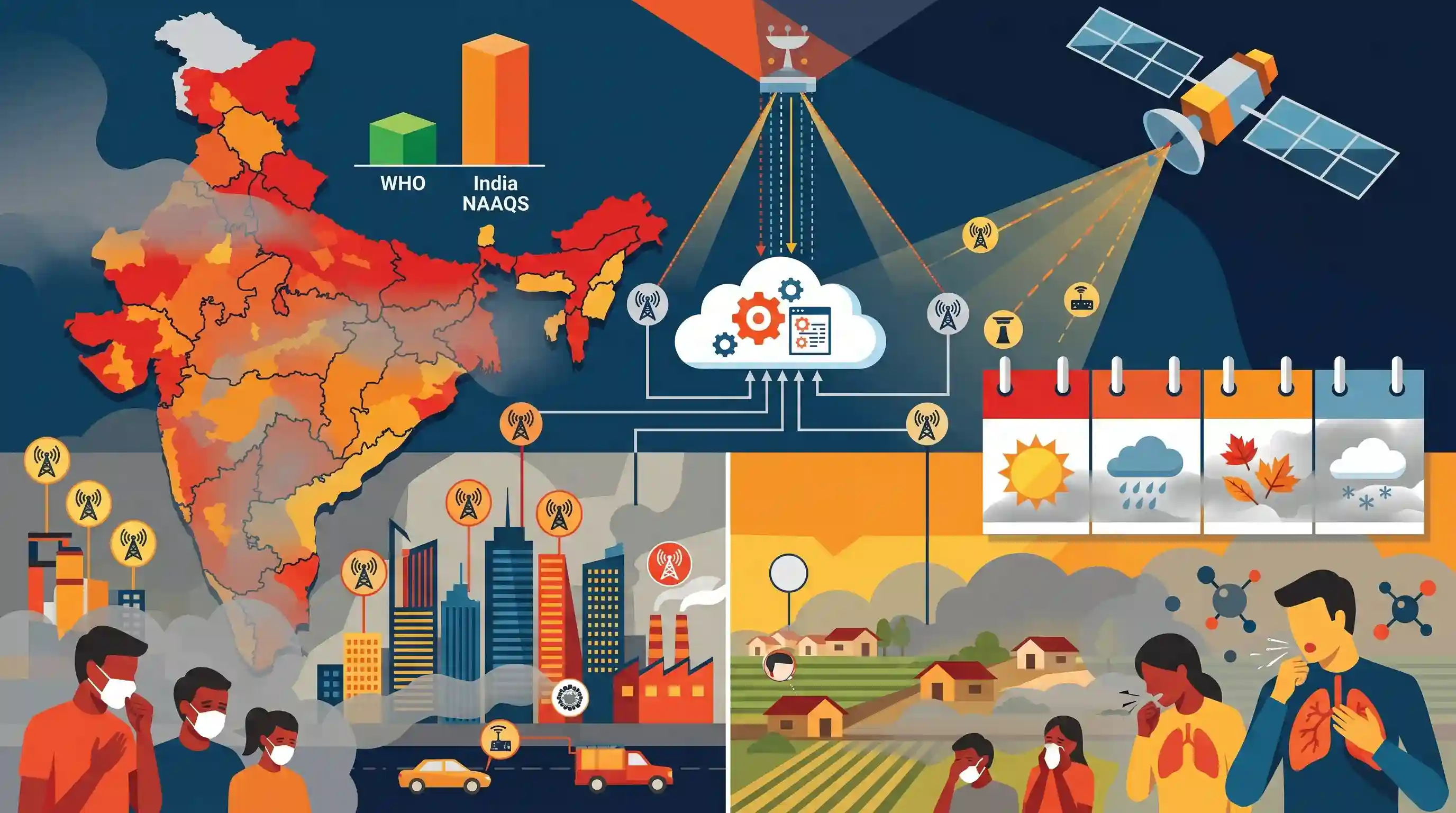
Why It Matters
The article demonstrates the utility of space technology (satellite data) and artificial intelligence (machine learning) in environmental governance to overcome the limitations of physical infrastructure. It also emphasizes the vast disparity between India's air quality targets and international (WHO) standards, which is a frequent theme in UPSC Mains and Prelims.
Summary
A study by the Centre for Research on Energy and Clean Air reveals that nearly 60% of Indian districts experience year-round PM2.5 pollution exceeding India's National Ambient Air Quality Standard (NAAQS) of 40 µg/m³, while no district meets the stricter WHO guideline of 5 µg/m³. Using machine learning to synthesize satellite data and ground sensor readings, the study highlights that toxic air is a pan-India, year-round crisis extending far beyond North India's winter months. Ground monitoring by the Central Pollution Control Board (CPCB) is currently concentrated in urban centers, exposing significant gaps in tracking pollution in rural and semi-urban areas.
Key Points
- Nearly 60% of Indian districts experience year-round PM2.5 pollution that exceeds India's National Ambient Air Quality Standard (NAAQS) of 40 µg/m³.
- Not a single district in India meets the stricter World Health Organization (WHO) annual safe limit of 5 µg/m³ for PM2.5.
- The study challenges the perception that air pollution is primarily a winter phenomenon restricted to North India, exposing it as a perennial, pan-India crisis.
- Researchers utilized a machine-learning model combining satellite measurements with ground sensor data to estimate district-level, population-weighted PM2.5 exposure.
- The CPCB's 966 ground monitoring stations are disproportionately clustered in major cities, leading to an underestimation of toxic air exposure in rural and smaller urban areas.
Important Terms
National Ambient Air Quality Standards (NAAQS)

Regulatory limits for 12 air pollutants set by the CPCB under the Air Act, 1981. For PM2.5, India's annual permissible limit is 40 µg/m³.
UPSC context
GS-III (Environment); essential for understanding India’s domestic regulatory framework and pollution management standards.
Central Pollution Control Board (CPCB)
A statutory body under the Ministry of Environment established in 1974. It sets national standards, provides technical guidance, and monitors air/water quality.
UPSC context
GS-II (Statutory Bodies) and GS-III (Environment); the apex authority for pollution control in India.
WHO Air Quality Guidelines
Health-based recommendations by the WHO for safe pollutant levels. The 2021 update tightened the annual PM2.5 limit to 5 µg/m³.
UPSC context
GS-III (Environment); frequently used to benchmark and critique the health-centricity of India's national standards.
PM 2.5
Fine particulate matter smaller than 2.5 micrometres. These particles enter the bloodstream, causing cardiovascular diseases, respiratory infections, and premature mortality.
UPSC context
GS-III (Pollution/Health); a primary indicator for air quality monitoring and environmental impact assessments.
Centre for Research on Energy and Clean Air (CREA)
An independent international research organization providing data-driven insights into air pollution trends and energy transitions to improve global public health.
UPSC context
Current Affairs; provides critical evidence and independent data for analyzing pollution trends beyond official urban sensors.
National Clean Air Programme (NCAP)
A central scheme launched in 2019 targeting a 20-30% reduction in particulate matter concentrations in 131 "non-attainment" cities by 2024.
UPSC context
GS-III (Environment); the flagship policy for combating urban air pollution through city-specific action plans.
Prelims Trap
Severe PM2.5 pollution in India is predominantly a winter phenomenon restricted to the Indo-Gangetic plain.
Media coverage creates an 'urban winter' bias. Data confirms PM2.5 breaches national standards year-round in 60% of districts nationwide, making it a perennial pan-India crisis.
Static Concepts Connected
What are the 12 pollutants monitored under National Ambient Air Quality Standards (NAAQS)?
- Criteria Pollutants: Includes PM10, PM2.5, Nitrogen Dioxide (NO2), Sulphur Dioxide (SO2), Carbon Monoxide (CO), Ozone (O3), Ammonia (NH3), and Lead (Pb).
- Toxic Trace Elements: Includes Benzene, Benzo(a)pyrene (BaP), Arsenic (As), and Nickel (Ni). Note: Carbon Dioxide (CO2) is NOT included.
What is the statutory backing of the Central Pollution Control Board (CPCB)?
- Water Act Origin: Constituted as a statutory organisation in 1974 under the Water (Prevention and Control of Pollution) Act.
- Air Act Powers: Later entrusted with additional powers and functions under the Air (Prevention and Control of Pollution) Act, 1981.
Cross-Topic Patterns
Space Tech for Environment
Satellite remote sensing (like Aerosol Optical Depth) paired with ML is now crucial for mapping rural pollution, linking GS3 Space Applications directly to Environmental Conservation.
Urban Bias in Public Goods
Concentrating ground sensors in mega-cities leaves rural toxic exposure unrecorded. This mirrors broader governance deficits where non-urban regions lack basic diagnostic and monitoring infrastructure.

Expect a 2026 prelims question contrasting NAAQS limits with revised WHO PM2.5 guidelines, alongside satellite AOD rural tracking.
Linked PYQs · 3
Linked PYQs · 3
- 2022PrelimsGS1
In the context of WHO Air Quality Guidelines, consider the following statements: 1. The 24-hour mean of PM2.5 should not exceed 15 µg/m³ and annual mean of PM2.5 should not exceed 5 µg/m³. 2. In a year, the highest levels of ozone pollution occur during the periods of inclement weather. 3. PM10 can penetrate the lung barrier and enter the bloodstream. 4. Excessive ozone in the air can trigger asthma. Which of the statements given above are correct?
- 2021MainsGS3
Describe the key points of the revised Global Air Quality Guidelines (AQGs) recently released by the World Health Organisation (WHO). How are these different from its last update in 2005? What changes in India's National Clean Air Programme are required to achieve these revised standards?
- 2019PrelimsGS1
For the measurement/estimation of which of the following are satellite images/remote sensing data used? 1. Chlorophyll content in the vegetation of a specific location 2. Greenhouse gas emissions from rice paddies of a specific location 3. Land surface temperatures of a specific location Select the correct answer using the code given below.
