Space Technology Startup Ecosystem Growth and Policy Reforms
Source:The Hindu ↗
Why It Matters
Demonstrates the growing importance of private sector participation and startups in India's space program, a key focus area under recent policy reforms like IN-SPACe. It also provides concrete examples of space technology applications relevant to GS3 Science and Technology questions.
Summary
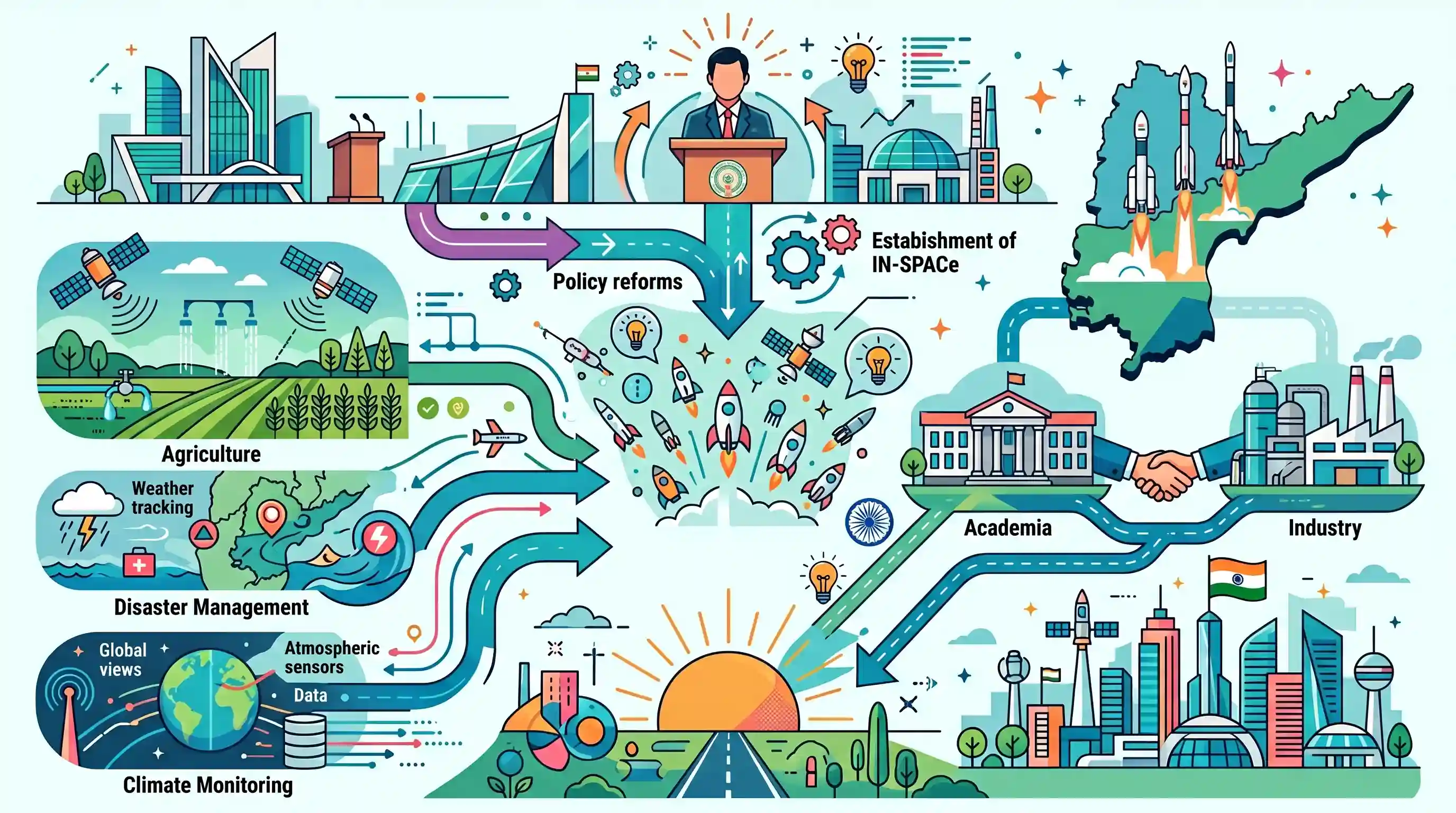
At the Andhra Pradesh Space Tech Summit-2026, NRSC Director Dr. Prakash Chauhan emphasized the critical role of startups in revolutionizing India's space technology sector. Policy reforms and the establishment of IN-SPACe have catalyzed the growth of nearly 300 space startups in the country. The summit highlighted the broad socio-economic applications of space technology, particularly in agriculture, disaster management, and climate monitoring. Furthermore, the event underscored Andhra Pradesh's strategic advantage due to its proximity to the Sriharikota launch facility, aiming to build a robust ecosystem connecting academia and industry to support India's vision of a 'Viksit Bharat' by 2047.
Key Points
- India's space startup ecosystem has witnessed rapid growth, expanding to nearly 300 startups, driven by government policy reforms and the creation of IN-SPACe.
- Space technology applications, including earth observation, communication, and navigation satellites, are increasingly vital for socio-economic development areas like agriculture, disaster management, and climate monitoring.
- Andhra Pradesh is positioning itself as a strategic hub for space technology by leveraging its geographical proximity to the Sriharikota spaceport and fostering strong academia-industry collaborations.
- Initiatives such as the 'South India Rocketry Challenge-2026' aim to nurture local talent and encourage innovation among students in the aerospace sector.
Important Terms
IN-SPACe

An autonomous nodal agency under the Department of Space acting as a single-window interface to promote, authorize, and supervise private sector participation in the Indian space sector.
UPSC context
GS III (Science & Tech); tests knowledge of space sector reforms and private sector participation.
National Remote Sensing Centre (NRSC)
An ISRO unit in Hyderabad responsible for satellite data reception, processing, and dissemination for applications like agriculture, disaster management, and natural resource monitoring.
UPSC context
GS III (Science & Tech); covers satellite applications for socio-economic development and governance.
Viksit Bharat 2047
The Union Government's strategic roadmap to transform India into a developed nation by 2047, emphasizing technological leadership and self-reliance in critical sectors like space.
UPSC context
GS II/III; crucial for national vision, development planning, and technological sovereignty.
AP SpaceTech Academy
A specialized institution established to bridge the gap between academic curricula and the space industry's technical requirements through research and workforce skill development.
UPSC context
GS III; reflects industry-academia collaboration and regional efforts in high-tech human resource development.
South India Rocketry Challenge-2026
A regional competition aimed at nurturing rocketry and aerospace engineering skills among students through hands-on innovation in chemical and hydro rocketry.
UPSC context
GS III; tests awareness of indigenous innovation and STEM initiatives for technological growth.
Space Tech Spectrum Journal
A specialized publication launched to disseminate advancements in space research and promote knowledge sharing between academia and the space industry ecosystem.
UPSC context
GS III; relevant for academic contributions to the indigenization of technology.
Prelims Trap
IN-SPACe is the commercial arm of ISRO responsible for marketing space technologies globally.
IN-SPACe is an autonomous regulatory and promotion agency for private entities. NewSpace India Limited (NSIL) is the actual commercial arm of ISRO.
Static Concepts Connected
What are the distinct roles of IN-SPACe, NSIL, and Antrix in India's space ecosystem?
- IN-SPACe: An autonomous agency under DOS acting as a single-window regulator, promoter, and authorization body for non-governmental private entities (NGEs).
- NSIL: A CPSE under DOS acting as ISRO's commercial arm, focusing on scaling up domestic industry participation and manufacturing launch vehicles.
- Antrix: The legacy commercial arm of ISRO, primarily dealing with the international marketing of ISRO's satellite and launch services.
Why is Sriharikota's geographical location strategically advantageous for satellite launches?
- East Coast Location: Rockets are launched eastward over the Bay of Bengal, ensuring that stage-debris falls safely into the ocean, minimizing risks to populated areas.
- Equatorial Proximity: Being closer to the equator provides an Earth-rotational velocity boost to eastward-launched rockets, significantly saving fuel and maximizing payload capacity.
Cross-Topic Patterns
Earth Observation + Disaster Management
UPSC frequently tests remote sensing applications. Link NRSC's geospatial data directly to GS-3 disaster management (hazard zonation mapping) and agriculture (crop health assessment).
Deep Tech Policy + Indigenization
The surge to 300+ space startups serves as a prime case study for Mains answers on India's deep tech policies and private sector indigenization.

Expect a multi-statement Prelims question differentiating IN-SPACe, NSIL, and ISpA, or a Mains GS3 query on space startups' economic impact.
Linked PYQs · 3
Linked PYQs · 3
- 2016MainsGS3
Discuss India's achievements in the field of Space Science and Technology. How the application of this technology has helped India in its socio-economic development?
- 2019MainsGS3
What is India's plan to have its own space station and how will it benefit our space programme?
- 2019PrelimsGS1
For the measurement/estimation of which of the following are satellite images/remote sensing data used? 1. Chlorophyll content in the vegetation of a specific location 2. Greenhouse gas emissions from rice paddies of a specific location 3. Land surface temperatures of a specific location Select the correct answer using the code given below.
