Srisailam Reservoir Water Storage Rises Due to Inflows
Source:deccanchronicle ↗
Why It Matters
The Srisailam dam is a critical piece of water infrastructure for Andhra Pradesh and Telangana, serving irrigation, drinking water, and hydroelectric needs. The APPSC Prelims frequently tests candidates on major irrigation projects, dams, and the geography of river basins like the Krishna River.
Summary
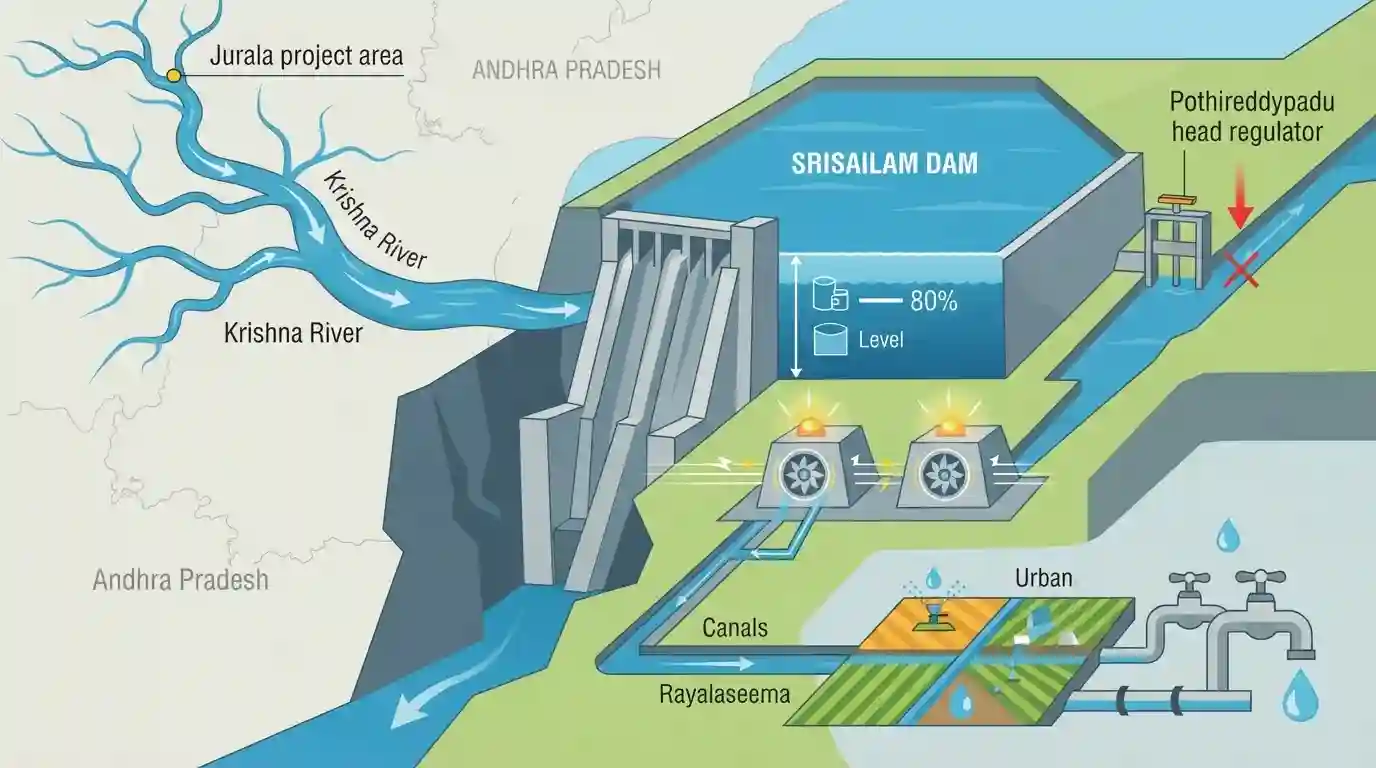
The Srisailam reservoir, a vital multi-purpose dam on the Krishna River, is experiencing a revival in water storage due to continuous flood inflows from the upstream Jurala project. The reservoir's water level has risen to 838.20 feet, and its storage capacity currently holds 59.16 TMC of water. These inflows are crucial for meeting the irrigation and drinking water demands of the Rayalaseema region, primarily facilitated through the Pothireddypadu head regulator, which requires a minimum water level of 854 feet to operate efficiently. Furthermore, the increased water availability is boosting hydroelectric power generation at the associated power stations.
Key Points
- The Srisailam reservoir on the Krishna River is receiving steady flood inflows from the Jurala project, significantly boosting its water storage.
- The current water level stands at 838.20 feet against the Full Reservoir Level (FRL) of 885 feet, with storage at 59.16 TMC against a total capacity of 215.80 TMC.
- The increased inflows bring relief to the drought-prone Rayalaseema region, as water can be drawn via the Pothireddypadu head regulator once the level reaches 854 feet.
- The rising water levels also support power generation at the Srisailam Right and Left Bank hydroelectric power stations.
Prelims Trap
Srisailam Dam and its reservoir are located entirely within the state of Andhra Pradesh.
Srisailam is an inter-state project spanning a deep gorge on the Krishna River, acting as the physical boundary between Andhra Pradesh and Telangana.
Static Concepts Connected
What are the major tributaries of the Krishna River?
- Right Bank: Tungabhadra (largest tributary by volume), Ghataprabha, Malaprabha, and Venna.
- Left Bank: Bhima (longest tributary), Musi, Munneru, and Dindi.
- Basin Origin: It is the second-largest east-flowing peninsular river, originating near Mahabaleshwar in the Western Ghats (Maharashtra).
What are the key geographical features of the Nagarjunasagar-Srisailam Tiger Reserve (NSTR)?
- Largest Area: It is India's largest tiger reserve by area, spreading across five districts in Andhra Pradesh and Telangana.
- Hill Ranges: Situated entirely within the Nallamala Hills, which are a continuous offshoot of the Eastern Ghats.
- River Gorge: The Krishna River cuts through the reserve, forming a deep gorge that hosts both the Srisailam and Nagarjunasagar dams.
Cross-Topic Patterns
Inter-State Water Dispute Tribunals
Water drawing thresholds for the Pothireddypadu regulator frequently trigger Krishna Water Disputes Tribunal (KWDT) conflicts between Andhra Pradesh and Telangana over shared basin allocations.
Dams overlapping Protected Areas
Srisailam's location within India's largest tiger reserve (NSTR) mirrors the UPSC's focus on infrastructure-ecology overlaps, similar to Ken-Betwa in Panna or Mullaperiyar in Periyar.

Expect a sequential mapping question ordering Krishna basin dams (Jurala, Srisailam, Nagarjunasagar) and their overlap with the NSTR.
Linked PYQs · 3
Linked PYQs · 3
- 2024APPSC_PRELIMSGS1
Within India, Ganga river basin has the largest catchment area. After that, following is the correct sequence in the decreasing order:
- 2019APPSC_PRELIMSGS1
Which one of the following pairs is not correctly matched ? Dam/Lake / River
- 2023APPSC_PRELIMSGS1
Match the following Irrigation Projects and their States (location): | Irrigation Projects | States | |---|---| | a. Parwan Multipurpose Project | I. Madhya Pradesh | | b. Renukaji Dam Project | II. Uttarakhand | | c. Lakhwar | III. Himachal Pradesh | | d. Ken-Betwa Link Project | IV. Rajasthan | Choose the correct answer using the codes given below: Code: a b c d
