Darjeeling hit by fatal landslides and transboundary river floods
Source:The Hindu ↗
Why It Matters
Himalayan landslides and river-induced flooding are critical components of UPSC Geography (GS1) and Disaster Management (GS3) syllabi. The incident highlights the vulnerability of the region to extreme weather, the complexities of transboundary water dynamics (involving Bhutan and India), and the importance of cross-border hydro-meteorological alerts.
Summary
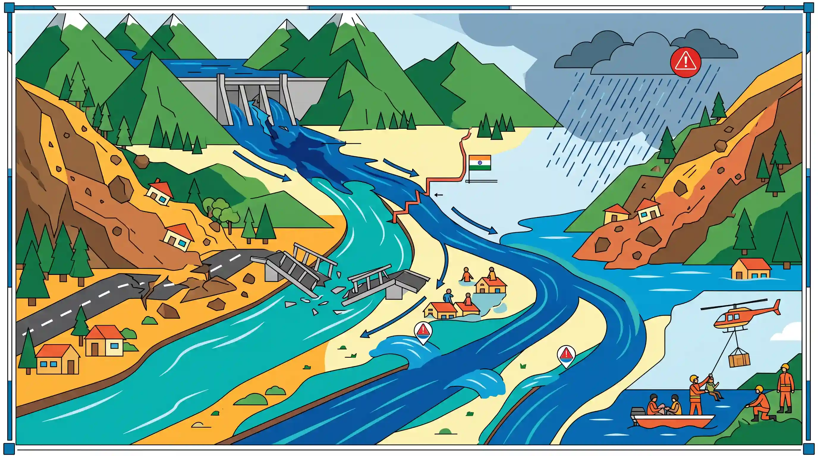
At least 23 people lost their lives following massive landslides triggered by torrential rains in the Darjeeling and Mirik sub-divisions of northern West Bengal. The heavy rainfall cut off major road networks, submerged national parks, and caused the collapse of a bridge over the Balasan river. Rivers such as the Teesta, Torsa, and Jaldhaka swelled above danger marks. Adding to the disaster, Bhutan's Tala Hydropower Dam on the Wangchu river overflowed due to a gate failure, releasing excess water downstream into Indian territory. NDRF teams have been deployed to assist in rescue operations as the IMD issued a red alert for the sub-Himalayan region.
Key Points
- Torrential rain in northern West Bengal caused severe landslides in Darjeeling and Mirik, resulting in at least 23 deaths.
- Road connectivity to major tourist areas was severed, and the Dudiya iron bridge over the Balasan river collapsed.
- Several North Bengal rivers (Teesta, Torsa, Jaldhaka, Balasan) flowed above the danger mark, inundating parts of the Dooars and national parks.
- Bhutan issued an alert as the gates of the Tala Hydropower Dam on the Wangchu river failed to open, causing water to overflow and threatening downstream regions.
- NDRF teams were deployed, and authorities (including the IMD) issued a red alert warning of further landslides and saturated soil conditions.
Important Terms
National Disaster Response Force (NDRF)

A specialized statutory force established under the Disaster Management Act, 2005, tasked with providing a swift and professional response to natural and man-made disasters across India.
UPSC context
GS Paper III (Disaster Management). Tests knowledge of India's institutional framework for emergency response and specialized rescue operations.
Gorkhaland Territorial Administration (GTA)
An autonomous district council created in 2012 to administer the Darjeeling and Kalimpong hills, possessing administrative, executive, and financial powers over various subjects to ensure regional development.
UPSC context
GS Paper II (Polity/Governance). Relevant for questions on federalism, local self-governance, and the management of regional ethnic aspirations.
India Meteorological Department (IMD)
India’s principal agency under the Ministry of Earth Sciences responsible for meteorological observations, weather forecasting, and issuing early warnings for hazardous weather events like heavy rainfall.
UPSC context
GS Paper I (Geography) & GS Paper III (Disaster Management). Tests understanding of weather monitoring systems and early warning protocols.
Druk Green Power Corporation (DGPC)
Bhutan's state-owned utility that manages hydropower resources, including the Tala project, and collaborates with Indian authorities on transboundary water management and disaster communication.
UPSC context
GS Paper II (International Relations). Key for India-Bhutan energy ties and transboundary disaster risk reduction under the neighborhood first policy.
Red Alert (IMD)
The highest level of weather warning issued when rainfall exceeds 204.5 mm in 24 hours, signaling a high risk to life and disruption of essential services.
UPSC context
GS Paper III (Disaster Management). Tests technical knowledge of disaster triggers and the standard operating procedures for public safety.
National Centre for Hydrology and Meteorology (Bhutan)
Bhutan’s national agency responsible for providing hydrological and meteorological services, including flood monitoring and sharing real-time water level data with India for downstream safety.
UPSC context
GS Paper II (International Relations). Important for cross-border cooperation in water management and early warning systems for floods.
Prelims Trap
"The Tala Dam is situated on the Teesta, and Bhutanese rivers join the Ganga system."
Bhutan-originating rivers like the Wangchu (Raidak) and Sankosh flow into the Brahmaputra system, not the Ganga. Additionally, Tala Dam is on the Wangchu.
Static Concepts Connected
Which major rivers flow from Bhutan into India's Brahmaputra basin?
- Wangchu (Raidak): Originates in Bhutan, flows as the Raidak River through West Bengal, and ultimately joins the Brahmaputra system in Bangladesh.
- Sankosh: Originates in northern Bhutan, forms the natural border between West Bengal and Assam, and joins the Brahmaputra.
- Manas: A major transboundary river flowing from Bhutan into Assam, heavily impacting the ecology of Manas National Park before meeting the Brahmaputra.
Why are the Himalayas more prone to landslides than the Western Ghats?
- Tectonic instability: The Himalayas are young, active fold mountains highly susceptible to seismic activity, unlike the relatively stable, ancient peninsular block of the Western Ghats.
- Geological composition: Himalayan slopes consist largely of fragile, unconsolidated sedimentary formations, whereas the Western Ghats are built of resilient, hard basalts.
- Steeper gradients: The steep, jagged slopes of the Himalayas increase shear stress, making mass wasting highly probable during intense monsoon rains.
Cross-Topic Patterns
Transboundary Hydro-projects and Disaster Risk
Bhutan's Tala Dam overflow illustrates how upstream infrastructure management directly dictates downstream flood risks in India, linking neighborhood diplomacy with internal disaster preparedness.
Dooars Floodplains and Wildlife Conservation
Swelling of the Teesta and Torsa repeatedly inundates critical Dooars habitats like Jaldapara and Gorumara National Parks, testing the resilience of flood-prone wildlife sanctuaries.

Geography Qs in 2026 will likely map Bhutan-originating rivers (Wangchu/Raidak, Sankosh) to their adjacent Indian national parks.
Linked PYQs · 5
Linked PYQs · 5
- 2021MainsGS3
Describe the various causes and the effects of landslides. Mention the important components of the National Landslide Risk Management Strategy.
- 2019MainsGS3
Disaster preparedness is the first step in any disaster management process. Explain how hazard zonation mapping will help disaster mitigation in the case of landslides.
- 2021MainsGS1
Differentiate the causes of landslides in the Himalayan region and Western Ghats.
- 2016MainsGS1
The Himalayas are highly prone to landslides. Discuss the causes and suggest suitable measures of mitigation.
- 2013MainsGS1
Bring out the causes for more frequent occurrence of landslides in the Himalayas than in the Western Ghats.
