Samruddhi Mahamarg: Traffic Restrictions Announced for ITMS Work
Source:pune-pulse ↗
Why It Matters
For MPSC Combined Prelims, major state-specific infrastructure projects like the Samruddhi Mahamarg, their transit routes (districts like Nashik, interchanges like Sinnar/Igatpuri), and the incorporation of safety technologies like ITMS are frequent areas of questioning under Maharashtra geography and infrastructure development.
Summary
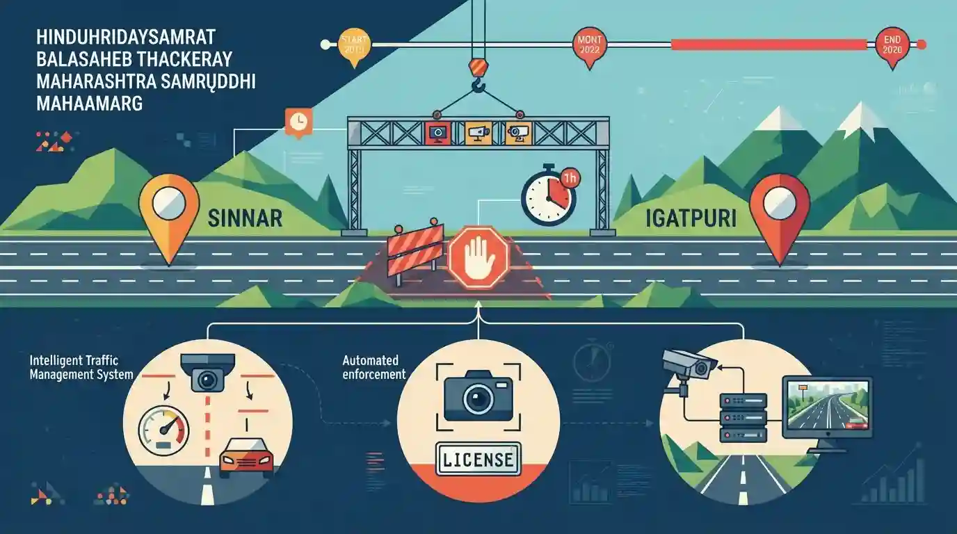
Temporary traffic restrictions will be imposed on the Hinduhridaysamrat Balasaheb Thackeray Maharashtra Samruddhi Mahamarg between Sinnar and Igatpuri interchanges from August 31 to September 7, 2026. The blocks are scheduled during specific one-hour windows to install overhead CCTV gantries as part of the expressway's Intelligent Traffic Management System (ITMS). Designed to bolster road safety, the system will feature automated enforcement, speed detection, and real-time surveillance.
Key Points
- Planned traffic restrictions will take place on the Hinduhridaysamrat Balasaheb Thackeray Maharashtra Samruddhi Mahamarg between August 31 and September 7, 2026.
- The restrictions are designed to facilitate the installation of overhead CCTV gantries for the Intelligent Traffic Management System (ITMS).
- The work will be executed in two distinct phases: Phase 1 (Sinnar to Bharvir from August 31 to September 2) and Phase 2 (Bharvir to Igatpuri from September 4 to September 7, excluding September 6).
- Daily closures will restrict Mumbai-bound traffic from 12 noon to 1:00 PM and Nagpur-bound traffic from 3:00 PM to 4:00 PM.
- The ITMS aims to integrate technology-enabled speed monitoring, CCTV surveillance, and automated traffic law enforcement to improve overall road safety.
Important Terms
Hinduhridaysamrat Balasaheb Thackeray Maharashtra Samruddhi Mahamarg

A 701-km-long, six-lane, access-controlled expressway connecting Mumbai and Nagpur. Developed by MSRDC, it spans 10 districts of Maharashtra to boost regional connectivity and economic growth.
UPSC context
GS Paper I (Maharashtra Geography) & GS IV (Economy). Tests state connectivity and infrastructure megaprojects.
Intelligent Traffic Management System
An integrated technology system using AI, smart sensors, and high-resolution cameras to monitor real-time traffic, detect speed or lane violations, and automatically enforce traffic laws to enhance road safety.
UPSC context
GS Paper IV (Science and Tech). Tests application of IT and AI in daily governance and public safety.
Maharashtra State Road Development Corporation
A public sector enterprise established by the Government of Maharashtra in 1996, tasked with planning, designing, constructing, and managing major road networks, bridges, and expressways across the state.
UPSC context
GS Paper IV (Economy and Planning). Tests the role of state-owned enterprises in regional infrastructure development.
Highway Safety Patrol
A specialized wing of the Maharashtra Police established to regulate vehicular traffic, check violations, prevent highway crimes, and provide emergency aid across the state's highways.
UPSC context
GS Paper II (State Administration). Tests public safety, traffic policing, and executive state machinery.
Prelims Trap
The Samruddhi Mahamarg directly enters Mumbai City district to connect it with Nagpur.
The expressway starts at Nagpur and ends at Amane in Thane district (providing connectivity to JNPT), rather than entering Mumbai city district directly. MPSC often tests precise start/end terminals.
Static Concepts Connected
What are the key geographical and administrative features of the Samruddhi Mahamarg?
- Length and Lanes: 701 km long, 6-lane wide access-controlled expressway designated as Maharashtra Expressway-2 (ME-2).
- District Coverage: Directly traverses 10 districts: Nagpur, Wardha, Amravati, Washim, Buldhana, Jalna, Chhatrapati Sambhajinagar, Ahmednagar, Nashik, and Thane.
- Terminal Points: Connects MIHAN (Nagpur) in the east to Amane near Bhiwandi (Thane district) near JNPT in the west.
- Nodal Agency: Maharashtra State Road Development Corporation (MSRDC) is the nodal implementing agency.
What are Krushi Samruddhi Kendras and MSRDC's role as NTDA?
- Definition: Planned integrated smart townships focusing on agro-industries, cold chains, and commercial hubs to boost local rural employment along the corridor.
- Planning Power: MSRDC has been declared as the New Town Development Authority (NTDA) under the MRTP Act, 1966, to develop these nodes.
Cross-Topic Patterns
ITMS & Digital Road Safety Governance
Integrating AI-based ITMS on state highways aligns with the Motor Vehicles Amendment Act, utilizing automated e-challans to institutionalize digital governance and safety.
Logistics Corridors: Port to Inland Hubs
Connecting JNPT (Thane/Mumbai) to MIHAN (Nagpur) establishes an economic corridor that strengthens Maharashtra's logistics backbone, aligning with PM GatiShakti.

Multi-statement questions on Samruddhi Mahamarg's district routing, terminal points, and MSRDC's township authority are highly probable.
Linked PYQs · 2
Linked PYQs · 2
- 2009MPSC_PRELIMSGS1
________ National Highway has the maximum length in Maharashtra.
- 2025MPSC_PRELIMSGS1
Kalsubai is the highest mountain peak in Maharashtra located in which of the following mountain ranges ?
