Satopanth Glacier Rockfalls and Himalayan Climate Hazards
Source:the-times-of-india ↗
Why It Matters
The article highlights the direct environmental and geomorphological consequences of climate change in Uttarakhand. For UKPSC aspirants, understanding the geographical linkage between glaciers (like Satopanth) and major river systems (Alaknanda), alongside the disaster management implications of thawing permafrost and rockfalls, is highly relevant for both the Prelims geography and environment sections.
Summary
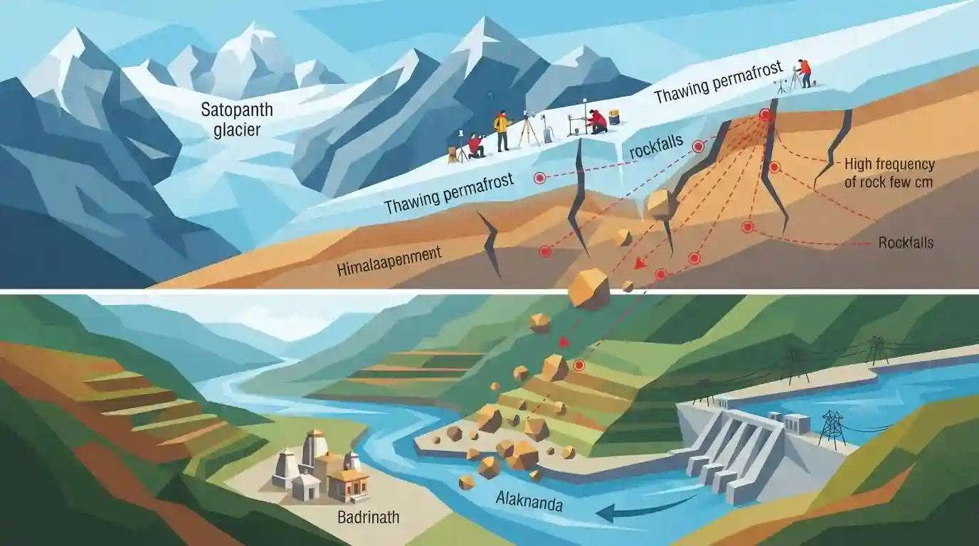
A scientific expedition to the Satopanth glacier in Uttarakhand has identified an alarming frequency of rockfalls—occurring every 30 seconds—as a new and underappreciated climate hazard in the Himalayas. Driven by glacial retreat and thawing permafrost, this slope instability threatens high-altitude regions and downstream infrastructure, including pilgrimage sites like Badrinath and hydropower projects along the Alaknanda river. The phenomenon, which mirrors risks seen in the European Alps, highlights the urgent need to address localized impacts of climate change in fragile mountain ecosystems.
Key Points
- A recent scientific expedition to Uttarakhand's Satopanth Glacier documented severe slope instability, observing rockfalls as frequently as every 30 seconds.
- The rockfalls are primarily driven by climate change, specifically retreating glaciers and thawing permafrost, which compromise the ice binding fractured rocks together.
- This emerging mountain hazard parallels conditions in the European Alps and poses severe risks to downstream areas, including Badrinath and hydropower projects on the Alaknanda River.
- Researchers also noted rapid, uneven glacial thinning, expansive debris cover on the glacier, and troubling accumulations of plastic waste near high-altitude lakes.
Prelims Trap
Satopanth glacier is the primary source of the Bhagirathi river.
Satopanth is the source of the Alaknanda river. UPSC frequently swaps Himalayan glacier-river pairs to trick candidates (e.g., 2019 Prelims).
Static Concepts Connected
What are the key Panch Prayag confluences along the Alaknanda river?
- Vishnuprayag: The first major confluence where the Alaknanda River meets the Dhauliganga River.
- Rudraprayag: The confluence where the Alaknanda River is joined by the Mandakini River.
- Devprayag: The final confluence where the Alaknanda meets the Bhagirathi River, officially forming the Ganga.
What mechanisms link permafrost thawing to paraglacial rockfalls?
- Cryogenic glue loss: Ice within rock fractures acts as a binding agent; its thawing directly removes critical structural support from steep mountain slopes.
- Glacial debuttressing: As glaciers retreat and thin, they remove the lateral physical support previously provided to adjacent steep valley walls.
- Hydrostatic pressure: Increased liquid meltwater penetrates deep into rock faults, lubricating slip planes and triggering frequent structural failures.
Cross-Topic Patterns
Cryosphere hazards + Hydropower viability
Escalating rockfalls and debris flows directly threaten the economic viability and safety of Run-of-River (RoR) hydroelectric projects situated in the geologically fragile Alaknanda basin.
Debris cover + Albedo modification
Accumulating plastic waste and expansive rock debris lower surface albedo, fundamentally altering glacial thermodynamics and driving the rapid, uneven thinning of Himalayan glaciers.

Glacier-river pairings (Satopanth-Alaknanda) combined with permafrost degradation mechanisms will likely form a 2026 Geography MCQ.
Linked PYQs · 2
Linked PYQs · 2
- 2025UKPSC_PRELIMSGS1
Which of the following is the correct order of rivers from west to east in Uttarakhand?
- 2024UKPSC_PRELIMSGS1
'Untadhura Pass' is situated near which one of the following glaciers of Uttarakhand ?
