Uttarakhand heavy rains push rivers above danger mark
Source:garhwal-post ↗
Why It Matters
This event provides practical context for questions regarding Uttarakhand's drainage systems (rivers like Alaknanda, Mandakini, and Bhagirathi and confluences like Rudraprayag and Devprayag) and the state's severe vulnerability to hydro-meteorological disasters such as landslides and flash floods. These topics are frequently tested in UKPSC Prelims Geography.
Summary
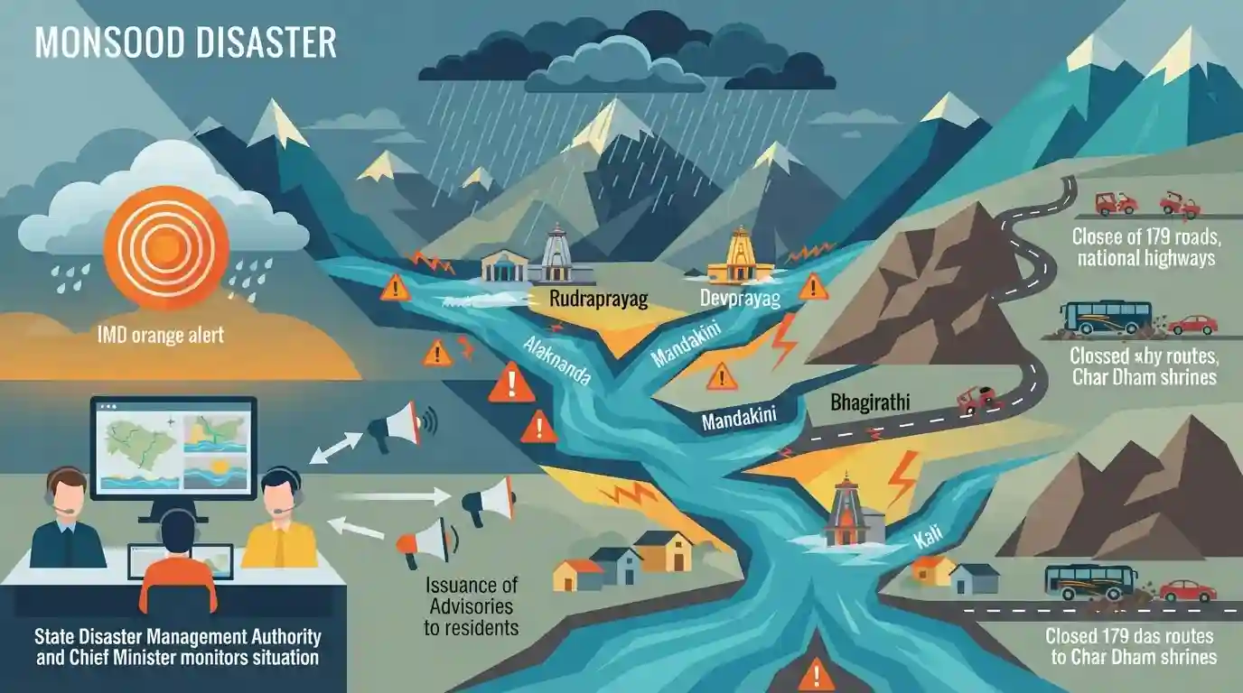
Relentless monsoon rains in Uttarakhand have triggered severe landslides and flash floods, leading to the closure of 179 roads, including major national highways connecting the Char Dham shrines. Critical Himalayan rivers and their tributaries—such as the Alaknanda, Mandakini, Bhagirathi, and Kali—have breached or approached danger and warning levels at key locations like Rudraprayag and Devprayag. The IMD has issued an orange alert for specific districts, and state disaster management authorities, led by the Chief Minister, are continuously monitoring the situation and issuing advisories for residents in low-lying riverbank areas.
Key Points
- Heavy rains in Uttarakhand triggered widespread landslides and flash floods, forcing the closure of 179 roads across the state.
- Major rivers crossed or touched danger marks, including Alaknanda at Rudraprayag and the Mandakini river.
- The Bhagirathi river at Devprayag and the Kali river at Dharchula crossed their respective warning levels.
- Key Char Dham routes and national highways, such as Rishikesh-Badrinath (NH-7) and Rishikesh-Gangotri (NH-34), were heavily affected by falling debris.
- The India Meteorological Department (IMD) issued an orange alert for Dehradun, Chamoli, and Bageshwar districts.
Important Terms
India Meteorological Department (IMD)

The principal government agency under the Ministry of Earth Sciences responsible for meteorological observations, weather forecasting, seismology, and issuing early warnings for weather-related hazards.
UPSC context
GS 1 (Geography) & GS 3 (Disaster Management). Crucial for topics on monsoons, cyclones, and early warning systems.
Border Roads Organisation (BRO)
A statutory body under the Ministry of Defence that develops and maintains road networks in India's border regions. It is vital for armed forces mobility and strategic infrastructure in challenging terrains.
UPSC context
GS 3 (Internal Security & Infrastructure). Relevant for questions on border management, strategic connectivity, and defense logistics.
Alaknanda River
A major Himalayan river and one of the Ganga's two main headstreams. Originating near the Satopanth Glacier in Uttarakhand, it forms critical confluences (Panch Prayag) before meeting the Bhagirathi.
UPSC context
GS 1 (Indian Geography). Frequently tested in Prelims regarding Himalayan river drainage, origins, and major tributaries.
Bhagirathi River
A crucial Himalayan headstream of the Ganga that originates from the Gangotri Glacier at Gaumukh. It flows through Uttarakhand and merges with the Alaknanda at Devprayag to form the Ganga.
UPSC context
GS 1 (Indian Geography). Often appears in Prelims mapping questions regarding river origins, glaciers, and the Ganga basin.
Devprayag
A town in Uttarakhand that marks the final of the Panch Prayag. It is the geographic confluence where the Alaknanda and Bhagirathi rivers merge to officially form the Ganga River.
UPSC context
GS 1 (Geography). Highly relevant for Prelims map-based questions on the Ganga river system and sacred confluences.
Prelims Trap
The river Ganga originates from the Gangotri glacier and is joined by the Mandakini at Devprayag.
The river originating from Gangotri is the Bhagirathi. It becomes the Ganga only after meeting the Alaknanda at Devprayag. Mandakini meets Alaknanda upstream at Rudraprayag.
Static Concepts Connected
What are the Panch Prayags (five confluences) of the Alaknanda river system?
- Vishnuprayag & Nandaprayag: Alaknanda meets the Dhauliganga at Vishnuprayag, and meets the Nandakini at Nandaprayag.
- Karnaprayag: The confluence of the Alaknanda and the Pindar river.
- Rudraprayag: The confluence of the Alaknanda and the Mandakini river.
- Devprayag: Alaknanda meets the Bhagirathi river, after which the combined stream is officially known as the Ganga.
What factors make the Himalayas highly vulnerable to landslides and flash floods?
- Tectonic Activity: The Himalayas are young fold mountains with active tectonic faults, making the terrain highly unstable and prone to frequent seismic activity.
- Steep Gradients: High relief and steep mountain slopes increase the velocity of surface water flow, accelerating mass wasting and severe soil erosion.
- Anthropogenic Pressures: Unplanned infrastructure, deforestation, hydroelectric projects, and extensive road-cutting (like highway widening) severely destabilize the region's fragile slopes.
Cross-Topic Patterns
Char Dham project vs Himalayan ecology
The frequent closure of NH-7 and NH-34 due to landslides brings the debate over carrying capacity and environmental clearances for the Char Dham Pariyojana into sharp focus.
IMD alerts & disaster preparedness
IMD's color-coded alerts (like Orange for Uttarakhand) link hydrometeorological forecasting directly to state-level disaster response protocols under the NDMA framework.

Map-based Prelims questions sequencing the Panch Prayags (North to South) or pairing rivers like Kali with border definitions are highly likely.
Linked PYQs · 5
Linked PYQs · 5
- 2007UKPSC_PRELIMSGS1
Mandakini river is associated with which drainage system or Main River?
- 2012UKPSC_PRELIMSGS1
In which of the following rivers' confluence is Gobindghat located?
- 2024UKPSC_PRELIMSGS1
Which of the following is a point of confluence of river Jadganga and Bhagirathi ?
- 2025UKPSC_PRELIMSGS1
Which of the following is the correct order of rivers from west to east in Uttarakhand?
- 2007UKPSC_PRELIMSGS1
Which of the following Natural Calamity has the most devastating impact in Uttarakhand State?
