Sikar hit by severe urban waterlogging following heavy downpour
Source:sangritoday ↗
Why It Matters
Understanding localized extreme rainfall events, spatial rainfall distribution gradients, and regional physiography (such as the Shekhawati internal drainage basin) is essential for RPSC RAS Geography and Disaster Management topics.
Summary
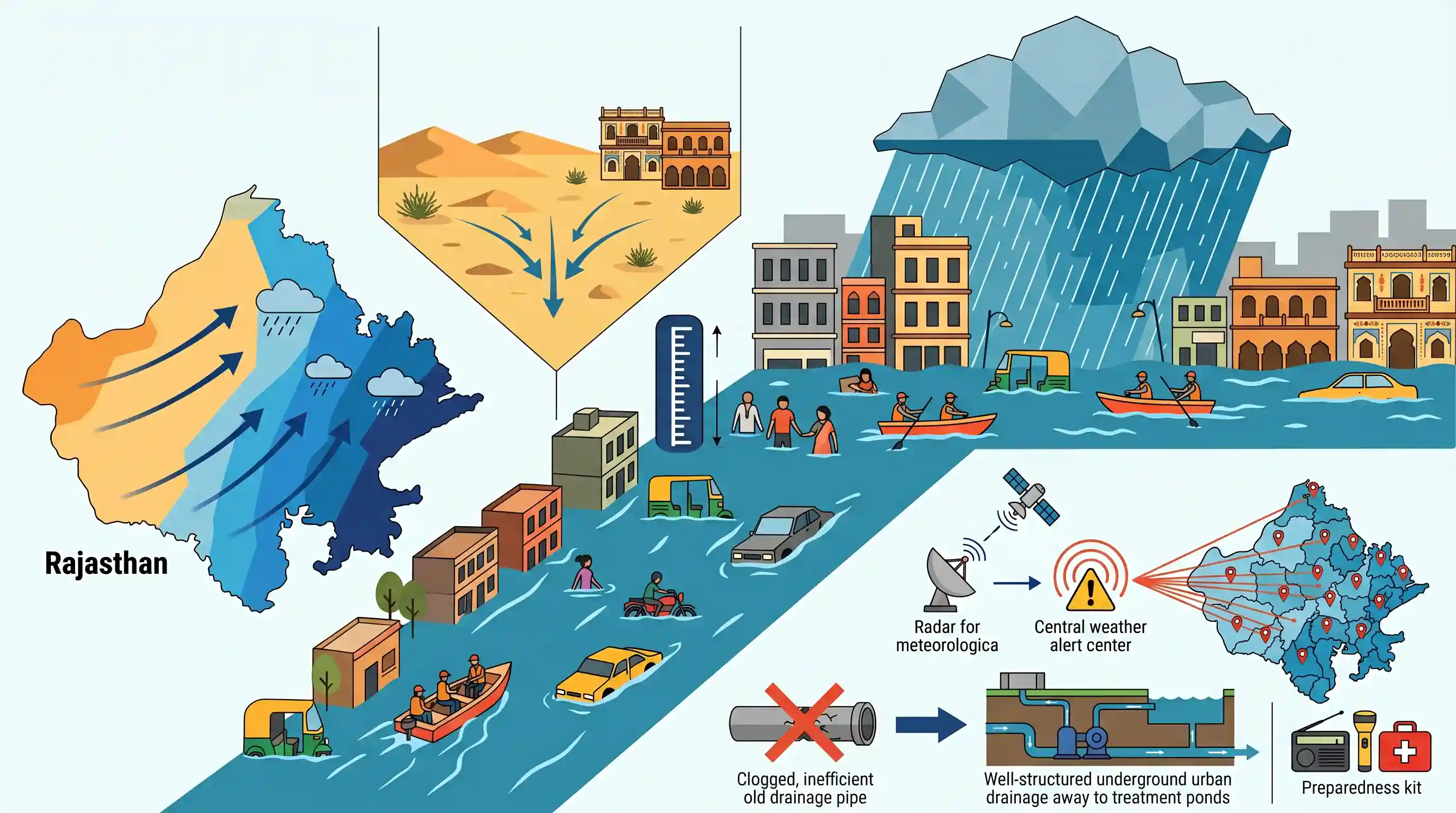
On June 13, intense rainfall led to severe flooding and 8-foot-deep waterlogging in Sikar, Rajasthan. Consequently, the Meteorological Department (IMD) issued heavy rain alerts for 23 districts in the state. This extreme weather event underscores the vulnerability of the semi-arid Shekhawati region to flash flooding and highlights the critical need for robust urban drainage systems and meteorological preparedness in Rajasthan.
Key Points
- Extreme Weather in Sikar: Mid-June downpours triggered severe waterlogging of up to 8 feet, causing flash flood-like conditions in Sikar and demonstrating the vulnerability of semi-arid urban centers to short-duration high-intensity rainfall.
- Statewide Weather Warning: The Meteorological Department issued heavy rainfall alerts for 23 districts across Rajasthan, urging administrative vigilance to manage potential urban flooding.
- Geographical & Climatic Context: Sikar belongs to the Shekhawati region, an internal-drainage sub-region of the Rajasthan Semi-Arid Plain (Bhangar), which is structurally distinct from the hyper-arid western plains and the humid southeastern plains.
- Monsoon & Rainfall Gradient: Rainfall in Rajasthan typically follows an ascending gradient from the west (e.g., Jalore) towards the east (e.g., Jaipur) and southeast (e.g., Kota). Early high-intensity rainfall in semi-arid zones like Sikar represents a significant localized climatic deviation.
Important Terms
India Meteorological Department (IMD)

Established in 1875 under the Ministry of Earth Sciences, it is India’s principal agency for meteorological observations, weather forecasting, seismology, and early warnings for weather-related hazards.
UPSC context
GS Paper 1 (Geography) and GS Paper 3 (Disaster Management); tests knowledge of institutional frameworks for weather monitoring and disaster preparedness.
Jaipur Meteorological Centre
Established in 1972, this regional center of the India Meteorological Department (IMD) provides localized weather forecasting, heavy rain warnings, agricultural advisories, and hydrological information for the state of Rajasthan.
UPSC context
GS Paper 1 (Geography of Rajasthan) and state PCS exams; tests understanding of regional weather warning systems and climate monitoring.
State Disaster Response Force (SDRF)
A state-level specialized rescue force, trained on the lines of the NDRF under the Disaster Management Act, 2005, serving as the first responder for localized natural and man-made disasters.
UPSC context
GS Paper 3 (Disaster Management); tests understanding of decentralized disaster response mechanisms and state-level governance structures.
Urban Flooding
The inundation of built-up urban areas caused by heavy rainfall that overwhelms drainage systems. It is characterized by rapid run-off, worsened by concretization, encroachment of water bodies, and unplanned urbanization.
UPSC context
GS Paper 3 (Disaster Management); tests knowledge of climate change adaptation, municipal infrastructure issues, and NDMA guidelines.
Prelims Trap
The seasonal Kantli River of Shekhawati drains into the Yamuna basin, preventing localized urban flooding in Sikar during intense monsoon spells.
The Kantli River is entirely endorheic (inland drainage) and terminates in desert depressions. It does not connect to the Yamuna, making the region prone to flash floods.
Static Concepts Connected
What are the four physiographic sub-regions of the Rajasthan Semi-Arid Plain (Bhangar)?
- Luni Basin: Also known as Godwar, this southwestern tract is drained by the seasonal Luni River into the Rann of Kutch.
- Shekhawati Plain: An inland drainage region lacking perennial surface rivers, characterized by active sand dunes and the seasonal Kantli River.
- Nagauri Uplands: A saline, elevated tract characterized by salt lakes like Didwana and Sambhar, and high groundwater fluoride.
- Ghaggar Plain: The northernmost alluvial tract formed by the seasonal Ghaggar River, highly modified by canal irrigation.
What factors dictate the Southwest Monsoon rainfall gradient in Rajasthan?
- Ascending Gradient: Rainfall progressively increases from the arid west (e.g., Jalore) to the semi-arid centre (Jaipur) and humid southeast (Kota).
- Aravalli alignment: The Aravallis run parallel to the Arabian Sea monsoon branch, preventing orographic precipitation in the western desert.
Cross-Topic Patterns
Inland drainage vs. Urban runoff
Endorheic basins like Shekhawati lack natural outlets to oceans. Rapid, unplanned concretization in these zones blocks localized seasonal sinks, compounding flash flood vulnerabilities.
Dryland wetlands as flood buffers
Notified dryland wetlands, like Sikar's Rewasa, serve as critical hydrological sponges. Neglecting their ecological boundaries directly converts extreme weather into urban disasters.

Shekhawati's inland drainage limits and Rajasthan's regional monsoon rainfall gradients (Jalore-Jaipur-Kota) are highly testable physical geography themes.
Linked PYQs · 3
Linked PYQs · 3
- 2025RPSC_PRELIMSGS1
What is the correct ascending order of the following group of districts of Rajasthan based on average rainfall in the southwest monsoon?
- 2023RPSC_PRELIMSGS1
Which of the following groups of districts is correctly arranged in descending order according to the amount of received monsoon rainfall?
- 2025RPSC_PRELIMSGS1
Consider the following statements: A. Luni Basin and Shekhawati region are sub-regions of Bhangar in Rajasthan. B. The Ghaggar plain is mostly spread in Hanumangarh and Ganganagar districts. C. Nagaur Uplands have saline lakes and internal drainage. D. The Aravalli ranges are rich in all types of minerals. Select the correct answer from the code given below: Code:
