Kota Gwalior Etawah Expressway Renamed Atal Expressway
Source:uniindia ↗
Why It Matters
The article is highly relevant for RPSC RAS aspirants as it covers major infrastructure developments in southeastern Rajasthan (Hadoti region), including key national highway linkages, environmental mitigation steps (bypassing Mukundra Wildlife Sanctuary), and mega-projects like the Delhi-Mumbai Expressway and the Atal Expressway.
Summary
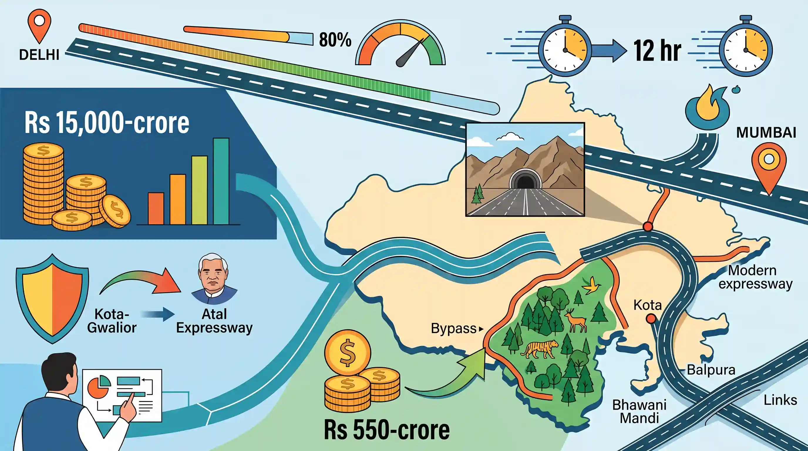
Union Minister Nitin Gadkari announced that the proposed Rs 15,000-crore Kota-Gwalior-Etawah Expressway will be renamed 'Atal Expressway' in honor of former PM Atal Bihari Vajpayee [1.1]. During his inspection of the country's first 8-lane tunnel on the Delhi-Mumbai Expressway in Rajasthan, he announced several key regional connectivity links, including a Rs 550-crore road bypassing the Mukundra Wildlife Sanctuary, a 21-km greenfield road connecting Kota via Balpura, and a proposed link to Bhawani Mandi [1.1]. The 1,386-km Delhi-Mumbai Expressway is 75-80% complete and will eventually reduce travel time between Delhi and Mumbai to 12 hours [1.1].
Key Points
- The proposed Rs 15,000-crore Kota-Gwalior-Etawah Expressway, running alongside the Chambal River, will be renamed 'Atal Expressway' after former PM Atal Bihari Vajpayee [1.1].
- A Rs 550-crore link road will connect NH-52 to the Delhi-Mumbai Expressway, bypassing the ecologically sensitive Mukundra Wildlife Sanctuary to protect local wildlife [1.1].
- Kota's regional connectivity will be enhanced with a 21-km, 4-lane greenfield link road to the Delhi-Mumbai Expressway via Balpura [1.1].
- A Detailed Project Report (DPR) is underway to link Bhawani Mandi to the Delhi-Mumbai Expressway [1.1].
- The 1,386-km-long 8-lane Delhi-Mumbai Expressway is 75-80% complete, constructed at a cost of Rs 1.10 lakh crore, and aims to reduce travel time between Delhi and Mumbai to 12 hours [1.1].
- The country's first 8-lane tunnel on the Delhi-Mumbai Expressway has been constructed through the Mukundra Hills area [1.1].
Important Terms
Delhi-Mumbai Expressway Project

An under-construction, 1,350 km-long, 8-lane greenfield expressway connecting New Delhi to Mumbai. It aims to reduce travel time between the two major cities to 12 hours while promoting industrial and regional economic growth.
UPSC context
GS Paper III (Infrastructure: Roads) — Tests knowledge of mega connectivity corridors, transit-oriented development, and regional economic integration.
Atal Expressway
An upcoming ~404-km-long greenfield expressway (formerly Chambal Expressway) running along the Chambal River. It connects Kota in Rajasthan, Gwalior in Madhya Pradesh, and Etawah in Uttar Pradesh to foster regional development.
UPSC context
GS Paper III (Infrastructure) — Tests knowledge of inter-state road networks, regional development in backward areas, and infrastructure planning.
Mukundra Hills Tiger Reserve
A protected wildlife corridor in southeastern Rajasthan, comprising Mukundra Hills National Park, Darrah, Jawahar Sagar, and Chambal sanctuaries. It sits along the Vindhyan range and is crossed by the Chambal river system.
UPSC context
GS Paper III (Environment) — Relates to national parks, tiger reserves, riverine ecosystems, and infrastructure impacts on wildlife conservation.
National Highways Authority of India (NHAI)
An autonomous statutory body under the Ministry of Road Transport and Highways, established in 1988, tasked with the development, maintenance, and management of India’s National Highways network.
UPSC context
GS Paper II (Statutory Bodies) — Evaluates institutional frameworks overseeing infrastructure development, project execution, and public-private partnerships.
Union Ministry of Road Transport and Highways
The apex central ministry in India responsible for formulating and administering laws, policies, and regulations concerning national highways, road safety, and overall road transport infrastructure.
UPSC context
GS Paper II (Government Policies) — Analyzes central government executive wings executing major connectivity, infrastructure, and transport development initiatives.
Prelims Trap
Mukundra Hills represent a geological extension of the Aravalli Range in southwestern Rajasthan.
Mukundra Hills are crescent-shaped geological extensions of the Vindhyan mountain ranges on the Hadoti Plateau, not the older Aravalli Range.
Static Concepts Connected
What are the key ecological and geographic features of the Mukundra Hills?
- Geological Origin: Classified as crescent-shaped geological extensions of the Vindhyan mountain ranges on the Hadoti Plateau in southeastern Rajasthan.
- River Boundaries: The reserve is naturally bounded by the Chambal River on the west and its tributary rivers like the Kali Sindh and Ahu.
- Conservation Status: It was notified as Rajasthan's 3rd Tiger Reserve in 2013, acting as a crucial dispersal corridor from Ranthambore.
Cross-Topic Patterns
Green Infrastructure & Eco-Sensitive Zones
The use of twin-tube subterranean tunnels under Mukundra Hills reflects India's evolving environmental jurisprudence on allowing linear infrastructure through protected habitats under strict mitigation.
Logistics Corridors & Riverine Ecology
The expressway's alignment along the Chambal basin links inland logistics to riverine ecological corridors hosting Schedule-I species like the Gharial and Gangetic Dolphin.

UPSC may test the Vindhyan-Hadoti geographical tracts and Rajasthan's tiger reserves in a multi-statement physical geography question.
Linked PYQs · 3
Linked PYQs · 3
- 2018RPSC_PRELIMSGS1
Which of the following hills are the extensions of the Vindhyan mountain ranges in Rajasthan?
- 2023RPSC_PRELIMSGS1
The National Tiger Conservation Authority has conferred the status of the fifth tiger sanctuary in Rajasthan, to which of the following sanctuaries?
- 2023RPSC_PRELIMSGS1
The Rajasthan State Highway Development Program-II project, which includes the upgrading of 11 highways with a length of 801 km, is financed by which agency?
