Uttarakhand Monsoon Casualties and Road Blockade Crisis
Source:etvbharat ↗
Why It Matters
The vulnerability of Uttarakhand to monsoon-induced disasters illustrates the direct impact of climate and geography on infrastructure and the local economy. It underscores the recurring challenges in disaster management, road connectivity, and safe execution of the Char Dham Yatra in fragile Himalayan ecosystems.
Summary
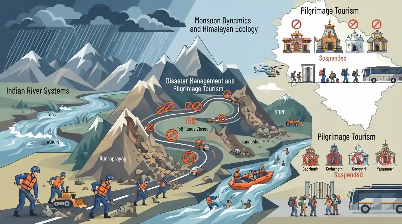
Heavy monsoon downpours in Uttarakhand have caused severe devastation, claiming 28 lives and triggering multiple landslides and flash floods. The adverse weather conditions forced the temporary suspension of the Char Dham Yatra and the closure of 158 roads. Rescue and relief operations, spearheaded by the SDRF and SEOC, are underway across severely impacted districts, including Dehradun, Rudraprayag, and Uttarkashi, with a focus on clearing blockages and rescuing stranded individuals along rivers like the Tons.
Key Points
- Torrential monsoon rains in Uttarakhand triggered widespread landslides and flooding, resulting in 28 fatalities across the state.
- The Garhwal administration temporarily suspended the Char Dham Yatra to ensure the safety of pilgrims amidst severe weather conditions.
- A total of 158 roads, including critical state highways and rural links, were blocked by landslide debris, according to the State Emergency Operations Centre (SEOC).
- The State Disaster Response Force (SDRF) conducted multiple rescue operations, saving individuals trapped by rising water levels in the Tons river and landslides in Rudraprayag.
Important Terms
Char Dham Yatra

A sacred Hindu pilgrimage circuit in Uttarakhand’s Garhwal Himalayas, encompassing four high-altitude shrines: Yamunotri, Gangotri, Kedarnath, and Badrinath, traditionally completed in a clockwise direction.
UPSC context
GS Paper I (Indian Geography & Culture); tests knowledge of Himalayan pilgrimage sites, associated river sources, and regional cultural geography.
State Disaster Response Force (SDRF)
A specialized state-level emergency response unit trained to provide rapid search, rescue, and relief operations during natural or man-made disasters, modeled after the National Disaster Response Force.
UPSC context
GS Paper III (Disaster Management); tests state-level institutional frameworks, tactical emergency response systems, and civil defense mechanisms.
State Emergency Operations Centre (SEOC)
A 24/7 centralized command and coordination facility at the state level that manages real-time communication, inter-agency mobilization, and resource allocation during critical disaster situations.
UPSC context
GS Paper III (Disaster Management); tests administrative preparedness, emergency communication infrastructure, and coordinated crisis management protocols.
Tons River
The largest and longest Himalayan tributary of the Yamuna River, originating from the Bandarpunch glacier and carrying more water than the main Yamuna at their confluence near Kalsi.
UPSC context
GS Paper I (Geography); tests drainage patterns, Himalayan river systems, and major tributaries of the Ganges-Yamuna basin.
State Disaster Response Fund (SDRF)
The primary statutory fund available to state governments under the Disaster Management Act, 2005, to finance immediate relief expenditures for officially notified calamities.
UPSC context
GS Paper III (Disaster Management / Fiscal Federalism); tests disaster financing mechanisms, center-state fund sharing, and statutory relief guidelines.
Prelims Trap
"The Tons River, which witnessed severe flash floods, is a major Himalayan tributary of the Ganga."
The Tons River is actually the largest tributary of the Yamuna, not the Ganga. It merges with the Yamuna near Kalsi in Dehradun.
Static Concepts Connected
What are the specific river associations for the Char Dham shrines?
- Gangotri: Located at the source of the Bhagirathi river, which becomes the Ganga after meeting the Alaknanda at Devprayag.
- Kedarnath: Situated on the banks of the Mandakini river, which later joins the Alaknanda at Rudraprayag.
- Badrinath: Positioned along the banks of the Alaknanda river, a primary headstream of the Ganges system.
Why are the Himalayas significantly more prone to landslides than the Western Ghats?
- Tectonic Instability: The Himalayas are young fold mountains situated on an active convergent plate boundary, making them seismically active and structurally unstable.
- Geological Makeup: They are heavily composed of friable sedimentary rocks and unconsolidated deposits, unlike the highly stable, hard igneous and metamorphic rocks of the Western Ghats.
- Anthropogenic Stress: Deforestation, road widening (cutting the toe of slopes), and massive hydel construction fundamentally alter natural drainage and destabilize steep gradients.
Cross-Topic Patterns
Pilgrimage Tourism vs. Carrying Capacity
The aggressive push for all-weather pilgrimage routes (Char Dham Pariyojana) directly conflicts with the fragile ecological carrying capacity of the Himalayas, exacerbating landslide frequency and disaster impacts.
Climate Change and Erratic Monsoons
Intense, localized monsoon bursts in the Himalayas are increasingly linked to climate change, altering regional hydrology and escalating the frequency of flash floods and multi-hazard cascading disasters.

Expect map-based pairs matching Char Dham shrines to their rivers/Prayags, or a GS3 Mains question on Himalayan carrying capacity.
Linked PYQs · 2
Linked PYQs · 2
- 2021UKPSC_PRELIMSGS1
'Govind National Park' includes :
- 2025UKPSC_PRELIMSGS1
As per Uttarakhand Budget 2025-26, the amount allocated for Char Dham Road network improvement is
