DILRMP 3.0 Guidelines and Digital Overhaul of Land Records
Source:PIB ↗
কেন এটি গুরুত্বপূর্ণ
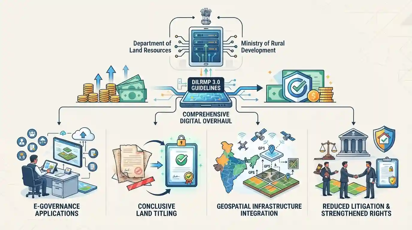
DILRMP 3.0 represents a major upgrade in India's land administration architecture, directly addressing judicial pendency due to property disputes, enabling transparent e-governance, and facilitating secure land markets essential for economic development and rural growth.
সারসংক্ষেপ
The Department of Land Resources (DoLR) under the Ministry of Rural Development is introducing operational guidelines for DILRMP 3.0, backed by a ₹565.50 crore financial outlay for the comprehensive digital overhaul of land records. This initiative aims to advance e-governance, establish conclusive land titling, integrate modern geospatial infrastructure, reduce land litigation, and strengthen property rights across India.
মূল বিষয়
- The Department of Land Resources (DoLR) is launching operational guidelines for DILRMP 3.0 along with a ₹565.50 crore digital overhaul package for land records.
- DILRMP 3.0 aims to modernize land administration, enhance transparency, reduce land-related disputes, and facilitate conclusive titling in India.
- The initiative integrates advanced geospatial technologies, unique land parcel identification numbers (ULPIN/Bhu-Aadhaar), and electronic registries to streamline citizen services and boost rural economic growth.
- The digital overhaul seeks to curb litigation, weed out fraudulent transactions, and secure property rights for citizens.
গুরুত্বপূর্ণ শব্দ
Digital India Land Records Modernization Programme (DILRMP) 3.0

The latest phase of India's flagship land records digitization scheme focusing on a GIS-enabled Land Stack, integrating ownership details, maps, registration, and court litigation into a unified ecosystem.
UPSC context
UPSC Prelims/Mains (GS Paper II/III): E-governance applications, digital infrastructure, and land reforms.
Digital India Land Records Modernization Programme (DILRMP)
A Central Sector Scheme aimed at modernizing land records, minimizing land disputes, and moving from presumptive titling to conclusive land titling through computerization and geospatial tech.
UPSC context
UPSC Prelims/Mains (GS Paper III): Economy, infrastructure, land reforms, and transparency in property rights.
Department of Land Resources
A department under the Ministry of Rural Development responsible for land reforms, administration, land acquisition, and managing programmes like DILRMP for modernized land governance.
UPSC context
UPSC Prelims: Government bodies, administrative ministries, and developmental schemes in rural sectors (GS Paper II/III).
Ministry of Rural Development
The Union ministry charged with rural development policies, poverty alleviation, infrastructure creation, and land governance initiatives in India.
UPSC context
UPSC Prelims: Central ministries executing welfare, agricultural, and land reform schemes (GS Paper II).
প্রিলিমস ফাঁদ
India has already fully implemented a nationwide conclusive land titling system under DILRMP.
India currently operates on a presumptive land titling system (where records show ownership history but the state does not guarantee title). DILRMP 3.0 aims to transition towards conclusive titling, but it is not yet fully universal across all states.
সংযুক্ত স্থির ধারণা
What is the difference between Presumptive and Conclusive Land Titling systems in India?
- Presumptive System: Ownership proof relies on a long chain of historical deeds and encumbrance documents rather than a state-guaranteed title certificate.
- Conclusive System: The state guarantees ownership, compensating the owner if errors occur, drastically reducing property litigation and court burdens.
- Indian Context: India currently follows the presumptive model; schemes like DILRMP aim to transition towards a conclusive titling framework.
What is ULPIN (Bhu-Aadhaar) and how does it function within land administration?
- Definition: A unique 14-digit alphanumeric code assigned to every land parcel based on its geospatial coordinates.
- Integration: Acts as a 'fingerprint' for land, integrating cadastral maps, textual property registry, and survey data seamlessly.
- Benefits: Eliminates boundary disputes, deters land grabbing, and enables transparent land transactions across state borders.
আন্তঃবিষয় প্যাটার্ন
Conclusive Titling + Constitutional Property Rights (Art 300A)
Conclusive land titling systems shift the state's liability in property matters, creating direct intersections with constitutional property rights (Article 300A) and administrative law reforms.
Geospatial Land Records + PM GatiShakti Master Plan
Integrating GIS and satellite mapping for ULPIN establishes foundational infrastructure for the PM GatiShakti National Master Plan and rural infrastructure asset tracking.

DILRMP 3.0's shift from presumptive to conclusive titling and ULPIN mechanics will likely feature in a multi-statement Prelims question.
সংযুক্ত PYQ · 3
সংযুক্ত PYQ · 3
- 2024MainsGS2
e-governance is not just about the routine application of digital technology in service delivery process. It is as much about multifarious interactions for ensuring transparency and accountability. In this context evaluate the role of the 'Interactive Service Model' of e-governance.
- 2023MainsGS3
State the objectives and measures of land reforms in India. Discuss how land ceiling policy on landholding can be considered as an effective reform under economic criteria.
- 2023MainsGS3
What is the status of digitalization in the Indian economy? Examine the problems faced in this regard and suggest improvements.
