India Land Governance Digital Public Infrastructure African Delegation
Source:PIB ↗
Why It Matters
This article is highly relevant for UPSC aspirants as it intersects several core syllabus areas: E-Governance (GS2), Land Reforms and Digitalization of the Economy (GS3), and International Relations (GS2). It provides concrete examples of India's DPI extending beyond financial tech (like UPI) into complex administrative sectors like land records (Bhu-Aadhaar/DILRMP). Furthermore, it illustrates India's proactive role in South-South Cooperation and tech diplomacy with Africa, a persistent theme in recent Mains examinations.
Summary
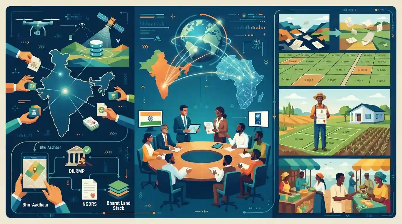
India's Department of Land Resources (DoLR) recently engaged with a high-level African delegation and the UNDP to showcase India's Digital Public Infrastructure (DPI) in Land Governance. The discussions focused on sharing the success of initiatives like Bhu-Aadhaar (ULPIN), DILRMP, NGDRS, and the overarching Bharat Land Stack. Aimed at fostering South-South Cooperation, the meeting explored how these models, which leverage technologies like drones and LiDAR for mapping and digitization, can be adapted by African nations to formalize property rights, reduce litigation, and stimulate economic growth. This engagement highlights India's expanding technology diplomacy and leadership in exporting robust, scalable DPI to the Global South.
Key Points
- A high-level African delegation (including representatives from the AU, Ethiopia, Malawi, Rwanda, Sierra Leone, and Zambia) and the UNDP engaged with India's Department of Land Resources to study India's Digital Public Infrastructure (DPI) in Land Governance.
- The engagement focused on exploring the adaptability of Indian models in African countries through the South-South Cooperation framework.
- Key DPI initiatives showcased included Bhu-Aadhaar/ULPIN (a 14-digit unique geospatial identifier for land parcels) and DILRMP (which aims at holistic digitization of land records).
- Also highlighted were NGDRS ('One Nation One Registration Software'), NAKSHA (urban land surveying using Drones, LiDAR, and RTK GNSS), and the overarching Bharat Land Stack architecture.
- This engagement underscores India's growing role as a tech diplomat and leader in exporting DPI solutions to the Global South.
Important Terms
Digital India Land Records Modernisation Programme (DILRMP)

A Central Sector Scheme funding the complete computerization of land records, digitization of cadastral maps, and integration of property registration to ensure transparent land governance.
UPSC context
GS-2 (E-Governance) & GS-3 (Land Reforms). Tests the national shift from presumptive to conclusive, state-guaranteed land titling.
Bhu-Aadhaar / Unique Land Parcel Identification Number (ULPIN)
A 14-digit alphanumeric code that assigns a unique identity to every land parcel across India based on its precise geospatial coordinates (latitude and longitude).
UPSC context
GS-3 (Technology in Agriculture). Crucial for verifying land ownership, reducing litigation, and enabling direct credit or subsidies.
National Generic Document Registration System (NGDRS)
A common, customizable software framework developed for state registration departments to enable online property valuation, document entry, stamp duty calculation, and digital property registration.
UPSC context
GS-2 (E-Governance). Highlights the 'One Nation, One Software' approach to standardizing public service delivery and reducing corruption.
Bharat Land Stack
An integrated digital public infrastructure (DPI) framework combining land governance tools to formalize property rights, enhance institutional credit access, and unlock the economic potential of land.
UPSC context
GS-2 (Digital Public Infrastructure) & GS-3. Highly relevant for tech diplomacy and India's DPI exports to the Global South.
Department of Land Resources (DoLR)
A department under the Ministry of Rural Development responsible for national land reforms, modernizing land records via DILRMP, and implementing watershed development schemes.
UPSC context
Prelims & GS-2. Frequently tested on its nodal role in digital land administration and rural natural resource management.
Prelims Trap
Bhu-Aadhaar is a 12-digit unique land parcel identification number administered by the UIDAI.
Bhu-Aadhaar (ULPIN) is a 14-digit unique identifier for land parcels, not 12. It is implemented by the Department of Land Resources under the Ministry of Rural Development, not UIDAI.
Static Concepts Connected
What are the core components of the Digital India Land Records Modernization Programme (DILRMP)?
- Computerization of Records: Digitizing all textual records, mutations, and spatial data to create a centralized, easily accessible land database.
- Survey and Re-survey: Updating existing records using modern tools like drones, LiDAR, and GIS mapping to ensure ground truth matches digital data.
- Registration Integration: Computerizing the registration process (via NGDRS) and integrating it seamlessly with land revenue records.
What are the defining principles of South-South Cooperation (SSC)?
- Mutual Benefit: Cooperation based on solidarity, shared historical experiences, and equality among developing nations, distinct from traditional donor-recipient dynamics.
- Non-interference: Respecting national sovereignty and avoiding the stringent conditionalities often attached to North-South developmental aid.
- Knowledge Sharing: Promoting the transfer of adaptable technologies and successful domestic governance models among Global South nations.
Cross-Topic Patterns
DPI as a tool for Tech Diplomacy
India is increasingly leveraging its domestic digital successes (UPI, Aadhaar, Bharat Land Stack) as soft-power tools, positioning itself as a technology leader for the Global South and moving beyond traditional diplomacy.
Tech-enabled Phase 2 Land Reforms
Modern land reforms have shifted from traditional ceiling and tenancy laws to digital titling and spatial mapping (DILRMP, SVAMITVA, NAKSHA) to reduce litigation, formalize property rights, and unlock institutional credit.

Expect a multi-statement question combining Bhu-Aadhaar's features (14-digit, DoLR) with India's broader DPI exports to the Global South.
Linked PYQs · 5
Linked PYQs · 5
- 2025MainsGS2
India-Africa digital partnership is achieving mutual respect, co-development and long-term institutional partnerships. Elaborate.
- 2024PrelimsGS1
With reference to the Digital India Land Records Modernisation Programme, consider the following statements : 1. To implement the scheme, the Central Government provides 100% funding. 2. Under the Scheme, Cadastral Maps are digitised. 3. An initiative has been undertaken to transliterate the Records of Rights from local language to any of the languages recognized by the Constitution of India. Which of the statements given above are correct?
- 2024MainsGS2
e-governance is not just about the routine application of digital technology in service delivery process. It is as much about multifarious interactions for ensuring transparency and accountability. In this context evaluate the role of the 'Interactive Service Model' of e-governance.
- 2023MainsGS3
State the objectives and measures of land reforms in India. Discuss how land ceiling policy on landholding can be considered as an effective reform under economic criteria.
- 2023MainsGS3
What is the status of digitalization in the Indian economy? Examine the problems faced in this regard and suggest improvements.
