MeitY Partners with PhonePe to Integrate Economic Data into GatiShakti
Source:PIB ↗
हे का महत्त्वाचे आहे
This highlights an evolving paradigm in governance where private-sector big data (transactional patterns) is directly integrated into national public infrastructure and economic planning (PM GatiShakti), serving as a strong case study for digital public goods and e-governance innovation.
सारांश
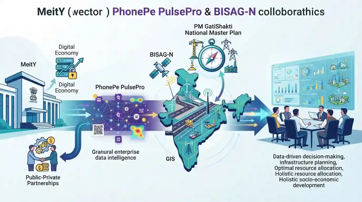
MeitY has partnered with fintech platform PhonePe to integrate granular enterprise data intelligence from PhonePe PulsePro into the PM GatiShakti National Master Plan. Facilitated by BISAG-N, this collaboration will inject hyperlocal economic insights into the GIS-based portal, empowering government bodies to make data-driven decisions for infrastructure planning, optimal resource allocation, and holistic socio-economic development across urban and rural areas.
मुख्य मुद्दे
- The Ministry of Electronics and Information Technology (MeitY) has signed an MoU with PhonePe to integrate insights from PhonePe PulsePro into the PM GatiShakti portal.
- This public-private collaboration aims to utilize granular, hyperlocal transactional data to assist in data-driven planning and economic analysis.
- The PM GatiShakti National Master Plan, managed in collaboration with BISAG-N, uses a multi-layered GIS framework to optimize national infrastructure and resource allocation.
- The integration serves the 'Whole of Government' approach, allowing state and central governments to identify growth clusters and plan holistic urban and rural development.
महत्त्वाच्या संज्ञा
PM GatiShakti National Master Plan

A digital platform launched in 2021 that integrates planning across ministries and states to coordinate multi-modal infrastructure development and significantly reduce India's logistics costs.
UPSC context
GS Paper 3 (Infrastructure/Planning). Crucial for questions on infrastructure development, logistics efficiency, and federal policy execution.
Bhaskaracharya National Institute for Space Applications and Geo-informatics (BISAG-N)
An autonomous scientific society under MeitY that provides specialized space, satellite communication, and geo-spatial technology solutions for governance, resource management, and planning.
UPSC context
GS Paper 3 (Science and Technology/IT). Tests technology in public service delivery, spatial mapping, and digital governance.
Ministry of Electronics and Information Technology (MeitY)
The executive ministry of the Government of India responsible for IT policy, electronics manufacturing, digital public infrastructure, e-governance, and cybersecurity initiatives.
UPSC context
GS Papers 2 & 3 (E-Governance/Digital Economy). Critical for concepts regarding public policy, data protection, and technological administrative reforms.
Geographic Information System (GIS)
A computer-based tool designed to capture, store, manipulate, analyze, manage, and visualize geographically referenced or spatial data to reveal patterns and relationships.
UPSC context
GS Paper 3 (Science and Technology). Tested under e-governance tools, environmental mapping, disaster management, and smart city planning.
पूर्वपरीक्षा सापळा
BISAG-N, which acts as the technical node for PM GatiShakti, functions under the Ministry of Science and Technology.
BISAG-N is an autonomous scientific society under the Ministry of Electronics and Information Technology (MeitY), not Science & Technology or Department of Space.
संबंधित स्थिर संकल्पना
What is BISAG-N and its governance role?
- Nodal body: Acts as the nodal technical agency managing the GIS-based PM GatiShakti National Master Plan.
- Parent ministry: Operates as an autonomous scientific society under MeitY since its elevation to national status in 2020.
- Core technology: Specializes in GIS-based map generation, satellite communication, and geo-spatial software development.
What are the core pillars of PM GatiShakti?
- Six pillars: Comprehensiveness, prioritization, optimization, synchronization, analytical capacity, and dynamic tools.
- Seven engines: Roads, railways, airports, ports, mass transport, waterways, and logistics infrastructure.
- Institutional mechanism: Governed by an Empowered Group of Secretaries (EGoS) to bypass inter-ministerial silos.
आंतर-विषय नमुने
Fintech data + Geospatial planning
Integrating anonymized private transactional data with geospatial maps shifts infrastructure planning from static physical surveys to dynamic economic-demand modeling.
Geospatial Policy + DPI
The partnership advances the National Geospatial Policy 2022 by building unified datasets that combine private financial footprints with public asset registries.

MeitY's administrative control over BISAG-N and PM GatiShakti's geospatial data-sharing protocols are prime targets for Prelims.
संबंधित PYQ · 2
संबंधित PYQ · 2
- 2024MainsGS2
e-governance is not just about the routine application of digital technology in service delivery process. It is as much about multifarious interactions for ensuring transparency and accountability. In this context evaluate the role of the 'Interactive Service Model' of e-governance.
- 2021MainsGS3
“Investment in infrastructure is essential for more rapid and inclusive economic growth.” Discuss in the light of India's experience.
