Uttarkashi earthquake epicenter and seismic zone vulnerability
Source:thestatesman ↗
Why It Matters
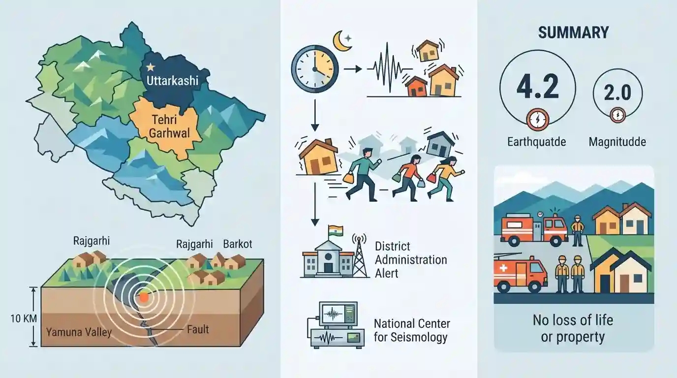
The seismically active regions of Uttarkashi and Tehri Garhwal fall under high-risk seismic zones (Zone IV and V). Analyzing recent seismic activity and the spatial distribution of districts, valleys (Yamuna, Ganga), and local centers (Barkot, Rajgarhi) is critical for UKPSC PCS Prelims questions targeting Uttarakhand's geography and vulnerability to natural disasters.
Summary
An earthquake measuring 4.2 on the Richter scale struck Uttarakhand's Uttarkashi district, with a milder 2.0 magnitude tremor felt in Tehri Garhwal. The epicenter was located in Rajgarhi near Barkot in the Yamuna Valley at a depth of 10 km. Residents evacuated their homes in panic in the early hours of Monday, but no loss of life or property was reported. The National Center for Seismology monitored the seismic activity while district administrations remained alert.
Key Points
- A 4.2 magnitude earthquake struck Uttarkashi district, while Tehri Garhwal felt a 2.0 magnitude tremor.
- The epicenter was located at a depth of 10 km in Rajgarhi, near Barkot Tehsil in the Yamuna Valley.
- Other affected areas in the region included the Ganga Valley, Kirtinagar, and Ghansali.
- The National Center for Seismology confirmed the seismic parameters, and district administrations were placed on high alert.
- No loss of life or damage to property was reported, though residents rushed out of their homes in panic around 1:21 am.
Important Terms
National Center for Seismology

The nodal agency of the Government of India, under the Ministry of Earth Sciences, responsible for monitoring earthquake activity and maintaining the national seismological network.
UPSC context
Relevant for GS Papers 1 and 3, testing knowledge of India's institutional framework for earthquake monitoring and early warning.
District Emergency Operation Centre
A district-level command and control facility that coordinates disaster response, relief, and rescue operations. It functions under the District Disaster Management Authority (DDMA) during emergencies.
UPSC context
Crucial for GS Paper 3 (Disaster Management) to understand decentralized administrative frameworks and grassroots-level disaster response mechanisms.
Richter Scale
A base-10 logarithmic scale used to quantify the magnitude of an earthquake by measuring the amplitude of seismic waves, indicating the total energy released.
UPSC context
Important for GS Paper 1 (Physical Geography) as it tests foundational concepts in seismology, geophysics, and geological hazard measurement.
Prelims Trap
"NDMA under the Ministry of Home Affairs is the nodal agency for monitoring seismic activity in India."
NDMA handles overall disaster response and management, but the National Center for Seismology (under the Ministry of Earth Sciences) exclusively monitors earthquakes.
Static Concepts Connected
How do the Richter and Mercalli scales differ in earthquake measurement?
- Richter Scale: Measures magnitude (total energy released at the source). It is an absolute, open-ended logarithmic scale, usually expressed in numbers from 0 to 10.
- Mercalli Scale: Measures intensity (visible damage to structures, environment, and people). It is an empirical scale written in Roman numerals (I to XII) based on localized observation.
Why is the Himalayan region, including Uttarakhand, highly prone to earthquakes?
- Tectonic Collision: The Indian Plate continuously moves northward, subducting beneath the Eurasian Plate at a convergent boundary. This builds immense stress that eventually releases as earthquakes.
- Shallow Foci: Quakes here often have shallow focal depths (0-70 km), meaning less seismic energy dissipates before reaching the surface, resulting in intense surface shaking.
- Seismic Zoning: Due to this tectonic reality, the Bureau of Indian Standards (BIS) places the entire state of Uttarakhand in highly vulnerable Zones IV and V.
Cross-Topic Patterns
Dam safety in Seismic Zones
Frequent tremors in Tehri Garhwal continually test the structural resilience of major infrastructure like the Tehri Dam, closely linking physical seismology to India's energy and infrastructure policies.
Earthquakes exacerbating Joshimath crisis
Shallow Himalayan earthquakes often act as critical trigger mechanisms for landslides and land subsidence, severely worsening the existing geological instability seen in towns like Joshimath.

Expect a multi-statement question combining BIS seismic zonation, nodal monitoring agencies (NCS vs NDMA), and Himalayan plate boundaries.
Linked PYQs · 3
Linked PYQs · 3
- 2016UKPSC_PRELIMSGS1
Where is Khatling glacier situated?
- 2025UKPSC_PRELIMSGS1
Which of the following groups of districts of Uttarakhand is correct in descending order of sex-ratio according to the Census of India 2011?
- 2025UKPSC_PRELIMSGS1
Which of the following is the correct order of rivers from west to east in Uttarakhand?
