Section of Delhi Dehradun Expressway Caves In After Rain
Source:The Hindu ↗
Why It Matters
Infrastructure projects in and around Uttarakhand face complex geological, administrative, and local social challenges. This article highlights the critical nature of slope protection and drainage systems in the fragile foothills (Shiwalik range) of Uttarakhand, aligning with previous UKPSC Prelims questions on highway funding and geological composition of regional terrains.
Summary
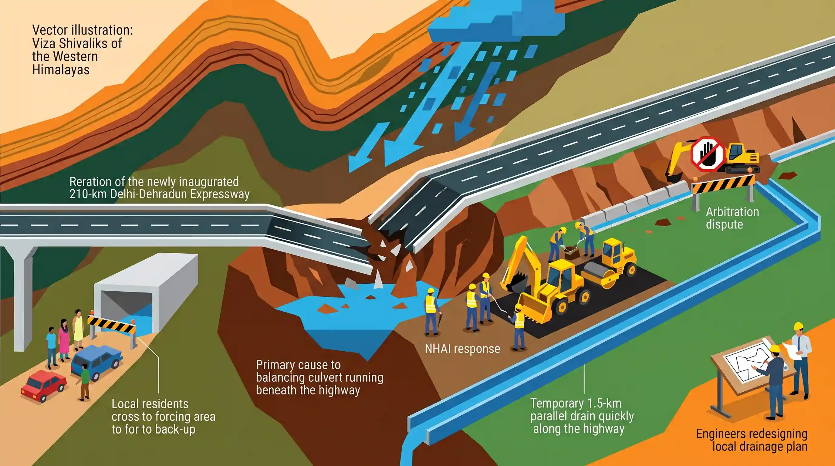
A portion of the newly inaugurated 210-km Delhi-Dehradun Expressway caved in following overnight rainfall on July 2, 2026. The National Highways Authority of India (NHAI) repaired the stretch and attributed the cave-in to localized waterlogging and an incomplete drainage system. The permanent balancing culvert was blocked by local residents for vehicular crossing, and critical slope protection and drainage works remain stalled due to a land arbitration dispute. NHAI has deployed a temporary 1.5-km parallel drain and is redesigning the local drainage plan to prevent future damage.
Key Points
- A portion of the newly built Delhi-Dehradun Expressway caved in on July 2, 2026, following overnight heavy rains, sparking public concerns over the construction quality of the flagship project.
- The 210-km Delhi-Dehradun Expressway (Economic Corridor), which connects Delhi to Dehradun (Uttarakhand), was inaugurated by Prime Minister Narendra Modi in April 2026.
- The National Highways Authority of India (NHAI) attributed the cave-in to localized waterlogging. It stated that a permanent balancing culvert (cross-drainage system) could not be operationalized due to resistance from local residents, who were using the culvert opening as a vehicle crossing.
- Permanent slope protection and drainage works along the stretch remain stalled due to an ongoing land-related arbitration dispute with landowners.
- As an interim measure, NHAI has constructed a 1.5-km parallel drain to safely channel rainwater and is redesigning the drainage system until permanent works can resume.
Important Terms
Delhi-Dehradun Expressway

A newly-inaugurated 210-km, six-lane, access-controlled expressway connecting Delhi to Dehradun. Spanning Delhi, Uttar Pradesh, and Uttarakhand, it cuts travel time to 2.5 hours and features Asia's largest elevated wildlife corridor.
UPSC context
GS Paper III (Infrastructure: Roads & Environment). Tests understanding of high-speed transport infrastructure and its ecological impact mitigation.
Delhi-Dehradun Economic Corridor
The broader flagship highway and regional connectivity infrastructure project (NH-709B) promoting trade, connecting Western Uttar Pradesh's agricultural hubs, and linking the national capital with the Char Dham tourist circuit.
UPSC context
GS Paper III (Infrastructure & Planning). Tests knowledge of industrial and economic transport corridors in fostering national regional growth.
National Highways Authority of India (NHAI)
An autonomous statutory body established under the NHAI Act, 1988, operating under the Ministry of Road Transport and Highways. It is responsible for developing, maintaining, and managing India's national highways network.
UPSC context
GS Paper II & III (Statutory Bodies & Infrastructure). Tests familiarity with public institutions steering India's infrastructure development.
Prelims Trap
Statutory land-acquisition arbitrations under the National Highways Act must strictly adhere to the 12-month award timeline under Section 29A.
The Supreme Court/courts have held that Section 3G(5) of the NH Act acts as a self-contained code; thus, the 12-month limit under Section 29A of the Arbitration Act does not strictly apply.
Static Concepts Connected
Why is the Shiwalik Range highly vulnerable to geological hazards?
- Unconsolidated Sediments: Composed of loose sandstones, shales, clays, and conglomerates that lack deep consolidation, making them highly prone to water-induced erosion and slope failure.
- Tectonic Activity: As the outermost and youngest Himalayan range, it is seismically active and constantly shifting due to proximity to the Main Boundary Thrust.
- Hydrological Vulnerability: Heavy monsoonal downpours quickly saturate the loose topsoil, triggering rapid-onset land subsidence and debris flows.
How are land disputes resolved under Section 3G of the National Highways Act, 1956?
- Statutory Arbitration: Disputes regarding land compensation amounts are referred to a statutory arbitrator appointed by the Central Government.
- Exclusion of Civil Jurisdiction: Civil courts are barred from entertaining suits or granting injunctions in respect of land being acquired under the Act.
- Special Procedure: The Act serves as a self-contained code, prioritizing rapid public interest acquisition over prolonged litigation.
Cross-Topic Patterns
Eco-sensitive corridors vs. infrastructure growth
Integrating structures like Rajaji's 12-km wildlife corridor under Article 48A to balance rapid connectivity with the conservation of ecologically fragile mountain ecosystems.
Arbitration delays & infrastructure vulnerability
How unresolved land disputes and incomplete drainage networks during highway expansion create immediate physical vulnerabilities, linking administrative delays directly to climate-disaster susceptibility.

Shiwalik geology's fragility and the statutory arbitration limits of the National Highways Act will likely be paired in a 2026 GS-3 question.
Linked PYQs · 3
Linked PYQs · 3
- 2025UKPSC_PRELIMSGS1
As per Uttarakhand Budget 2025-26, the amount allocated for Char Dham Road network improvement is
- 2025UKPSC_PRELIMSGS1
The Shiwalik range is primarily composed of which type of material ?
- 2025UKPSC_PRELIMSGS1
Which of the following is the correct order of the following physiographic regions of Uttarakhand from south to north direction?
