Bay of Bengal Deep Depression Triggers Floods in Odisha
Source:The Hindu ↗
Why It Matters
This event is a classic example of compounding natural disasters—a cyclonic depression triggering heavy rainfall, leading to localized flooding and landslides. It emphasizes the relevance of disaster risk reduction (DRR) and climate-resilient infrastructure, key themes in the GS3 Disaster Management syllabus.
Summary
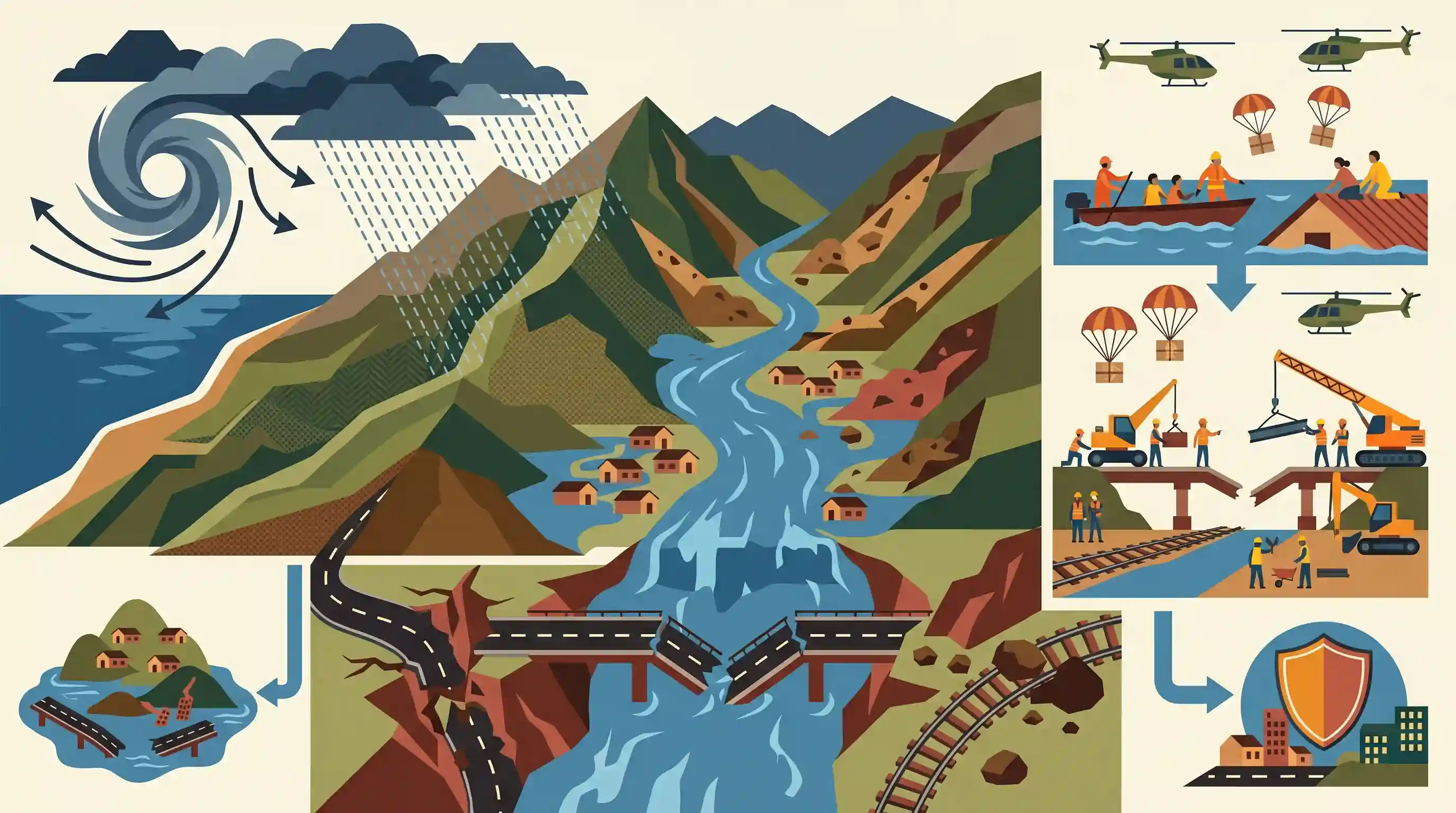
A deep depression over the Bay of Bengal caused severe heavy rainfall across southern Odisha, triggering landslides and riverine flooding in the Eastern Ghats region. The extreme weather significantly damaged critical infrastructure, including roads, bridges, and railway tracks, isolating several remote areas and highlighting the urgent need for robust disaster management strategies.
Key Points
- A deep depression over the Bay of Bengal crossed the Odisha-Andhra Pradesh coasts, causing intense rainfall and disrupting normal life in southern Odisha.
- The Eastern Ghats districts of Gajapati, Rayagada, and Koraput experienced severe landslides that resulted in casualties and blocked major transport routes.
- Swollen rivers such as Sankha, Ghodasala, and Harabhangi caused massive infrastructure damage, including washing away bridges and submerging National Highway 326.
- The disruption of both vehicular and railway movement underscores the region's vulnerability to extreme weather and the urgent need for disaster-resilient infrastructure.
Important Terms
India Meteorological Department (IMD)

The principal government agency under the Ministry of Earth Sciences responsible for meteorological observations, weather forecasting, and seismology in India.
UPSC context
GS Paper 1 (Geography) and GS Paper 3 (Disaster Management). Tests institutional roles in climate monitoring and early warning.
Disaster Management Act, 2005
A landmark 2005 law providing the legal framework for disaster management; it established the NDMA and SDMAs, shifting India toward a proactive preparedness-based approach.
UPSC context
GS Paper 3 (Disaster Management). Tests legislative frameworks, institutional hierarchies, and the evolution of disaster governance in India.
Deep Depression
An intensified stage of a tropical low-pressure system in the North Indian Ocean, characterized by sustained wind speeds between 55 and 75 km/h.
UPSC context
GS Paper 1 (Geographical Phenomena). Tests cyclone classification, atmospheric disturbances, and their impact on coastal and inland geography.
Eastern Ghats
A discontinuous, fragmented mountain range along India's eastern coast that influences regional rainfall patterns and serves as a major watershed for peninsular rivers.
UPSC context
GS Paper 1 (Indian Geography). Tests physiological features of India, orographic rainfall, and the role of topography in regional climates.
Disaster Resilient Infrastructure (DRI)
Physical systems designed to withstand and recover quickly from natural disasters, ensuring the continuity of critical services and reducing economic losses during crises.
UPSC context
GS Paper 3 (Infrastructure/Disaster Management). Tests sustainable development goals and India-led global initiatives like the CDRI.
Riverine Flooding
A type of flooding that occurs when excessive rainfall causes a river to overflow its banks, often impacting low-lying plains and delta regions.
UPSC context
GS Paper 3 (Disaster Management). Tests understanding of flood mechanisms, catchment area management, and disaster mitigation strategies.
Prelims Trap
The Eastern Ghats are entirely safe from landslide hazards due to their stable, highly eroded relict topography.
Aspirants often assume only the Himalayas or Western Ghats face landslides. However, the Eastern Ghats are heavily susceptible due to fractured rocks, lateritic soils, and intense cyclonic rainfall.
Static Concepts Connected
How does the IMD classify Depressions versus Tropical Cyclones based on wind speed?
- Depression: Wind speeds between 31–50 kmph. It often brings heavy, sustained rainfall but lacks the destructive winds of a mature cyclone.
- Deep Depression: Wind speeds between 51–61 kmph. Characterized by intense precipitation and high potential for triggering severe regional floods.
- Cyclonic Storm: Wind speeds of 62–88 kmph. This is the threshold where the system is officially named as a tropical cyclone.
What factors make the Eastern Ghats vulnerable to landslides despite being relict mountains?
- Geological makeup: Highly fractured, weathered rock formations combined with deep lateritic soil profiles that lose cohesion and slip during heavy rains.
- Extreme triggers: Intense, short-duration precipitation dumps from frequent Bay of Bengal cyclonic systems act as the primary natural catalyst for slope failure.
- Anthropogenic stress: Unscientific road cutting, deforestation, and mining on steep gradients significantly amplify slope instability in districts like Gajapati and Koraput.
Cross-Topic Patterns
Physical topography + Tribal socio-economic vulnerability
Southern Odisha districts (Rayagada, Koraput) host significant tribal populations. Infrastructure collapse directly isolates these vulnerable communities, linking disaster management (GS3) with social justice and tribal welfare (GS1/GS2).
CDRI and Sendai Framework implementation
The washing away of NH326 bridges provides a perfect case study for the Coalition for Disaster Resilient Infrastructure (CDRI) and Sendai Framework goals regarding vital transport infrastructure protection.

Expect a Prelims geography question contrasting landslide vulnerabilities across the Himalayas, Western Ghats, and Eastern Ghats in 2026.
Linked PYQs · 5
Linked PYQs · 5
- 2014MainsGS1
Tropical cyclones are largely confined to South China Sea, Bay of Bengal and Gulf of Mexico. Why?
- 2022MainsGS1
Discuss the meaning of colour-coded weather warnings for cyclone prone areas given by India Meteorological Department.
- 2021MainsGS3
Describe the various causes and the effects of landslides. Mention the important components of the National Landslide Risk Management Strategy.
- 2019MainsGS3
Disaster preparedness is the first step in any disaster management process. Explain how hazard zonation mapping will help disaster mitigation in the case of landslides.
- 2024MainsGS3
What is disaster resilience? How is it determined? Describe various elements of a resilience framework. Also mention the global targets of Sendai Framework for Disaster Risk Reduction (2015–2030).
