Northeast Monsoon Floods and Disaster Relief Operations
Source:The Hindu ↗
Why It Matters
Provides a concrete case study for GS3 Disaster Management, illustrating cascading hazards (heavy rainfall causing concurrent floods and landslides) in the ecologically fragile Northeast, and demonstrates the crucial deployment of Armed Forces (HADR) in crisis response.
Summary
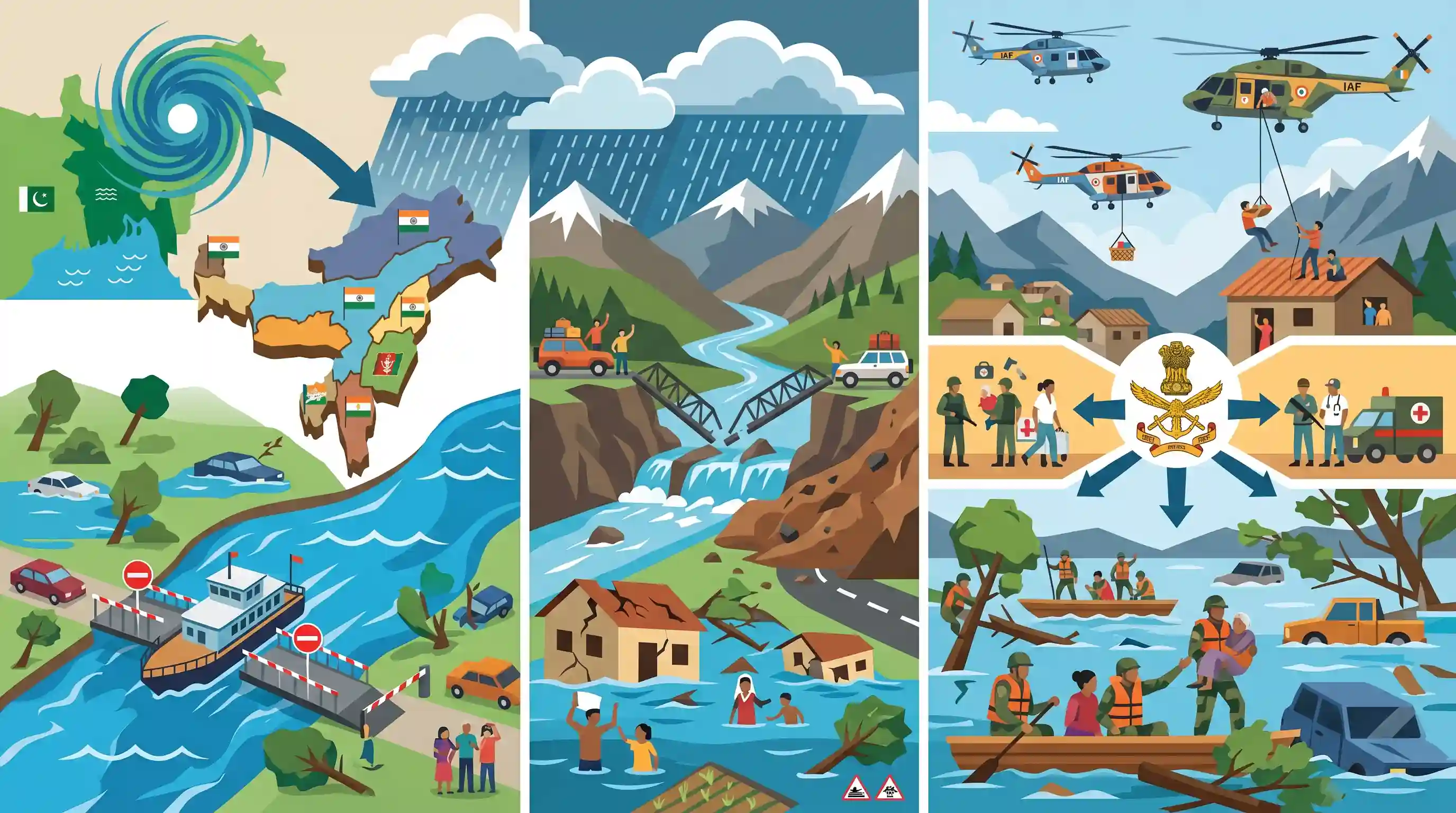
The Northeast states of Assam, Manipur, Tripura, Sikkim, Arunachal Pradesh, and Mizoram are experiencing severe flooding and landslides triggered by heavy rainfall associated with a depression originating over Bangladesh. Key incidents include halted ferry services on the swelling Brahmaputra in Assam, tourist strandings along the Teesta in Sikkim due to collapsed bridges, multiple fatalities, and severe infrastructural damage. The Indian Armed Forces have been pivotal in rescue operations, launching "Operation JalRahat-2" in Manipur and conducting aerial rescues via the Indian Air Force in Arunachal Pradesh. The situation underscores the region's vulnerability to extreme weather and highlights the critical role of coordinated Humanitarian Assistance and Disaster Relief (HADR) efforts in mitigating disaster impacts.
Key Points
- A depression moving north-northeastwards from Bangladesh has triggered extreme rainfall, causing severe floods and landslides across six Northeast Indian states.
- The surging water levels of the Brahmaputra (halting ferry services to Majuli) and the Teesta rivers have caused massive infrastructural damage, collapsing bridges and stranding over a thousand tourists.
- The Indian Armed Forces are spearheading relief efforts, conducting aerial evacuations in Arunachal Pradesh and launching 'Operation JalRahat-2' in Manipur to rescue stranded civilians.
- The disaster highlights the compounding impacts of extreme weather events in the ecologically and topographically fragile Himalayan and Northeast regions.
Important Terms
Operation JalRahat-2

A comprehensive Indian Army-led flood relief mission in Northeast India (Assam, Manipur, Nagaland) focused on rescues, medical aid, and supply distribution during severe monsoonal flooding and landslides.
UPSC context
GS Paper 3 (Disaster Management); illustrates the Armed Forces' pivotal role in civil-military humanitarian response and domestic disaster mitigation.
Humanitarian Assistance and Disaster Relief (HADR)
Coordinated civil-military operations providing rapid aid, search and rescue, and essential service restoration following disasters. It is a key component of India's 'Net Security Provider' role in the Indo-Pacific.
UPSC context
GS Paper 3 (Disaster Management) and GS Paper 2 (Diplomacy); assesses disaster preparedness and regional leadership capabilities.
Assam Rifles
India's oldest paramilitary force (est. 1835), termed 'Sentinels of the Northeast.' It operates under dual control—administrative via the Ministry of Home Affairs and operational via the Indian Army.
UPSC context
GS Paper 3 (Internal Security); relevant for security architecture in the Northeast and the unique dual-control governance model.
National Disaster Management Authority (NDMA)
The apex statutory body for disaster management in India, established under the Disaster Management Act, 2005. Chaired by the Prime Minister, it formulates national policies, plans, and guidelines.
UPSC context
GS Paper 3 (Disaster Management); tests knowledge of the legal and institutional framework for national disaster risk reduction.
India Meteorological Department (IMD)
India’s principal meteorological agency under the Ministry of Earth Sciences. It provides weather forecasting, seismology services, and early warnings for extreme events like cyclones and heavy rainfall.
UPSC context
GS Paper 1 (Geography) and Paper 3; central to early warning systems (EWS) and climate change adaptation strategies.
Prelims Trap
The Teesta river joins the Brahmaputra river within the Indian state of West Bengal or Assam.
Aspirants often assume this confluence happens in India. However, the Teesta flows through Sikkim and West Bengal before merging into the Brahmaputra (Jamuna) in Bangladesh.
Static Concepts Connected
What geographical characteristics of the Brahmaputra system cause recurring floods in Assam?
- Braided Channel: The river carries a massive silt load from the young Himalayas, creating a braided channel with temporary sandbars and highly vulnerable river islands like Majuli.
- Funnel Effect: Topographically restricted valleys funnel intense moisture from Bay of Bengal depressions, leading to extreme, concentrated precipitation over narrow catchments.
- Tributary Surges: Numerous steep, fast-flowing northern tributaries (e.g., Subansiri, Kameng) bring rapid surges of water, causing sudden flash floods and severe bank erosion.
What is the structural mandate for deploying Armed Forces in disaster management in India?
- Aid to Civil Authority: Under the DMA 2005 framework, Armed Forces are not primary responders but are requisitioned as 'aid to civil authorities' when local/NDRF capacities are overwhelmed.
- Specialized HADR Role: They provide critical heavy engineering, specialized aerial evacuation via the IAF, and rapid-deployment logistics essential for topographically inaccessible terrains.
Cross-Topic Patterns
Climate Change + Tectonic Fragility
The Northeast's compounding disasters link changing monsoon depression tracks to the active tectonics of the Himalayas, creating a deadly flood-landslide feedback loop requiring localized hazard zonation.
Border Infrastructure vs. Natural Hazards
Massive infrastructural damage in border states like Arunachal and Sikkim highlights the persistent tension between strategic border-road expansion (Border Roads Organisation) and the region's ecological carrying capacity.

Expect a multi-statement Prelims question mapping Northeast rivers (Teesta, Iril) to their confluences and associated fragile ecosystems.
Linked PYQs · 3
Linked PYQs · 3
- 2017PrelimsGS1
With reference to river Teesta, consider the following statements: 1. The source of river Teesta is the same as that of Brahmaputra but it flows through Sikkim. 2. River Rangeet originates in Sikkim and it is a tributary of river Teesta. 3. River Teesta flows into Bay of Bengal on the border of India and Bangladesh. Which of the statements given above is/are correct?
- 2021MainsGS3
Describe the various causes and the effects of landslides. Mention the important components of the National Landslide Risk Management Strategy.
- 2019MainsGS3
Disaster preparedness is the first step in any disaster management process. Explain how hazard zonation mapping will help disaster mitigation in the case of landslides.
