Gujarat GIS Mapping Initiative for MSME Industrial Units
Source:financialexpress ↗
Why It Matters
Understanding regional economic development, technology integration in governance (GIS mapping), and MSME sector support schemes is crucial for administrative and policy perspectives in state and national civil services examinations.
Summary
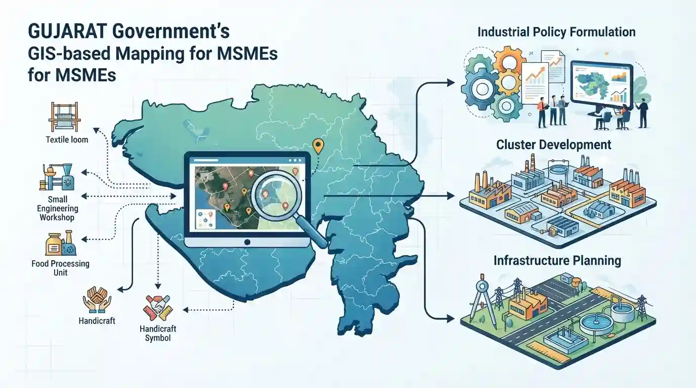
The Gujarat government is launching a Geographic Information System (GIS)-based mapping exercise for MSME units across the state to build a robust, spatially-integrated database that will improve industrial policy formulation, cluster development, and infrastructure planning.
Key Points
- Gujarat government is undertaking a comprehensive Geographic Information System (GIS) based mapping initiative for Micro, Small, and Medium Enterprises (MSMEs) across the state.
- The move aims to create a centralized database, improve infrastructure planning, and target policy interventions effectively for industrial units.
- GIS mapping will help identify regional clusters, infrastructure gaps, and optimize support schemes for MSMEs in Gujarat.
Important Terms
GIS-based MSME Mapping

A Geographic Information System (GIS) mapping exercise launched by Gujarat to geo-tag manufacturing units, building a structured database integrated with the PM Gati Shakti portal to optimize industrial planning.
UPSC context
UPSC Prelims/Mains (Economy & Technology): Tests applications of digital governance, spatial planning tools, and state-level industrial policy implementation.
RAMP Scheme
A central sector scheme supported by the World Bank, aimed at improving performance, competitiveness, and institutional coordination of micro, small, and medium enterprises across Indian states.
UPSC context
UPSC Prelims/Mains (Economy - MSME Sector): Tests government schemes for industrial growth, financial assistance, and cooperative federalism in MSME development.
PM Gati Shakti National Master Plan
India's multi-modal connectivity master plan utilizing a centralized GIS platform to integrate infrastructure projects, eliminate departmental silos, and improve logistics and industrial efficiency.
UPSC context
UPSC Prelims/Mains (Economy & Infrastructure): Tests understanding of multi-modal connectivity, geospatial mapping applications, and infrastructure logistics in India.
Static Concepts Connected
What are the core parameters defining Micro, Small, and Medium Enterprises (MSMEs) in India?
- Micro Enterprises: Investment in plant and machinery/equipment does not exceed ₹1 crore and annual turnover does not exceed ₹5 crores.
- Small Enterprises: Investment does not exceed ₹10 crores and annual turnover does not exceed ₹50 crores.
- Medium Enterprises: Investment does not exceed ₹50 crores and annual turnover does not exceed ₹250 crores.
Cross-Topic Patterns
GIS Mapping + PM Gati Shakti Integration
Integration of state-level MSME databases with PM Gati Shakti exemplifies how spatial data infrastructure underpins both federal logistics master planning and decentralized industrial policy.
RAMP Scheme + Cooperative Federalism Linkages
Implementation of state projects under central frameworks like the RAMP scheme illustrates cooperative federalism in administrative capacity building for MSMEs.

Expect a statement-based question combining RAMP scheme objectives, PM Gati Shakti integration, and MSME classification criteria.
Linked PYQs · 2
Linked PYQs · 2
- 2025GPSC_PRELIMSGS1
______ is one of the cities chosen by the NITI Aayog for its Growth Hub (G-HUB) programme to boost their economic growth.
- 2022GPSC_PRELIMSGS1
Which of the following schemes facilitates bank loans to at least one Scheduled Caste/ Scheduled Tribe borrower and at least one woman borrower per bank branch for setting up greenfield enterprises?
