High Resolution Subglacial Map Reveals Hidden Antarctic Terrain
Source:Indian Express ↗
Why It Matters
Antarctica's ice sheet holds about 70% of the planet's freshwater. Understanding its underlying topography is critical for accurate climate modeling and predicting the pace of global sea-level rise, directly linking physical geography with environmental change scenarios.
Summary
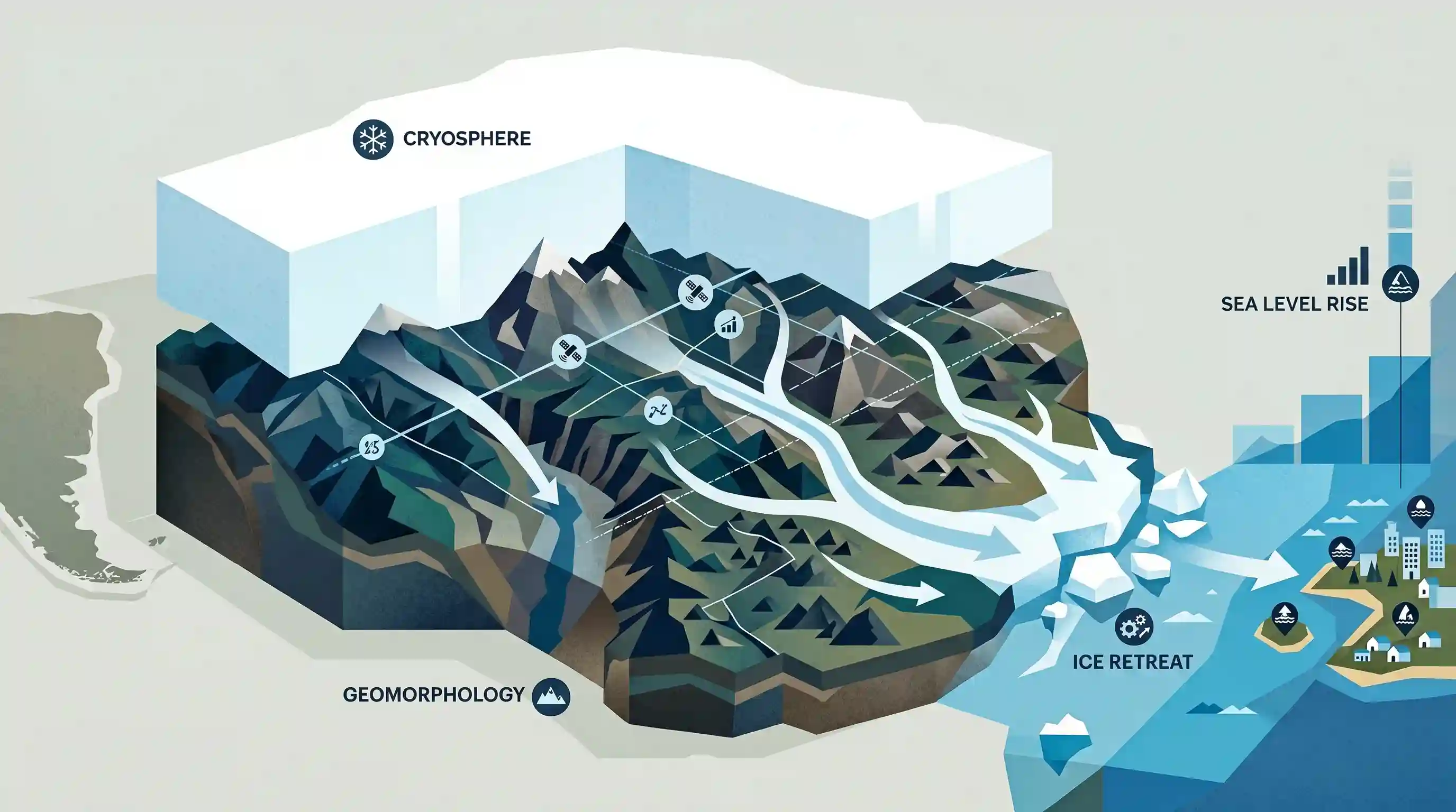
A newly developed high-resolution map has revealed the dramatic and extreme topography hidden beneath Antarctica's miles-thick ice sheet. Created using advanced satellite observations and ice-flow perturbation analysis, the map uncovers features like massive mountains, canyons, and tens of thousands of hills. This subglacial terrain—shaped before the continent separated from South America—plays a crucial role in controlling the speed at which ice flows to the ocean. The data provides vital parameters for climate models, aiding predictions of ice sheet retreat and subsequent global sea-level rise.
Key Points
- Researchers have created a new, highly detailed map of Antarctica's subglacial terrain, revealing mountains, deep canyons, and over 30,000 previously uncharted hills hidden beneath the ice.
- The map was developed using high-resolution satellite data combined with ice-flow perturbation analysis.
- The continent's diverse sub-ice topography was originally formed before Antarctica separated from South America due to tectonic plate movements.
- The roughness of the hidden terrain creates friction that can significantly slow down the retreat of the ice sheet in a warming climate.
- This new topographical data is essential for numerical models used by bodies like the IPCC to project how rapidly Antarctic ice will flow into the ocean and contribute to global sea-level rise.
Important Terms
Intergovernmental Panel on Climate Change (IPCC)

UN body established by the WMO and UNEP in 1988 to provide policymakers with regular scientific assessments on climate change, its risks, and options for adaptation and mitigation.
UPSC context
GS Paper 3 (Environment). Vital for global climate negotiations and understanding the scientific consensus guiding international agreements like the Paris Agreement.
Cryosphere
The frozen parts of the Earth system, including ice sheets, glaciers, snow cover, and permafrost. It plays a critical role in regulating the global climate and sea levels.
UPSC context
GS Paper 1 (Physical Geography) and Paper 3 (Environment). Tests understanding of Earth's climate regulators and the impact of global warming.
Ice Sheet
A mass of glacial ice covering more than 50,000 square kilometers. The Antarctic and Greenland ice sheets are the only ones remaining, together holding 68% of Earth's freshwater.
UPSC context
GS Paper 1 (Geomorphology). Crucial for studying global freshwater reserves and the primary drivers of long-term sea-level rise.
Subglacial Topography
The physical land surface (mountains, canyons, valleys) hidden beneath an ice sheet. Its shape and roughness provide frictional resistance that controls the speed of ice flow toward the sea.
UPSC context
GS Paper 1 (Physical Geography). Essential for understanding glacial dynamics and predicting the stability of major ice masses in response to warming.
Plate Tectonics
The theory that Earth's outer shell is divided into several plates that glide over the mantle, responsible for continental drift and the original shaping of Antarctica's bedrock.
UPSC context
GS Paper 1 (Physical Geography). A fundamental topic testing Earth's geological evolution, continental movement, and the formation of major landforms.
Ice-Flow Perturbation Analysis (IFPA)
A modeling technique that uses satellite observations of ice surface patterns and the physics of ice movement to mathematically infer the detailed landscape hidden deep beneath the ice.
UPSC context
GS Paper 3 (Science & Technology). Highlights advancements in remote sensing and geophysical modeling used to refine climate change impact projections.
Albedo Effect
The measure of a surface's reflectivity. Ice has high albedo, reflecting up to 90% of solar radiation, which helps keep the Earth cool by preventing heat absorption.
UPSC context
GS Paper 1 (Climatology) and Paper 3 (Global Warming). Key for explaining climate feedback loops where melting ice accelerates further heating.
Prelims Trap
Antarctica's subglacial mountains and deep canyons were primarily carved by glacial erosion after the continent froze.
The dramatic terrain was largely shaped by tectonic plate movements before the continent separated from South America, long before the ice sheet formed.
Static Concepts Connected
How does the geological history of Antarctica connect to South America?
- Gondwanaland origin: Antarctica, South America, Africa, India, and Australia together formed the ancient southern supercontinent.
- Drake Passage: Separation from South America (~34 million years ago) opened the Drake Passage, leading to the Antarctic Circumpolar Current and thermal isolation.
- Tectonic shaping: The dramatic sub-ice topography was formed by these ancient tectonic movements prior to the continent's massive glaciation.
What is basal friction and how does it affect ice sheet dynamics?
- Basal friction: The resistance to movement occurring between the base of a glacier or ice sheet and the underlying bedrock.
- Natural brake: High bedrock roughness increases friction, slowing down ice flow and preventing rapid discharge of ice into the oceans.
- Climate modeling: Accurate bedrock topography mapping allows numerical climate models to estimate this friction, reducing uncertainties in sea-level rise projections.
Cross-Topic Patterns
Cryosphere data feeds IPCC models
Subglacial bedrock data refines 'basal friction' variables in climate models, directly addressing the uncertainties in IPCC sea-level rise projections often tested in Mains GS-3.
Remote sensing for hidden topography
Uses of high-resolution satellite imagery extend beyond surface mapping; advanced algorithms deduce sub-surface geology, linking GS-3 Space Tech to Environmental monitoring.

Expect a multi-statement Prelims question linking basal friction of ice sheets to tectonic history and IPCC sea-level projections in 2026.
Linked PYQs · 4
Linked PYQs · 4
- 2021MainsGS1
How do the melting of the Arctic ice and glaciers of the Antarctic differently affect the weather patterns and human activities on the Earth? Explain.
- 2025MainsGS1
Discuss how the changes in shape and sizes of continents and ocean basins of the planet take place due to tectonic movements of the crustal masses.
- 2013MainsGS1
What do you understand by the theory of 'continental drift'? Discuss the prominent evidences in its support.
- 2025MainsGS1
How are climate change and the sea level rise affecting the very existence of many island nations? Discuss with examples.
