Gandak Barrage Discharge: Chief Minister Aerial Survey of Flood Zones
Source:The Hindu ↗
Why It Matters
North Bihar's recurrent flooding is primarily driven by rivers like the Gandak, Kosi, and Bagmati that originate in Nepal. Understanding this transboundary river system, the role of barrages like Valmikinagar, and flood disaster mitigation is a staple for BPSC Prelims and Mains exams.
Summary
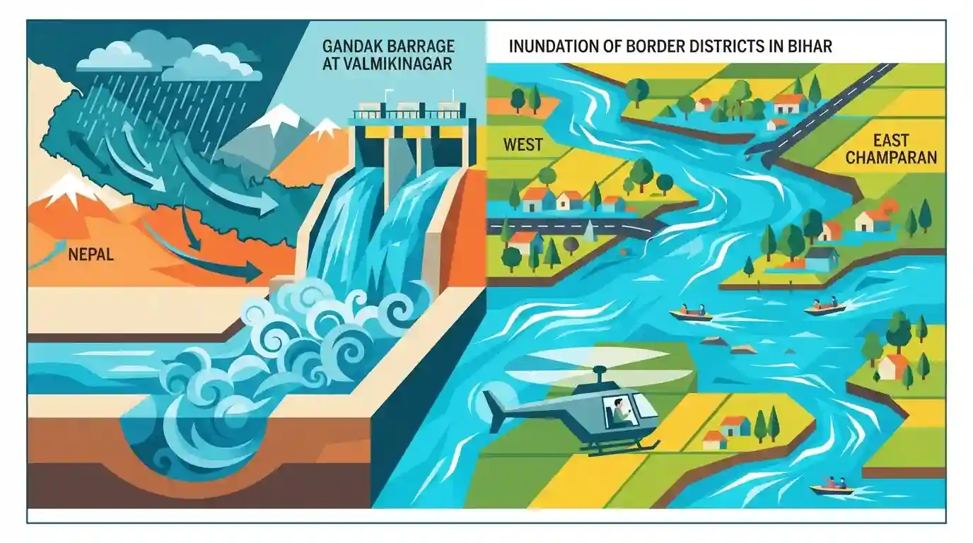
Following flash floods in Nepal, heavy water discharge from the Gandak barrage at Valmikinagar caused river levels to surge, inundating border districts in Bihar. Chief Minister Nitish Kumar conducted an aerial survey of affected areas in West and East Champaran to assess the flood situation.
Key Points
- Flash floods in Nepal led to a massive discharge of water from the Gandak barrage at Valmikinagar into Bihar.
- The sudden rise in water levels in the Gandak river resulted in the inundation of low-lying areas in northern border districts.
- Bihar Chief Minister Nitish Kumar conducted an aerial survey of flood-affected regions, particularly in Bagaha, Valmikinagar, Bettiah (West Champaran), and Motihari (East Champaran).
- The situation highlights the persistent vulnerability of North Bihar to flooding caused by transboundary rivers originating in the Himalayas.
Important Terms
Government of Bihar

The state administrative authority responsible for policy execution, disaster response, and regional governance, directing departments and district magistrates to coordinate rescue and relief during natural crises like floods.
UPSC context
Relevant to State Polity and Governance (GS Paper 2). Highlights the state executive's role in disaster preparedness and administrative coordination.
Water Resources Department (WRD)
The state government department responsible for constructing and maintaining irrigation systems, managing flood control infrastructure like embankments and barrages, and monitoring river levels across Bihar.
UPSC context
Vital for Bihar Governance and Disaster Management (GS Paper 2). Tests knowledge of the institutional framework handling the state's chronic flooding issues.
Gandak Barrage
A major flood-control and irrigation structure with 36 gates located across the Gandak River in Valmikinagar, Bihar. It regulates surges in water discharge flowing from Nepal into northern Bihar.
UPSC context
Crucial for Bihar Geography and Disaster Management (GS Paper 2). Assesses knowledge of key infrastructure managing India-Nepal transboundary river flows.
Valmikinagar
A town in West Champaran district on the India-Nepal border. It serves as the geographical entry point for the Gandak River into Bihar and houses the critical Gandak Barrage.
UPSC context
Important for Bihar Geography (Prelims and GS Paper 1). Tests awareness of border towns, river entry points, and strategic infrastructure locations.
Transboundary Flooding
Flooding in downstream regions, such as Bihar, caused by extreme weather, heavy discharge, or glacial bursts in upstream neighboring territories like Nepal or Tibet.
UPSC context
Highly relevant for Disaster Management and IR (GS Paper 2). Tests understanding of hydrological interdependencies and the need for cross-border cooperation.
West and East Champaran
Northernmost border districts of Bihar. Because the Gandak River enters the state through West Champaran, these districts are highly vulnerable to flash floods resulting from heavy upstream discharge.
UPSC context
Essential for Bihar-specific Geography and Disaster Management (GS Paper 1 & 2). Evaluates knowledge of regional vulnerability and flood-prone zones.
Prelims Trap
"The Gandak River joins the Ganga near Chhapra."
A classic BPSC geographic trap. The Gandak joins the Ganga at Hajipur/Sonpur (Vaishali), while the Ghaghra (Saryu) joins near Chhapra (Saran).
Static Concepts Connected
What is the course and significance of the Gandak River in Bihar?
- Origin (Nepal): Known as the Narayani or Kali Gandaki in the Nepal Himalayas before entering India.
- Bihar Entry: Enters the state at Valmikinagar in the West Champaran district.
- Confluence: Flows southeast and joins the Ganga near Hajipur/Sonpur in the Vaishali district.
- Irrigation: The historic Triveni Canal sources its water directly from the Gandak at Valmikinagar.
Why is North Bihar exceptionally prone to severe annual flooding?
- Topography: Steep Himalayan gradients flatten abruptly in the Bihar plains, causing massive silt deposition and river meandering.
- Himalayan Catchment: Rivers like Kosi, Gandak, Kamla, and Bagmati carry massive, fast-flowing unregulated discharge from Nepal.
- Severe Siltation: High sediment load naturally reduces the carrying capacity of river channels, leading to frequent embankment breaches.
Cross-Topic Patterns
Transboundary Hydro-Diplomacy
North Bihar's flooding is tied to India-Nepal treaties (e.g., 1959 Gandak Agreement). Disaster mitigation in BPSC Mains often requires discussing bilateral hydro-diplomacy and barrage management.
Floods & Valmiki Ecology
Inundation at Valmikinagar directly threatens the Valmiki Tiger Reserve (VTR), connecting physical geography of Himalayan rivers to biodiversity conservation challenges in the Terai landscape.

Expect multi-statement questions mapping Nepal-border districts, the Gandak's exact course, and bilateral flood agreements.
Linked PYQs · 4
Linked PYQs · 4
- 2020BPSC_PRELIMSGS1
Which of the following rivers flowing in Bihar is a north flowing river?
- 2023BPSC_PRELIMSGS1
The other name of river Gandak is
- 2025BPSC_PRELIMSGS1
Which of the following parks/sanctuaries come under the project tiger in Bihar?
- 2024-EBPSC_PRELIMSGS1
Which of the following drainage systems drains the lands of Bihar?
