Torrential Rains Cause Flooding and Traffic Disruption on Highways
Source:himachalscape ↗
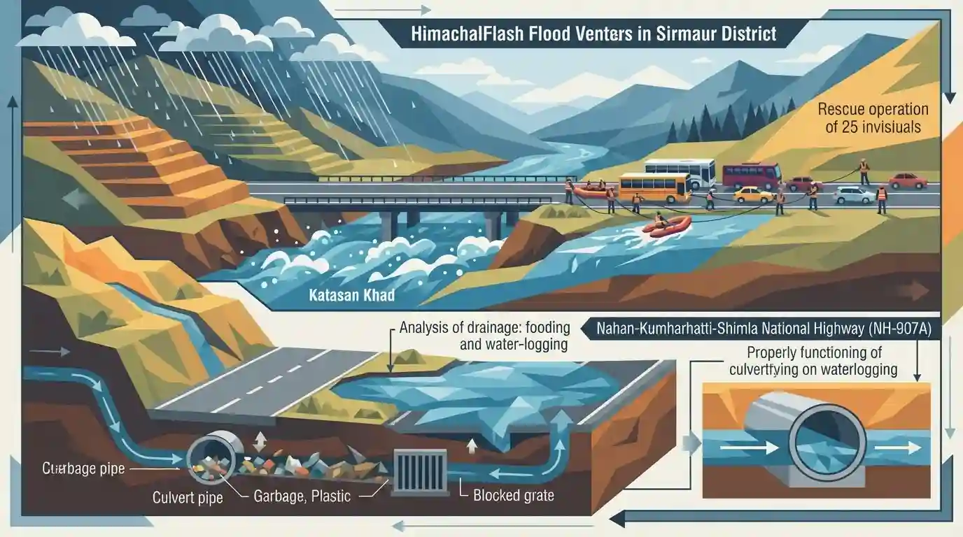
Why It Matters
Understanding the causes of localized and urban flooding in hilly areas is crucial for disaster management and infrastructure planning. It highlights how poor engineering (inadequate drainage pipes) and civic negligence (garbage dumping) combine with natural events (heavy rainfall) to create life-threatening hazards, a key area of study for HPAS aspirants.
Summary
A severe flash flood triggered by torrential rain in Sirmaur district, Himachal Pradesh, resulted in the trapping of 25 commuters in the Katasan Khad along the Dehradun-Chandigarh National Highway, before they were safely rescued. Furthermore, the Nahan-Kumharhatti-Shimla NH (NH-907A) witnessed massive flooding and waterlogging. The incidents have drawn intense scrutiny towards the inadequate drainage systems, specifically undersized pipes laid by the PWD (NH) and garbage accumulation in culverts, which failed to handle the heavy precipitation. The event highlights critical vulnerabilities in highway infrastructure and urban drainage management in hilly terrains.
Key Points
- Torrential rainfall triggered flash floods in Sirmaur district, trapping 25 commuters whose vehicles were swept away in the Katasan Khad on the Dehradun-Chandigarh National Highway.
- The Nahan-Kumharhatti-Shimla National Highway (NH-907A) experienced severe waterlogging and flooding, stranding numerous commuters and bringing traffic to a standstill.
- The primary cause of the localized flooding was identified as poor drainage infrastructure, with narrow and inadequate drainage pipes installed by the NH division of the PWD.
- Additionally, garbage dumped by local residents blocked the culverts, further exacerbating the waterlogging on the highways.
Important Terms
Public Works Department (NH wing)

A specialized division within state Public Works Departments entrusted by the Ministry of Road Transport and Highways to plan, construct, and maintain specific National Highway stretches passing through the state.
UPSC context
Relevant to GS Paper 3 (Infrastructure/Governance) for understanding the institutional framework and accountability in highway maintenance.
Flash Floods
Highly localized, rapid-onset flooding events that peak within six hours of intense rainfall, cloudbursts, or sudden water releases, frequently devastating hilly regions due to steep slopes and poor drainage.
UPSC context
Key disaster management topic in GS Paper 3 and Geography (GS Paper 1), testing climate change impact on urban flooding.
Culvert
An enclosed conduit or short tunnel structure designed to convey surface water safely beneath roads, railways, or embankments. When clogged by debris, they frequently cause highway waterlogging and structural damage.
UPSC context
Important for GS Paper 3 (Infrastructure/Disaster Management) regarding urban planning, stormwater drainage, and infrastructure resilience against climate events.
Katasan Khad
A natural rivulet in the Sirmaur district of Himachal Pradesh, intersecting the Dehradun-Chandigarh National Highway, which recently witnessed severe flash flooding and stranded commuters due to torrential rains.
UPSC context
Useful geographical example for GS Paper 1 (Geography) and GS 3 (Disaster Management) illustrating the vulnerability of Himalayan riverine ecology.
Prelims Trap
The Giri River, which divides Sirmaur district into Cis and Trans regions, is a major tributary of the Sutlej.
Aspirants frequently misidentify the Giri river as a tributary of the Sutlej or Beas. It is actually a significant tributary of the Yamuna River system.
Static Concepts Connected
What causes highway and urban flooding in Himalayan terrains?
- Unplanned Infrastructure: Undersized pipes and narrow culverts fail to accommodate the sudden peak runoff generated by intense, localized rainfall in steep catchments.
- Waste Accumulation: Dumping of solid garbage and construction/demolition waste directly into natural drainage channels (Khads) severely restricts water flow capacity.
- Terrain Alteration: Unscientific road cutting and deforestation loosen the topsoil, drastically increasing sediment loads that rapidly clog drainage networks during heavy rains.
What is the geographical and cultural significance of the Giri River?
- Yamuna Drainage System: Originating at Kupar Peak in Shimla district, it flows southeast and is a crucial tributary of the Yamuna River.
- Physiographic Divide: It naturally bisects the Sirmaur district into two distinct physiographic and administrative zones: Cis-Giri and Trans-Giri.
- Tribal Demographics: The Trans-Giri basin is the traditional homeland of the Hatti community, which was recently granted Scheduled Tribe (ST) status by Parliament.
Cross-Topic Patterns
Geography meets Tribal Demographics
The Trans-Giri region, vulnerable to these Himalayan flash floods, recently gained prominence when the Hatti community received Scheduled Tribe status, linking physical geography with social justice.
Hill Infrastructure vs. Carrying Capacity
Highway expansion in the Shivaliks often ignores local hydrology. Much like the Joshimath subsidence, poor drainage engineering and waste dumping compound natural hazard vulnerabilities.

Expect a Prelims question combining Himalayan drainage (Giri/Markanda rivers) with socio-cultural geography like the Hatti community.
Linked PYQs · 2
Linked PYQs · 2
- 2020HPAS_PRELIMSGS1
Consider the given four statements and choose the correct answer from the given options. Select the true statements from the following: 1. Chamba, Kullu and Kinnaur are considered the most susceptible of landslide threat. 2. Una, Bilaspur, Sirmaur, Shimla and Solan are considered as low vulnerable of disaster threats. 3. Hum valley of Una district has hardly any natural drinking water source. 4. As per the study of central water board, Kala Amb valley in Sirmaur district has exploited the least underground water.
- 2011HPAS_PRELIMSGS1
Loss of forests, urbanization and increasing pollution are all due to :
