Monsoon Rains Revive Flood Fears in Sahastradhara Villages Dehradun
Source:timesofindia ↗
Why It Matters
This article highlights the recurring vulnerability of the fragile Himalayan eco-system to cloudbursts and flash floods, showcasing the administrative and infrastructural challenges in disaster mitigation, river channelisation, and early warning communications in Uttarakhand's tourist-heavy districts.
Summary
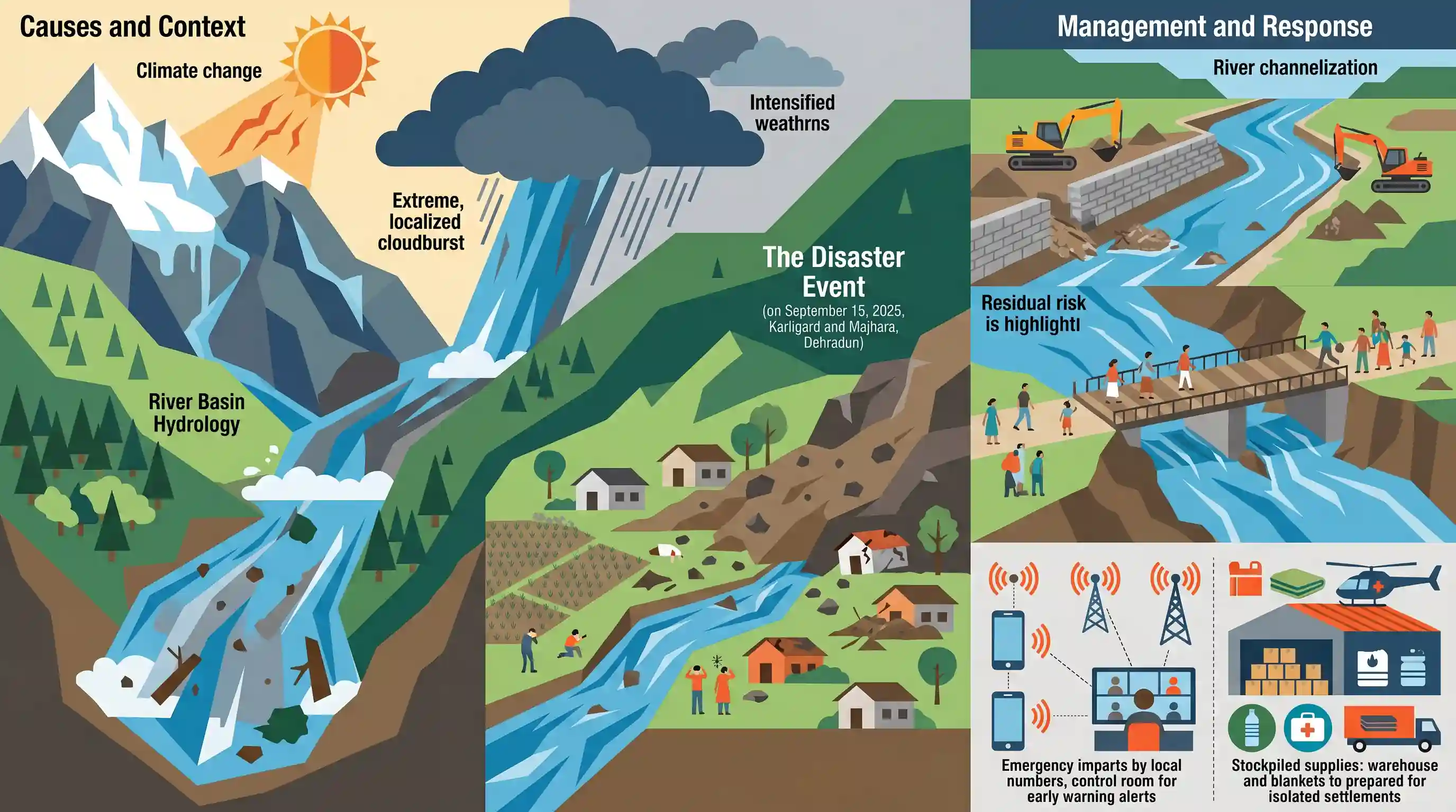
The article highlights the rising anxiety of villagers in Karligard and Majhara, located near the popular tourist spot Sahastradhara in Dehradun, as the monsoon season revives fears of the devastating cloudburst and flash floods of September 15, 2025. The disaster had killed three people, damaged houses, and buried agricultural fields under debris. While the state's irrigation department has executed river channelisation and debris clearance, the absence of a complete bridge remains a threat during high flows. The Dehradun district administration has directed the registration of local phone numbers with the District Control Room for early warning and ensured the stockpiling of essential supplies for isolated settlements.
Key Points
- Villagers in Karligard and Majhara near Sahastradhara, Dehradun, face heightened anxiety with the onset of the monsoon following a devastating cloudburst and flash floods on September 15, 2025.
- The 2025 disaster claimed three lives, destroyed houses, washed away bridges, and buried valuable agricultural land under tons of rocky debris.
- The Uttarakhand Irrigation Department has carried out river channelisation, debris clearance, and land levelling work in Karligard, though the lack of a functional bridge continues to isolate communities during high river discharges.
- Dehradun District Magistrate Ashish Chauhan has instructed the local tehsil administration to secure dry rations, maintain essential services, and register the phone numbers of vulnerable families with the District Control Room for real-time emergency alerts.
- Geographically, Sahastradhara is located on the Baldi River (a tributary of the Song River, which flows into the Ganga) and is globally famed for its medicinal sulphur springs. This region lies in the active, fragile Himalayan foothills.
Important Terms
District Administration

The principal unit of field administration in India, led by the District Collector/Magistrate, responsible for maintaining law and order, land revenue collection, disaster management, and grass-roots policy implementation.
UPSC context
GS Paper II (Polity & Governance). Tests understanding of decentralized administrative efficiency, emergency coordination, and grassroots service delivery.
Tehsil Administration
The sub-district level administrative unit (Tehsil/Taluka) headed by a Tehsildar, responsible for rural land record management, local tax collection, public service certificate issuance, and local disaster relief coordination.
UPSC context
GS Paper II (Governance). Evaluates the role of sub-district administrative machinery in revenue collection, land record management, and local grievance redressal.
District Control Room
A 24/7 localized command and communication facility set up during emergencies to coordinate relief-and-rescue operations, monitor flood situations, and issue early warnings to local communities.
UPSC context
GS Paper III (Disaster Management). Evaluates the role of real-time emergency communication, multi-agency coordination, and early warning systems in minimizing disaster impact.
Irrigation Department
A state-level line department tasked with the development, operation, and maintenance of canal networks, river channelisation, and structural flood-control measures to manage surface water resources.
UPSC context
GS Paper III (Agriculture & Infrastructure). Tests policies on flood-control infrastructure, water resources management, and structural measures for disaster mitigation.
Cloudburst
A sudden, heavy, and highly localized rainfall event, usually exceeding 100 mm per hour, that occurs over a small geographic region and often causes destructive flash floods and landslides.
UPSC context
GS Paper I (Physical Geography) & GS Paper III (Disaster Management). Analyzes localized extreme meteorological phenomena and hazard mitigation in fragile mountainous regions.
River Channelisation
An engineering method involving the straightening, widening, or deepening of a river channel to enhance its flow velocity and carrying capacity, thereby mitigating local flood hazards.
UPSC context
GS Paper I (Geography) & GS Paper III (Disaster Management). Evaluates structural engineering solutions for flood mitigation and their ecological consequences on river basin hydrology.
Prelims Trap
The State Action Plan on Climate Change (SAPCC) in Uttarakhand is drafted and monitored by the State Disaster Management Authority.
The UAPCC is formulated by the State Council for Climate Change (SCCC)/Environment Department, not the SDMA or State Revenue Department.
Static Concepts Connected
What is the meteorological definition of a cloudburst and the physical mechanism driving it?
- IMD Definition: Rainfall of 100 mm or more per hour over an area of 20–30 square kilometers.
- Orographic Lifting: Steep mountain topography forces warm, moist air rapidly upward, forming towering cumulonimbus clouds.
- Updraft Collapse: Heavy moisture is suspended by strong updrafts until they collapse, releasing torrential rain instantaneously.
What are the hydrological characteristics of the Song River basin?
- Ganga Tributary: It is a perennial, spring-fed, right-bank tributary of the Ganga River draining the Doon Valley.
- Key Tributaries: It receives flows from the Bandal, Suswa, Jakhan Rao, and the Baldi River (famous for Sahastradhara's sulphur springs).
- Drainage Pattern: It exhibits a dendritic to sub-dendritic pattern, making it highly susceptible to rapid flash floods.
Cross-Topic Patterns
Himalayan Tourism vs. Ecological Carrying Capacity
Unregulated infrastructure near eco-sensitive zones like Sahastradhara amplifies vulnerability, necessitating carrying capacity laws to match active disaster mitigation.
Decentralized Early Warning Systems
Using local tehsil-level mobile databases for direct alerts exemplifies the transition from reactive relief to localized, community-led climate adaptation.

2026 Prelims may link the physical mechanism of cloudbursts with the micro-tributary drainage network of the Upper Ganga basin.
Linked PYQs · 4
Linked PYQs · 4
- 2025UKPSC_PRELIMSGS1
Consider the following statements and select the correct answer from the options given below : Statement 1 : Uttarakhand is highly vulnerable to climate change. Statement 2 : Climate change is causing water stress and depleting biodiversity in Uttarakhand.
- 2007UKPSC_PRELIMSGS1
Which of the following Natural Calamity has the most devastating impact in Uttarakhand State?
- 2025UKPSC_PRELIMSGS1
Which of the following is the correct order of the following physiographic regions of Uttarakhand from south to north direction?
- 2024UKPSC_PRELIMSGS1
Headquarters of which of the following is located in Dehradun, the Capital of Uttarakhand ?
